Estimated Value: $337,392 - $443,000
3
Beds
3
Baths
2,192
Sq Ft
$182/Sq Ft
Est. Value
About This Home
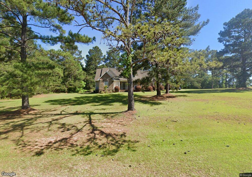
This home is located at 102 Stone Edge Dr, Gray, GA 31032 and is currently estimated at $398,098, approximately $181 per square foot. 102 Stone Edge Dr is a home located in Jones County with nearby schools including Gray Elementary School, Gray Station Middle School, and Jones County High School.
Ownership History
Date
Name
Owned For
Owner Type
Purchase Details
Closed on
Feb 28, 2011
Sold by
Roland Jason B
Bought by
Roland Jason B
Current Estimated Value
Home Financials for this Owner
Home Financials are based on the most recent Mortgage that was taken out on this home.
Original Mortgage
$185,085
Outstanding Balance
$125,537
Interest Rate
4.75%
Mortgage Type
FHA
Estimated Equity
$272,561
Purchase Details
Closed on
Jan 18, 2001
Sold by
Willis Michael T
Bought by
Anderson Timothy
Purchase Details
Closed on
Nov 9, 2000
Sold by
A & D Electric Llc
Bought by
Willis Michael T
Purchase Details
Closed on
Sep 8, 2000
Bought by
A & D Electric Llc
Create a Home Valuation Report for This Property
The Home Valuation Report is an in-depth analysis detailing your home's value as well as a comparison with similar homes in the area
Home Values in the Area
Average Home Value in this Area
Purchase History
| Date | Buyer | Sale Price | Title Company |
|---|---|---|---|
| Roland Jason B | -- | -- | |
| Roland Jason B | $189,900 | -- | |
| Anderson Timothy | $30,000 | -- | |
| Willis Michael T | $88,400 | -- | |
| A & D Electric Llc | $163,000 | -- |
Source: Public Records
Mortgage History
| Date | Status | Borrower | Loan Amount |
|---|---|---|---|
| Open | Roland Jason B | $185,085 |
Source: Public Records
Tax History
| Year | Tax Paid | Tax Assessment Tax Assessment Total Assessment is a certain percentage of the fair market value that is determined by local assessors to be the total taxable value of land and additions on the property. | Land | Improvement |
|---|---|---|---|---|
| 2025 | $4,230 | $132,638 | $16,380 | $116,258 |
| 2023 | $2,390 | $88,072 | $12,600 | $75,472 |
| 2022 | $3,022 | $87,820 | $12,348 | $75,472 |
| 2021 | $3,025 | $87,820 | $12,348 | $75,472 |
| 2020 | $2,941 | $85,437 | $12,348 | $73,089 |
| 2019 | $2,941 | $85,437 | $12,348 | $73,089 |
| 2018 | $2,941 | $85,437 | $12,348 | $73,089 |
| 2017 | $2,941 | $85,437 | $12,348 | $73,089 |
| 2016 | $2,941 | $85,437 | $12,348 | $73,089 |
| 2015 | $2,779 | $85,437 | $12,348 | $73,089 |
| 2014 | $2,564 | $85,437 | $12,348 | $73,089 |
Source: Public Records
Map
Nearby Homes
- 179 Stone Edge Dr
- 548 Greene Settlement Rd
- 0 Eatonton Hwy Unit 23385714
- 0 Sandra Dr Unit M179018
- 0 Sandra Dr Unit 52382
- 0 Sandra Dr Unit 10487926
- 0 Sandra Dr Unit 252106
- 106 Davis St
- 232 North St
- 583 Greene Settlement Rd
- 236 Old Clinton Rd
- 122 Pinewood Dr
- 129 Woodland Dr
- 176 Childs St
- 251 Autumn Ridge Ct
- 1023 Boulder Dr Unit LOT 65
- 1023 Boulder Dr
- 1023 Boulder Lot 65 Dr
- 132 Oak Dr
- 0 Bill Conn Pkwy
- 110 Stone Edge Dr
- 103 Stone Edge Dr
- 280 Weidner Dr
- 117 Stone Edge Dr
- 118 Stone Edge Dr
- 129 Stone Edge Dr
- 300 Weidner Dr
- 283 Weidner Dr
- 246 Weidner Dr
- 255 Weidner Dr
- 126 Stone Edge Dr
- 307 Weidner Dr
- 147 Stone Edge Dr
- 146 Stone Edge Dr
- 248 Weidner Dr
- 250 Weidner Dr
- 152 Stone Edge Dr
- 322 Weidner Dr
- 164 Stone Edge Dr
- 234 Weidner Dr
Your Personal Tour Guide
Ask me questions while you tour the home.