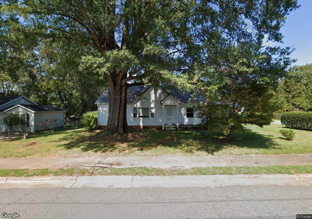
102 W 21st St Newton, NC 28658
Estimated Value: $195,000 - $213,000
2
Beds
1
Bath
1,452
Sq Ft
$140/Sq Ft
Est. Value
About This Home
This home is located at 102 W 21st St, Newton, NC 28658 and is currently estimated at $203,230, approximately $139 per square foot. 102 W 21st St is a home located in Catawba County with nearby schools including North Newton Elementary School, Newton-Conover Middle School, and Newton-Conover High School.
Ownership History
Date
Name
Owned For
Owner Type
Purchase Details
Closed on
May 21, 2007
Sold by
Hawn Sylvia Ann
Bought by
Lovelace Ronnie K
Current Estimated Value
Home Financials for this Owner
Home Financials are based on the most recent Mortgage that was taken out on this home.
Original Mortgage
$96,806
Outstanding Balance
$58,723
Interest Rate
6.12%
Mortgage Type
Purchase Money Mortgage
Estimated Equity
$144,507
Purchase Details
Closed on
May 7, 2007
Sold by
Wilkinson Joyce Hawn and Wilkinson Wayne W
Bought by
Hawn Sylvia Ann
Home Financials for this Owner
Home Financials are based on the most recent Mortgage that was taken out on this home.
Original Mortgage
$96,806
Outstanding Balance
$58,723
Interest Rate
6.12%
Mortgage Type
Purchase Money Mortgage
Estimated Equity
$144,507
Create a Home Valuation Report for This Property
The Home Valuation Report is an in-depth analysis detailing your home's value as well as a comparison with similar homes in the area
Home Values in the Area
Average Home Value in this Area
Purchase History
| Date | Buyer | Sale Price | Title Company |
|---|---|---|---|
| Lovelace Ronnie K | $100,000 | None Available | |
| Hawn Sylvia Ann | -- | None Available |
Source: Public Records
Mortgage History
| Date | Status | Borrower | Loan Amount |
|---|---|---|---|
| Open | Lovelace Ronnie K | $96,806 |
Source: Public Records
Tax History Compared to Growth
Tax History
| Year | Tax Paid | Tax Assessment Tax Assessment Total Assessment is a certain percentage of the fair market value that is determined by local assessors to be the total taxable value of land and additions on the property. | Land | Improvement |
|---|---|---|---|---|
| 2025 | $1,558 | $183,600 | $10,900 | $172,700 |
| 2024 | $1,558 | $183,600 | $10,900 | $172,700 |
| 2023 | $1,558 | $183,600 | $10,900 | $172,700 |
| 2022 | $1,097 | $98,400 | $8,900 | $89,500 |
| 2021 | $1,097 | $98,400 | $8,900 | $89,500 |
| 2020 | $1,097 | $98,400 | $8,900 | $89,500 |
| 2019 | $1,097 | $98,400 | $0 | $0 |
| 2018 | $866 | $77,700 | $8,900 | $68,800 |
| 2017 | $866 | $0 | $0 | $0 |
| 2016 | $866 | $0 | $0 | $0 |
| 2015 | $1,018 | $77,730 | $8,900 | $68,830 |
| 2014 | $1,018 | $100,800 | $11,100 | $89,700 |
Source: Public Records
Map
Nearby Homes
- 2075 N Whisnant Ave
- 118 W 15th St
- 210 W 15th St
- 227 W 27th St
- 2661 N Ashe Ave
- The Piedmont Plan at Rowe Crossing
- The Braselton II Plan at Rowe Crossing
- The Caldwell Plan at Rowe Crossing
- The Benson II Plan at Rowe Crossing
- The Coleman Plan at Rowe Crossing
- The Reynolds Plan at Rowe Crossing
- The Harrington Plan at Rowe Crossing
- 1208 N Ashe Ave
- 1208 N Davis Ave
- 503 W 12th St
- 1128 McRee Heights Cir
- 10 Maple Ct
- 902 N Ashe Ave
- 805 Mount Olive Church Rd
- 418 W 9th St
- 108 W 21st St
- 2118 N Shipp Ave
- 26 W 21st St
- 103 W 21st St
- 2214 N Shipp Ave Unit 1
- 2214 N Shipp Ave
- 118 W 21st St
- 109 W 21st St
- 2107 N Stewart Ave
- 2122 N Shipp Ave
- 2117 N Shipp Ave
- 31 W 21st St
- 119 W 21st St
- 2111 N Stewart Ave
- 2030 N Shipp Ave
- 2128 N Shipp Ave
- 123 W 21st St
- 2112 N Main Ave
- 2031 N Shipp Ave
- 202 W 21st St