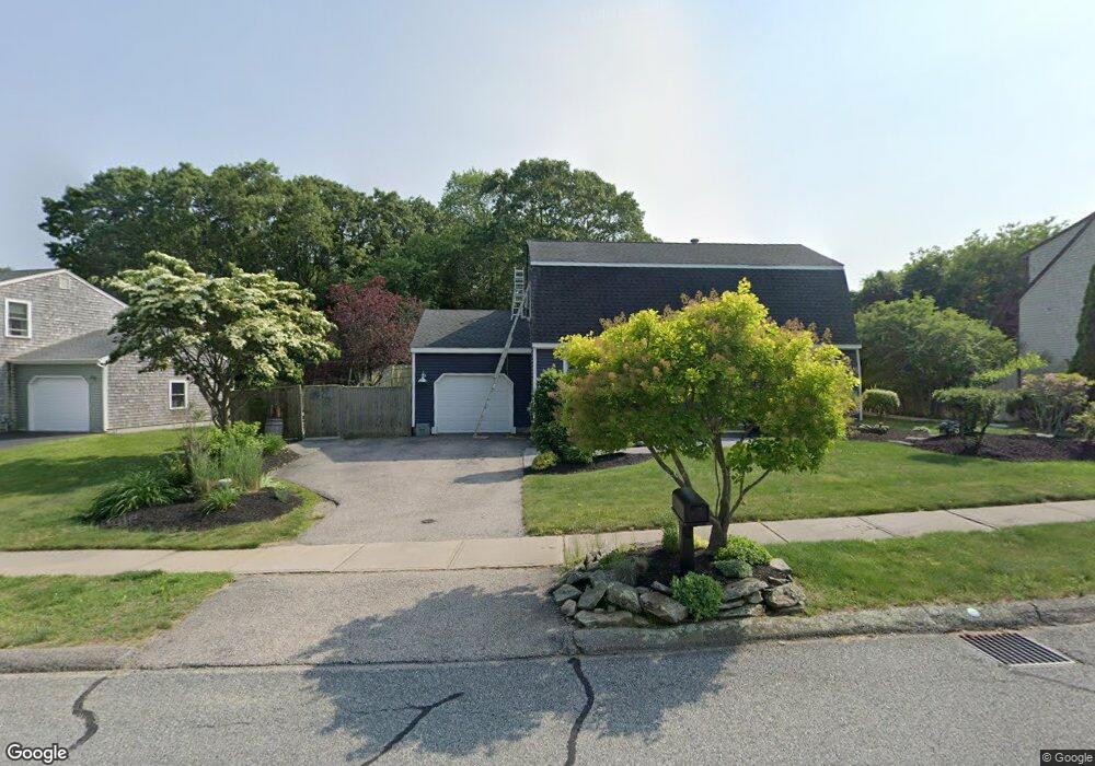
102 Weathervane Rd Wakefield, RI 02879
Estimated Value: $647,579 - $698,000
3
Beds
2
Baths
1,728
Sq Ft
$385/Sq Ft
Est. Value
About This Home
This home is located at 102 Weathervane Rd, Wakefield, RI 02879 and is currently estimated at $665,145, approximately $384 per square foot. 102 Weathervane Rd is a home located in Washington County with nearby schools including South Kingstown High School, Monsignor Matthew Clarke Catholic Regional School, and South Shore School.
Ownership History
Date
Name
Owned For
Owner Type
Purchase Details
Closed on
Jan 27, 1992
Sold by
Devine Constr Co
Bought by
Mcloughlin Michael C
Current Estimated Value
Create a Home Valuation Report for This Property
The Home Valuation Report is an in-depth analysis detailing your home's value as well as a comparison with similar homes in the area
Home Values in the Area
Average Home Value in this Area
Purchase History
| Date | Buyer | Sale Price | Title Company |
|---|---|---|---|
| Mcloughlin Michael C | $126,000 | -- |
Source: Public Records
Mortgage History
| Date | Status | Borrower | Loan Amount |
|---|---|---|---|
| Open | Mcloughlin Michael C | $124,000 | |
| Closed | Mcloughlin Michael C | $136,000 | |
| Closed | Mcloughlin Michael C | $50,000 |
Source: Public Records
Tax History Compared to Growth
Tax History
| Year | Tax Paid | Tax Assessment Tax Assessment Total Assessment is a certain percentage of the fair market value that is determined by local assessors to be the total taxable value of land and additions on the property. | Land | Improvement |
|---|---|---|---|---|
| 2025 | $5,056 | $565,600 | $219,300 | $346,300 |
| 2024 | $5,045 | $456,600 | $162,500 | $294,100 |
| 2023 | $5,045 | $456,600 | $162,500 | $294,100 |
| 2022 | $5,000 | $456,600 | $162,500 | $294,100 |
| 2021 | $4,988 | $345,200 | $125,000 | $220,200 |
| 2020 | $4,988 | $345,200 | $125,000 | $220,200 |
| 2019 | $4,988 | $345,200 | $125,000 | $220,200 |
| 2018 | $4,963 | $316,500 | $119,600 | $196,900 |
| 2017 | $4,846 | $316,500 | $119,600 | $196,900 |
| 2016 | $4,776 | $316,500 | $119,600 | $196,900 |
| 2015 | $4,634 | $298,600 | $108,700 | $189,900 |
| 2014 | $4,622 | $298,600 | $108,700 | $189,900 |
Source: Public Records
Map
Nearby Homes
- 82 Foster Sheldon Rd
- 5 Secluded Dr
- 00 South Rd
- 17 Celestial Heights Dr
- 115 Dam St
- 128 Rodman St
- 333 South Rd
- 507 Curtis Corner Rd
- 23 Rockland Dr
- 228 Rodman St
- 53 Rocky Brook Way
- 35 Whittier Dr
- 37 Whittier Dr
- 48 Stone Bridge Dr
- 58 Vespia Ln
- 54 Vespia Ln
- 50 Vespia Ln
- 860 Curtis Corner Rd
- 42 Vespia Ln
- 0 Vespia Dr Unit 1317499
- 90 Weathervane Rd
- 112 Weathervane Rd
- 324 Sweet Allen Farm Rd
- 332 Sweet Allen Farm Rd
- 80 Weathervane Rd
- 99 Weathervane Rd
- 105 Weathervane Rd
- 93 Weathervane Rd
- 300 Sweet Allen Farm Rd
- 338 Sweet Allen Farm Rd
- 85 Weathervane Rd
- 72 Weathervane Rd
- 130 Weathervane Rd
- 325 Sweet Allen Farm Rd
- 79 Weathervane Rd
- 346 Sweet Allen Farm Rd
- 335 Sweet Allen Farm Rd
- 62 Weathervane Rd
- 293 Sweet Allen Farm Rd
- 138 Weathervane Rd