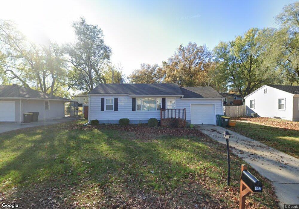
102 Woodland St Lansing, KS 66043
Estimated Value: $175,000 - $189,000
2
Beds
1
Bath
816
Sq Ft
$224/Sq Ft
Est. Value
About This Home
This home is located at 102 Woodland St, Lansing, KS 66043 and is currently estimated at $182,571, approximately $223 per square foot. 102 Woodland St is a home located in Leavenworth County with nearby schools including Lansing Elementary School, Lansing Middle 6-8, and Lansing High 9-12.
Ownership History
Date
Name
Owned For
Owner Type
Purchase Details
Closed on
Jul 29, 2024
Sold by
Maher Isaiah J and Maher Hannah
Bought by
Glassbrenner Dillan
Current Estimated Value
Home Financials for this Owner
Home Financials are based on the most recent Mortgage that was taken out on this home.
Original Mortgage
$174,600
Outstanding Balance
$172,654
Interest Rate
6.95%
Mortgage Type
New Conventional
Estimated Equity
$9,917
Purchase Details
Closed on
May 24, 2011
Sold by
Federal Natl Mtg Assn Fnma
Bought by
Maher Isaiah J
Create a Home Valuation Report for This Property
The Home Valuation Report is an in-depth analysis detailing your home's value as well as a comparison with similar homes in the area
Home Values in the Area
Average Home Value in this Area
Purchase History
| Date | Buyer | Sale Price | Title Company |
|---|---|---|---|
| Glassbrenner Dillan | -- | Lawyers Title Of Kansas | |
| Maher Isaiah J | -- | Stewart Title |
Source: Public Records
Mortgage History
| Date | Status | Borrower | Loan Amount |
|---|---|---|---|
| Open | Glassbrenner Dillan | $174,600 |
Source: Public Records
Tax History Compared to Growth
Tax History
| Year | Tax Paid | Tax Assessment Tax Assessment Total Assessment is a certain percentage of the fair market value that is determined by local assessors to be the total taxable value of land and additions on the property. | Land | Improvement |
|---|---|---|---|---|
| 2025 | $2,061 | $20,700 | $4,629 | $16,071 |
| 2024 | $1,949 | $16,050 | $3,651 | $12,399 |
| 2023 | $1,949 | $15,433 | $3,651 | $11,782 |
| 2022 | $1,854 | $13,881 | $2,942 | $10,939 |
| 2021 | $1,674 | $11,822 | $2,942 | $8,880 |
| 2020 | $1,619 | $11,259 | $2,803 | $8,456 |
| 2019 | $1,522 | $10,584 | $2,803 | $7,781 |
| 2018 | $1,313 | $9,181 | $2,211 | $6,970 |
| 2017 | $1,251 | $8,740 | $2,211 | $6,529 |
| 2016 | $1,227 | $8,575 | $2,211 | $6,364 |
| 2015 | -- | $8,197 | $2,211 | $5,986 |
| 2014 | -- | $7,997 | $2,211 | $5,786 |
Source: Public Records
Map
Nearby Homes
- 268 Holiday Dr
- 1102 N Main St
- 129 Brookwood St
- 1100 N 4th St
- 4 Eisenhower Rd
- 1102 N 4th St
- 603 E Beth St
- 415 Fairlane St
- 129 Crestview Ct
- 601 E Eisenhower Rd
- 218 Oak Hill St
- 20958 Ida St
- 610 Meadowlark Rd
- 542 Creekside Ct
- 124 S Main St
- 202 S Main St
- 218 E Kay St
- 306 E Kay St
- 728 Eisenhower Rd
- 546 Hithergreen Dr
- 102 Woodland Rd
- 104 Woodland Rd
- 104 Woodland St
- 100 Woodland St
- 100 Woodland Rd
- 103 Crestview Terrace
- 105 Crestview Terrace
- 101 Crestview Terrace
- 106 Elmwood Dr
- 103 Woodland St
- 107 Crestview Terrace
- 105 Woodland St
- 101 Woodland Rd
- 101 Woodland St
- 107 Woodland Rd
- 107 Woodland St
- 108 Elmwood Dr
- 102 Crestview Terrace
- 109 Woodland Rd
- 109 Woodland St