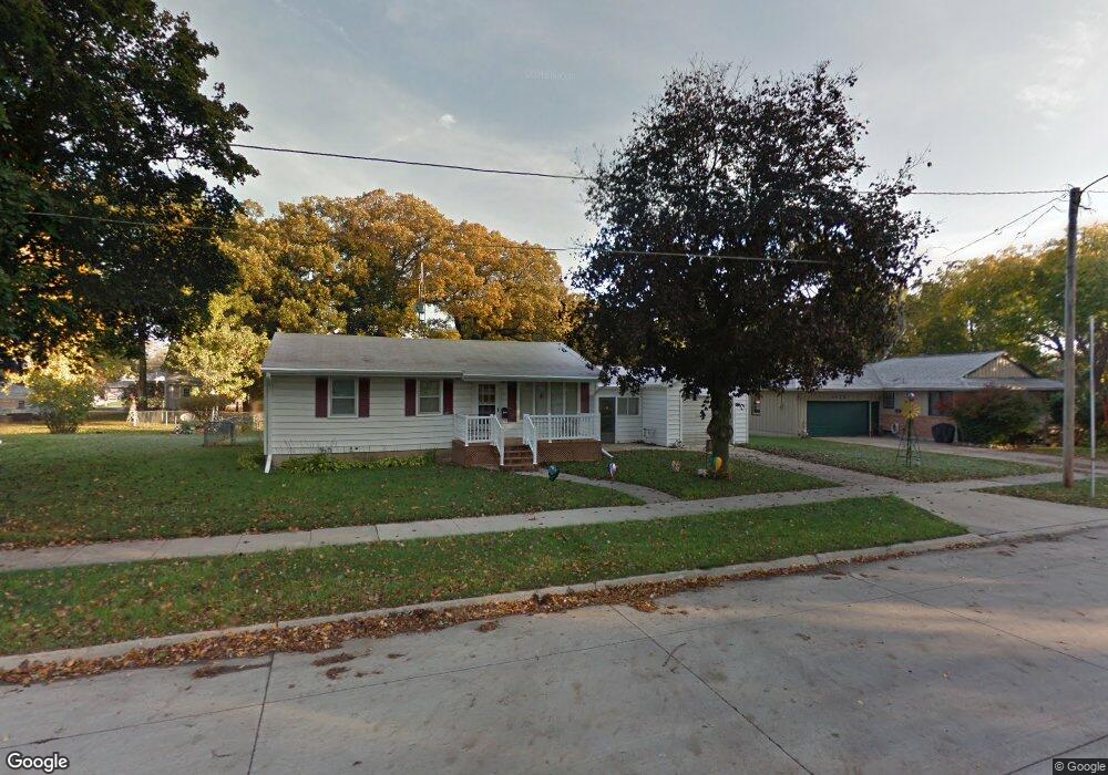
1020 11th St NE Mason City, IA 50401
Estimated Value: $126,284 - $155,000
3
Beds
1
Bath
912
Sq Ft
$153/Sq Ft
Est. Value
About This Home
This home is located at 1020 11th St NE, Mason City, IA 50401 and is currently estimated at $139,571, approximately $153 per square foot. 1020 11th St NE is a home with nearby schools including Mason City High School, Mason City Seventh Day Adventi, and North Iowa Christian School.
Ownership History
Date
Name
Owned For
Owner Type
Purchase Details
Closed on
May 1, 2025
Sold by
Holmes Jody L
Bought by
Holmes David L
Current Estimated Value
Purchase Details
Closed on
Nov 10, 2015
Sold by
Holmes Dixie A and Holmes Jody
Bought by
Holmes Dixie A and Holmes Jody
Purchase Details
Closed on
Dec 3, 2014
Sold by
Harris Dona S
Bought by
Holmes Dixie A
Purchase Details
Closed on
Nov 5, 2014
Sold by
The Estate Of Barbara J Albers
Bought by
Shackelford Steven W and Harris Dona S
Create a Home Valuation Report for This Property
The Home Valuation Report is an in-depth analysis detailing your home's value as well as a comparison with similar homes in the area
Home Values in the Area
Average Home Value in this Area
Purchase History
| Date | Buyer | Sale Price | Title Company |
|---|---|---|---|
| Holmes David L | -- | None Listed On Document | |
| Holmes Dixie A | -- | None Available | |
| Holmes Dixie A | $22,000 | None Available | |
| Shackelford Steven W | -- | None Available |
Source: Public Records
Tax History Compared to Growth
Tax History
| Year | Tax Paid | Tax Assessment Tax Assessment Total Assessment is a certain percentage of the fair market value that is determined by local assessors to be the total taxable value of land and additions on the property. | Land | Improvement |
|---|---|---|---|---|
| 2024 | $1,206 | $99,230 | $28,550 | $70,680 |
| 2023 | $1,642 | $99,230 | $28,550 | $70,680 |
| 2022 | $1,672 | $91,830 | $21,970 | $69,860 |
| 2021 | $1,702 | $90,230 | $21,970 | $68,260 |
| 2020 | $1,889 | $87,130 | $21,970 | $65,160 |
| 2019 | $1,492 | $0 | $0 | $0 |
| 2018 | $1,322 | $0 | $0 | $0 |
| 2017 | $1,360 | $0 | $0 | $0 |
| 2016 | $1,320 | $0 | $0 | $0 |
| 2015 | $1,320 | $0 | $0 | $0 |
| 2014 | $1,352 | $0 | $0 | $0 |
| 2013 | -- | $0 | $0 | $0 |
Source: Public Records
Map
Nearby Homes
- 1021 12th St NE
- 1100 N Tennessee Place
- 938 12th St NE
- 110 N Kentucky Ave
- 1368 12th St NE
- 1419 N Kentucky Ave
- 1416 N Kentucky Ave
- 1306 N Rhode Island Ave
- 807 10th St NE
- 726 11th St NE
- 1008 N Hampshire Ave
- 663 10th St NE
- 1533 Plymouth Rd
- 1551 N Rhode Island Ave
- 534 River Bend Ct
- 705 15th Place NE
- 1538 N Hampshire Ave
- 729 17th St NE
- 22 Asbury Place Unit Boulder Road
- 45 Ridge Rd NE
- 1016 11th St NE
- 1026 11th St NE
- 1021 11th St NE
- 1015 12th St NE
- 1013 11th St NE
- 1025 11th St NE
- 1004 11th St NE
- 1029 12th St NE
- 1115 N Kentucky Ave
- 1007 11th St NE
- 1101 12th St NE
- 1021 N Kentucky Ave
- 1123 N Kentucky Ave
- 1109 12th St NE
- 1014 10th St NE
- 946 11th St NE
- 1020 10th St NE
- 1026 10th St NE
- 1032 10th St NE
- 945 11th St NE