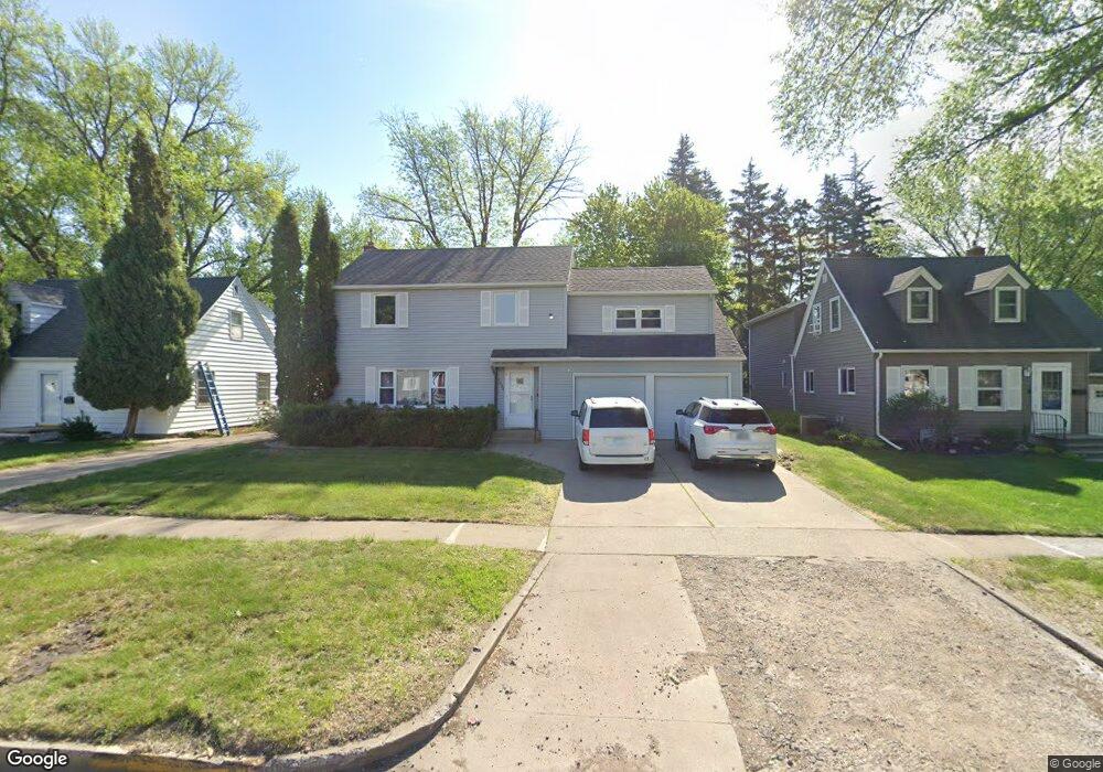
1020 12th St S Moorhead, MN 56560
Estimated Value: $325,227
4
Beds
3
Baths
2,228
Sq Ft
$146/Sq Ft
Est. Value
About This Home
This home is located at 1020 12th St S, Moorhead, MN 56560 and is currently estimated at $325,227, approximately $145 per square foot. 1020 12th St S is a home located in Clay County with nearby schools including R. Asp Elementary School, Horizon Middle School, and Moorhead High School.
Ownership History
Date
Name
Owned For
Owner Type
Purchase Details
Closed on
Aug 23, 2013
Sold by
Lontz David
Bought by
Solutions Inc
Current Estimated Value
Home Financials for this Owner
Home Financials are based on the most recent Mortgage that was taken out on this home.
Original Mortgage
$131,175
Outstanding Balance
$97,316
Interest Rate
4.33%
Mortgage Type
Commercial
Estimated Equity
$227,911
Create a Home Valuation Report for This Property
The Home Valuation Report is an in-depth analysis detailing your home's value as well as a comparison with similar homes in the area
Home Values in the Area
Average Home Value in this Area
Purchase History
| Date | Buyer | Sale Price | Title Company |
|---|---|---|---|
| Solutions Inc | $174,900 | -- |
Source: Public Records
Mortgage History
| Date | Status | Borrower | Loan Amount |
|---|---|---|---|
| Open | Solutions Inc | $131,175 |
Source: Public Records
Tax History Compared to Growth
Tax History
| Year | Tax Paid | Tax Assessment Tax Assessment Total Assessment is a certain percentage of the fair market value that is determined by local assessors to be the total taxable value of land and additions on the property. | Land | Improvement |
|---|---|---|---|---|
| 2025 | $128 | $275,200 | $39,800 | $235,400 |
| 2024 | $128 | $261,700 | $42,800 | $218,900 |
| 2023 | $130 | $259,100 | $42,800 | $216,300 |
| 2022 | $86 | $251,000 | $39,800 | $211,200 |
| 2021 | $42 | $228,700 | $36,700 | $192,000 |
| 2020 | $42 | $228,000 | $36,700 | $191,300 |
| 2019 | $42 | $218,600 | $36,700 | $181,900 |
| 2018 | $42 | $212,000 | $36,700 | $175,300 |
| 2017 | $42 | $209,000 | $33,700 | $175,300 |
| 2016 | $42 | $185,200 | $33,000 | $152,200 |
| 2015 | $76 | $168,000 | $28,800 | $139,200 |
| 2014 | $2,074 | $168,000 | $28,800 | $139,200 |
Source: Public Records
Map
Nearby Homes
- 1020 11th St S
- 1313 10th Ave S
- 1105 11th St S
- 1015 11th Ave S
- 912 11th St S
- 1328 10th Ave S
- 1501 13th St S
- 1409 9th Ave S
- 1002 9th St S
- 1512 10th Ave S
- 826 10th Ave S
- 1309 16th Ave S
- 1107 17th St S
- 1621 9th Ave S
- 1415 16th Ave S
- 1712 12th St S
- 1720 12th St S
- 511 11th St N
- 816 7th Ave S
- 1215 6th St S
- 1014 12th St S
- 1026 12th St S
- 1028 12th St S
- 1006 12th St S
- 1019 13th St S
- 1015 13th St S
- 1021 13th St S
- 1102 12th St S
- 1009 13th St S
- 1205 10th Ave S
- 1027 13th St S
- 1005 13th St S
- 1106 12th St S
- 1017 12th St S
- 1103 13th St S
- 1015 12th St S
- 1023 12th St S
- 1221 10th Ave S
- 1110 12th St S
- 1110 12th St S Unit 1