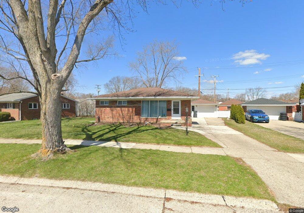
1020 Broadacre Ave Unit Bldg-Unit Clawson, MI 48017
Estimated Value: $293,000 - $347,000
4
Beds
2
Baths
1,060
Sq Ft
$297/Sq Ft
Est. Value
About This Home
This home is located at 1020 Broadacre Ave Unit Bldg-Unit, Clawson, MI 48017 and is currently estimated at $315,006, approximately $297 per square foot. 1020 Broadacre Ave Unit Bldg-Unit is a home located in Oakland County with nearby schools including Clawson Middle School, Clawson High School, and Japhet School.
Ownership History
Date
Name
Owned For
Owner Type
Purchase Details
Closed on
Aug 30, 2022
Sold by
Farrell Andrew J
Bought by
Boettger Hillarie F
Current Estimated Value
Purchase Details
Closed on
Feb 2, 2018
Sold by
Sharrak Al and Yousif Fatin Sabri
Bought by
Farrell Andrew J
Purchase Details
Closed on
May 5, 2010
Sold by
Habib Alaa
Bought by
Habib Alaa and Yousif Fatin Sabri
Purchase Details
Closed on
Aug 11, 2009
Sold by
Pruett Rebecca J
Bought by
Federal Home Loan Mortgage Corp
Purchase Details
Closed on
Aug 21, 2003
Sold by
Pruett Rebecca J and Vanwinkle Rebecca J
Bought by
Pruett Rebecca J
Create a Home Valuation Report for This Property
The Home Valuation Report is an in-depth analysis detailing your home's value as well as a comparison with similar homes in the area
Home Values in the Area
Average Home Value in this Area
Purchase History
| Date | Buyer | Sale Price | Title Company |
|---|---|---|---|
| Boettger Hillarie F | $257,000 | -- | |
| Boettger Hillarie F | $257,000 | -- | |
| Farrell Andrew J | $185,000 | None Available | |
| Farrell Andrew J | $185,000 | None Available | |
| Habib Alaa | -- | E Title Agency Inc | |
| Habib Alaa | -- | E Title Agency Inc | |
| Federal Home Loan Mortgage Corp | $74,426 | None Available | |
| Federal Home Loan Mortgage Corp | $74,426 | None Available | |
| Pruett Rebecca J | -- | -- | |
| Pruett Rebecca J | -- | -- |
Source: Public Records
Tax History
| Year | Tax Paid | Tax Assessment Tax Assessment Total Assessment is a certain percentage of the fair market value that is determined by local assessors to be the total taxable value of land and additions on the property. | Land | Improvement |
|---|---|---|---|---|
| 2025 | $6,045 | $138,920 | $0 | $0 |
| 2024 | $5,776 | $132,040 | $0 | $0 |
| 2023 | $5,538 | $121,370 | $0 | $0 |
| 2022 | $4,834 | $112,450 | $0 | $0 |
| 2021 | $4,735 | $105,170 | $0 | $0 |
| 2020 | $4,588 | $98,720 | $0 | $0 |
| 2019 | $4,740 | $93,810 | $0 | $0 |
| 2018 | $3,188 | $93,080 | $0 | $0 |
| 2017 | $3,169 | $90,020 | $0 | $0 |
| 2016 | $3,208 | $84,540 | $0 | $0 |
| 2015 | -- | $77,330 | $0 | $0 |
| 2014 | -- | $67,130 | $0 | $0 |
| 2011 | -- | $61,690 | $0 | $0 |
Source: Public Records
Map
Nearby Homes
- 310 N Marias Ave
- 320 N Batchewana St
- 846 Phillips Ave
- 674 Langley Blvd
- 609 John M Ave
- 4909 Crooks Rd Unit D6
- 4909 Crooks Rd Unit 4
- 4921 N Crooks Rd Unit N-10
- 4905 Crooks A2 Rd
- 931 W Elmwood Ave
- 5065 Crooks Rd Unit 49
- 4921 Crooks Rd Unit M-10
- 4921 Crooks Rd
- Fairfax Plan at The Village at Clawson Park
- Penrose Plan at The Village at Clawson Park
- 508 S Chocolay Ave
- 298 Broadacre Ave
- 542 S Manitou Ave
- 4401 Crooks Rd
- 2130 Wickham St Unit 4
- 1020 Broadacre Ave
- 1040 Broadacre Ave
- 1008 Broadacre Ave
- 220 N Chocolay Ave
- 219 N Manitou Ave
- 219 N Manitou Ave
- 230 N Chocolay Ave
- 229 N Manitou Ave
- 151 N Manitou Ave
- 240 N Chocolay Ave
- 239 N Manitou Ave
- 1041 Broadacre Ave
- 199 N Chocolay Ave
- 209 N Chocolay Ave
- 250 N Chocolay Ave
- 208 N Manitou Ave
- 249 N Manitou Ave
- 249 N Manitou Ave
- 220 N Manitou Ave
- 220 N Manitou Ave
Your Personal Tour Guide
Ask me questions while you tour the home.