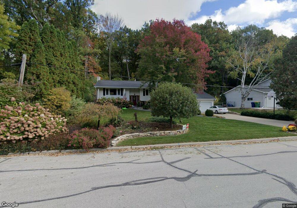
1020 Cornelius Dr Green Bay, WI 54311
Schmitt Park NeighborhoodEstimated Value: $325,000 - $352,311
3
Beds
3
Baths
1,384
Sq Ft
$246/Sq Ft
Est. Value
About This Home
This home is located at 1020 Cornelius Dr, Green Bay, WI 54311 and is currently estimated at $340,828, approximately $246 per square foot. 1020 Cornelius Dr is a home located in Brown County with nearby schools including Baird Elementary School, Preble High School, and St. Thomas More Catholic School.
Ownership History
Date
Name
Owned For
Owner Type
Purchase Details
Closed on
Oct 27, 2001
Sold by
Frantz Eric H and Frantz Lana J
Bought by
Dolski Dennis and Dolski Lynn
Current Estimated Value
Home Financials for this Owner
Home Financials are based on the most recent Mortgage that was taken out on this home.
Original Mortgage
$133,000
Outstanding Balance
$52,289
Interest Rate
6.8%
Estimated Equity
$288,539
Create a Home Valuation Report for This Property
The Home Valuation Report is an in-depth analysis detailing your home's value as well as a comparison with similar homes in the area
Home Values in the Area
Average Home Value in this Area
Purchase History
| Date | Buyer | Sale Price | Title Company |
|---|---|---|---|
| Dolski Dennis | $140,000 | Gb Title |
Source: Public Records
Mortgage History
| Date | Status | Borrower | Loan Amount |
|---|---|---|---|
| Open | Dolski Dennis | $133,000 |
Source: Public Records
Tax History Compared to Growth
Tax History
| Year | Tax Paid | Tax Assessment Tax Assessment Total Assessment is a certain percentage of the fair market value that is determined by local assessors to be the total taxable value of land and additions on the property. | Land | Improvement |
|---|---|---|---|---|
| 2024 | $4,205 | $225,800 | $42,900 | $182,900 |
| 2023 | $4,016 | $225,800 | $42,900 | $182,900 |
| 2022 | $3,927 | $225,800 | $42,900 | $182,900 |
| 2021 | $3,487 | $153,000 | $34,700 | $118,300 |
| 2020 | $3,528 | $153,000 | $34,700 | $118,300 |
| 2019 | $3,416 | $153,000 | $34,700 | $118,300 |
| 2018 | $3,338 | $153,000 | $34,700 | $118,300 |
| 2017 | $3,297 | $153,000 | $34,700 | $118,300 |
| 2016 | $3,245 | $153,000 | $34,700 | $118,300 |
| 2015 | $3,344 | $153,000 | $34,700 | $118,300 |
| 2014 | $3,443 | $153,000 | $34,700 | $118,300 |
| 2013 | $3,443 | $153,000 | $34,700 | $118,300 |
Source: Public Records
Map
Nearby Homes
- 3038 Bay View Dr
- 1014 Laverne Dr
- 3032 Humboldt Rd
- 910 Pine Ridge Dr
- 1019 Mt Mary Dr
- 980 Queoff St
- 1123 Saint Charles Dr
- 3199 Humboldt Rd
- 2800 Humboldt Rd
- 1000 Mount Hood Ct
- 2780 Humboldt Rd
- 1115 Bay Mist Dr
- 0 Largo Ridge Dr Unit 50299111
- 0 Largo Ridge Dr Unit 50316072
- 1211 Bay Mist Dr
- 2932 Suzanne Ct
- 1216 Bay Mist Dr
- 3327 Largo Ridge Dr
- 3329 Largo Ridge Dr
- 2686 Humboldt Rd Unit 1
- 1030 Cornelius Dr
- 1000 Cornelius Dr
- 960 Cedarview Ct
- 1011 Cornelius Dr
- 1003 Cornelius Dr
- 930 Cornelius Dr
- 3015 Bayview Dr
- 955 Cedarview Ct
- 942 Cedarview Ct
- 920 Cornelius Dr
- 849 Marvin Ln
- 3020 Bay View Dr
- 924 Cedarview Ct
- 925 Cornelius Dr
- 3025 Bay View Dr
- 951 Cedarview Ct
- 910 Cornelius Dr
- 916 Cedarview Ct
- 841 Marvin Ln
- 838 Marvin Ln