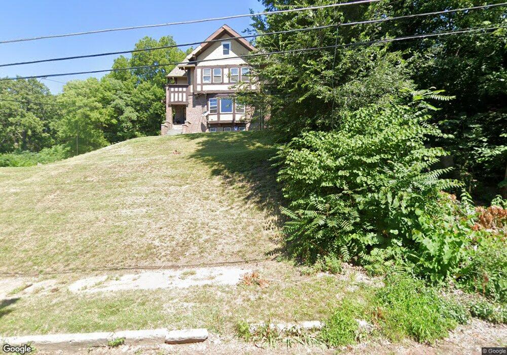
1020 E 6th St Davenport, IA 52803
East End NeighborhoodEstimated Value: $166,000 - $222,359
6
Beds
2
Baths
3,320
Sq Ft
$59/Sq Ft
Est. Value
About This Home
This home is located at 1020 E 6th St, Davenport, IA 52803 and is currently estimated at $195,590, approximately $58 per square foot. 1020 E 6th St is a home located in Scott County with nearby schools including Walnut Hill Elementary School, McKinley Elementary School, and Casey County Middle School.
Ownership History
Date
Name
Owned For
Owner Type
Purchase Details
Closed on
Aug 15, 2025
Sold by
Nicholson Albert and Roberts Joan Irene
Bought by
Jbr Investments Group Llc
Current Estimated Value
Purchase Details
Closed on
May 14, 2025
Sold by
Jbr Investment Group and Jbr Investment Group Llc
Bought by
Roberts Joan Irene and Mcdowell Paula Jean
Purchase Details
Closed on
May 26, 2022
Sold by
Roberts Simon O
Bought by
Ibr Investments Group Llc
Create a Home Valuation Report for This Property
The Home Valuation Report is an in-depth analysis detailing your home's value as well as a comparison with similar homes in the area
Home Values in the Area
Average Home Value in this Area
Purchase History
| Date | Buyer | Sale Price | Title Company |
|---|---|---|---|
| Jbr Investments Group Llc | -- | None Listed On Document | |
| Roberts Joan Irene | -- | None Listed On Document | |
| Ibr Investments Group Llc | $1,000 | None Listed On Document |
Source: Public Records
Tax History Compared to Growth
Tax History
| Year | Tax Paid | Tax Assessment Tax Assessment Total Assessment is a certain percentage of the fair market value that is determined by local assessors to be the total taxable value of land and additions on the property. | Land | Improvement |
|---|---|---|---|---|
| 2025 | $2,562 | $143,340 | $38,690 | $104,650 |
| 2024 | $2,500 | $143,340 | $38,690 | $104,650 |
| 2023 | $2,396 | $143,340 | $38,690 | $104,650 |
| 2022 | $2,372 | $112,190 | $22,110 | $90,080 |
| 2021 | $2,372 | $110,530 | $22,110 | $88,420 |
| 2020 | $2,126 | $97,900 | $22,110 | $75,790 |
| 2019 | $2,196 | $97,900 | $22,110 | $75,790 |
| 2018 | $2,150 | $97,900 | $22,110 | $75,790 |
| 2017 | $2,226 | $97,900 | $22,110 | $75,790 |
| 2016 | $2,148 | $98,070 | $0 | $0 |
| 2015 | $2,148 | $101,350 | $0 | $0 |
| 2014 | $2,250 | $101,350 | $0 | $0 |
| 2013 | $2,212 | $0 | $0 | $0 |
| 2012 | -- | $88,530 | $17,630 | $70,900 |
Source: Public Records
Map
Nearby Homes
- 1012 Bridge Ave
- 1004 College Ave
- 1108 Arlington Ave
- 1134 Tremont Ave
- 1224 E 11th St
- 616 E 6th St
- 1102 College Ave
- 914 Farnam St
- 1220 College Ave
- 603 Leclaire St
- 1215 Farnam St
- 715 Iowa St
- 417 E 6th St
- 1202 Adams St
- 1020 E 15th St
- 1501 Bridge Ave
- 637 E 15th St
- 1325 Mississippi Ave
- 1310 Kirkwood Blvd
- 1233 Eastern Ave
- 928 E 6th St
- 1013 E 6th St
- 1010 Charlotte Ave
- 1018 Charlotte Ave
- 1018 Charlotte St
- 1020 Charlotte Ave
- 920 E 6th St
- 1004 Charlotte Ave
- 1028 E 6th St
- 914 E 6th St
- 921 E 6th St
- 921 E 6th St
- 921 E 6th St
- 923 E 6th St
- 1024 Charlotte Ave
- 1024 Charlotte St
- 912 E 6th St
- 819 Tremont Ave
- 823 Tremont Ave
- 917 E 6th St