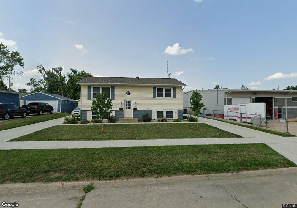
1020 Eisenhower Rd Unit 1022 Hiawatha, IA 52233
Estimated Value: $206,000 - $257,490
4
Beds
2
Baths
912
Sq Ft
$260/Sq Ft
Est. Value
About This Home
This home is located at 1020 Eisenhower Rd Unit 1022, Hiawatha, IA 52233 and is currently estimated at $236,830, approximately $259 per square foot. 1020 Eisenhower Rd Unit 1022 is a home located in Linn County with nearby schools including Hiawatha Elementary School, Ponderosa Elementary School, and Bowling Green Learning Center.
Ownership History
Date
Name
Owned For
Owner Type
Purchase Details
Closed on
Aug 21, 2001
Sold by
Igram Yusef A and Igram Samira
Bought by
Wilhelm Phillip R
Current Estimated Value
Home Financials for this Owner
Home Financials are based on the most recent Mortgage that was taken out on this home.
Original Mortgage
$95,200
Interest Rate
7.28%
Create a Home Valuation Report for This Property
The Home Valuation Report is an in-depth analysis detailing your home's value as well as a comparison with similar homes in the area
Home Values in the Area
Average Home Value in this Area
Purchase History
| Date | Buyer | Sale Price | Title Company |
|---|---|---|---|
| Wilhelm Phillip R | $118,500 | -- |
Source: Public Records
Mortgage History
| Date | Status | Borrower | Loan Amount |
|---|---|---|---|
| Closed | Wilhelm Phillip R | $95,200 |
Source: Public Records
Tax History Compared to Growth
Tax History
| Year | Tax Paid | Tax Assessment Tax Assessment Total Assessment is a certain percentage of the fair market value that is determined by local assessors to be the total taxable value of land and additions on the property. | Land | Improvement |
|---|---|---|---|---|
| 2025 | $2,766 | $215,700 | $25,200 | $190,500 |
| 2024 | $3,028 | $170,300 | $25,200 | $145,100 |
| 2023 | $3,028 | $168,300 | $25,200 | $143,100 |
| 2022 | $2,990 | $149,300 | $25,200 | $124,100 |
| 2021 | $2,890 | $149,300 | $25,200 | $124,100 |
| 2020 | $2,890 | $120,500 | $25,200 | $95,300 |
| 2019 | $2,410 | $113,000 | $25,200 | $87,800 |
| 2018 | $2,368 | $113,000 | $25,200 | $87,800 |
| 2017 | $2,402 | $112,500 | $25,200 | $87,300 |
| 2016 | $2,402 | $112,500 | $25,200 | $87,300 |
| 2015 | $2,408 | $112,500 | $25,200 | $87,300 |
| 2014 | $2,408 | $112,500 | $25,200 | $87,300 |
| 2013 | $1,172 | $112,500 | $25,200 | $87,300 |
Source: Public Records
Map
Nearby Homes
- 306 10th Ave
- 1213 Raney St
- 1213 Bowler St
- 1364 Cress Pkwy
- 2596 Anne Ln
- 5455 Blairs Ferry Rd NE
- 3 N Center Point Rd
- 1 N Center Point Rd
- 3620 Western Pine Dr NE
- 2602 Towne House Dr NE
- 4761 Westchester Dr NE Unit C
- 4745 Westchester Dr NE Unit A
- 109 E Willman St
- 114 Northwood Dr
- 3719 Blue Mound Dr NE
- 780 Ryan Ave
- 4642 Aspen Ln NE
- 4545 Westchester Dr NE Unit D
- 4609 White Pine Dr NE
- 4460 Westchester Dr NE Unit C
- 1021 Emmons St Unit 1023
- 1015 Eisenhower Rd
- 1027 Emmons St
- 1005 Eisenhower Rd
- 1038 Eisenhower Rd
- 1027 Eisenhower Rd
- 1033 Emmons St
- 104 10th Ave
- 1033 Eisenhower Rd
- 981 Emmons St Unit 6
- 981 Emmons St Unit 5
- 981 Emmons St Unit 4
- 981 Emmons St Unit 3
- 981 Emmons St Unit 2
- 981 Emmons St Unit 1
- 1039 Emmons St
- 1020 Rainbow Blvd
- 1014 Rainbow Blvd
- 108 10th Ave
- 1044 Eisenhower Rd