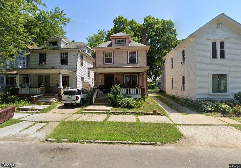
1020 N Ellis St Peoria, IL 61606
West Bluff NeighborhoodEstimated Value: $68,000 - $159,000
3
Beds
2
Baths
1,336
Sq Ft
$74/Sq Ft
Est. Value
About This Home
This home is located at 1020 N Ellis St, Peoria, IL 61606 and is currently estimated at $98,973, approximately $74 per square foot. 1020 N Ellis St is a home located in Peoria County with nearby schools including Franklin Primary School, Harold B. Dawson Jr. Middle School, and Peoria High School.
Ownership History
Date
Name
Owned For
Owner Type
Purchase Details
Closed on
Feb 19, 2025
Sold by
Bellemey Kathy
Bought by
Ladybug Realty Llc
Current Estimated Value
Purchase Details
Closed on
Mar 24, 2016
Sold by
West Blf Neighborhood Hsng Svc
Bought by
Bellemey Kathy
Purchase Details
Closed on
Sep 24, 2004
Bought by
Garcia Alfredo
Create a Home Valuation Report for This Property
The Home Valuation Report is an in-depth analysis detailing your home's value as well as a comparison with similar homes in the area
Home Values in the Area
Average Home Value in this Area
Purchase History
| Date | Buyer | Sale Price | Title Company |
|---|---|---|---|
| Ladybug Realty Llc | $22,000 | None Listed On Document | |
| Bellemey Kathy | -- | Attorney Only | |
| Garcia Alfredo | $39,900 | -- |
Source: Public Records
Tax History Compared to Growth
Tax History
| Year | Tax Paid | Tax Assessment Tax Assessment Total Assessment is a certain percentage of the fair market value that is determined by local assessors to be the total taxable value of land and additions on the property. | Land | Improvement |
|---|---|---|---|---|
| 2024 | $1,695 | $18,740 | $2,910 | $15,830 |
| 2023 | $1,617 | $17,190 | $2,670 | $14,520 |
| 2022 | $1,610 | $16,690 | $2,550 | $14,140 |
| 2021 | $1,581 | $15,900 | $2,430 | $13,470 |
| 2020 | $1,578 | $15,750 | $2,410 | $13,340 |
| 2019 | $1,601 | $16,070 | $2,460 | $13,610 |
| 2018 | $1,611 | $16,540 | $2,480 | $14,060 |
| 2017 | $1,611 | $16,710 | $2,510 | $14,200 |
| 2016 | $992 | $16,710 | $2,510 | $14,200 |
| 2015 | $1,028 | $16,380 | $2,460 | $13,920 |
| 2014 | $1,035 | $17,170 | $2,600 | $14,570 |
| 2013 | -- | $17,380 | $2,630 | $14,750 |
Source: Public Records
Map
Nearby Homes
- 429 W High St
- 1224 N Douglas St
- 1312 N Ellis St
- 1313 N Ellis St
- 1216 N North St
- 816 W Columbia Terrace
- 609 W Armstrong Ave
- 401 W Armstrong Ave
- 1410 N Douglas St
- 911 W Russell St
- 710 W Armstrong Ave
- 919 W Windom St
- 1402 N Broadway St
- 919 W Moss Ave
- 1009 W Armstrong Ave
- 1112 W Columbia Terrace
- 1504 N Linn St
- 1119 N Underhill St
- 1624 N Bigelow St
- 1220 N University St
- 1022 N Ellis St
- 1018 N Ellis St
- 1014 N Ellis St
- 1014 N Ellis St Unit 1018 N ELLIS
- 1024 N Ellis St
- 517 W Mahlon Ct
- 1025 N Ellis St
- 1021 N Ellis St
- 1015 N Ellis St
- 1019 N Ellis St
- 1106 N Ellis St
- 1017 N Flora Ave
- 608 W Russell St
- 1025 N Flora Ave
- 1015 N Flora Ave
- 1031 N Flora Ave
- 601 W Main St
- 1108 N Ellis St
- 1110 N Ellis St
- 1105 N Ellis St