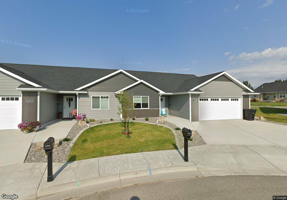
1020 Phil Cir Laurel, MT 59044
Estimated Value: $297,000 - $368,874
2
Beds
2
Baths
1,398
Sq Ft
$243/Sq Ft
Est. Value
About This Home
This home is located at 1020 Phil Cir, Laurel, MT 59044 and is currently estimated at $339,219, approximately $242 per square foot. 1020 Phil Cir is a home located in Yellowstone County with nearby schools including West School, Fred W. Graff School, and Laurel Middle School.
Ownership History
Date
Name
Owned For
Owner Type
Purchase Details
Closed on
Sep 29, 2021
Sold by
Lamore Philip B
Bought by
Baracker Pat and Baracker Denise
Current Estimated Value
Purchase Details
Closed on
Jun 30, 2021
Sold by
Mj Construction Inc
Bought by
Lamore Philip B
Home Financials for this Owner
Home Financials are based on the most recent Mortgage that was taken out on this home.
Original Mortgage
$208,000
Interest Rate
2.9%
Mortgage Type
New Conventional
Create a Home Valuation Report for This Property
The Home Valuation Report is an in-depth analysis detailing your home's value as well as a comparison with similar homes in the area
Home Values in the Area
Average Home Value in this Area
Purchase History
| Date | Buyer | Sale Price | Title Company |
|---|---|---|---|
| Baracker Pat | -- | First Montana Title Company | |
| Lamore Philip B | -- | Stewart Title Company |
Source: Public Records
Mortgage History
| Date | Status | Borrower | Loan Amount |
|---|---|---|---|
| Previous Owner | Lamore Philip B | $208,000 |
Source: Public Records
Tax History
| Year | Tax Paid | Tax Assessment Tax Assessment Total Assessment is a certain percentage of the fair market value that is determined by local assessors to be the total taxable value of land and additions on the property. | Land | Improvement |
|---|---|---|---|---|
| 2025 | $2,755 | $325,800 | $17,485 | $308,315 |
| 2024 | $2,755 | $292,200 | $12,185 | $280,015 |
| 2023 | $2,476 | $285,300 | $12,185 | $273,115 |
| 2022 | $1,877 | $224,900 | $0 | $0 |
| 2021 | $565 | $43,396 | $0 | $0 |
| 2020 | $354 | $17,856 | $0 | $0 |
| 2019 | $498 | $17,856 | $0 | $0 |
| 2018 | $404 | $17,138 | $0 | $0 |
| 2017 | $146 | $17,138 | $0 | $0 |
| 2016 | $432 | $17,523 | $0 | $0 |
| 2015 | $430 | $17,523 | $0 | $0 |
| 2014 | $446 | $9,326 | $0 | $0 |
Source: Public Records
Map
Nearby Homes
- 1712 Paynes Place
- TBD Block 3 Lot 6
- 1014 Rochelle Ln
- 1013 W 12th St
- 1109 10th Ave
- 1216 W 12th Street Cir
- 1254 W Beartooth Dr
- 310 (and 814 w 4) 8th Ave
- 102 8th Ave Unit B
- 1735 Lobo Dr
- 603 5th Ave
- 319 6th Ave
- 1960 Coyote Ridge Rd N
- 1319 Valley Dr
- 116 4th Ave
- 1631 Valley Dr
- 208 West Ave
- 120 Forrest Ave
- 110 E 5th St
- 516 Pennsylvania Ave
- 1018 Phil Cir
- 1022 Phil Cir
- 1015 Duval Dr
- 1016 Phil Cir
- 1021 Phil Cir
- 1017 Duval Dr
- 1013 Duval Dr
- 1014 Phil Cir
- 1019 Duval Dr
- 1021 Duval Dr
- 1019 Phil Cir
- 1710 Paynes Place
- 1017 Phil Cir
- 1012 Phil Cir
- 1015 Phil Cir Unit E
- 1015 Phil Cir
- 1015 Phil Cir Unit 34
- 1708 Paynes Place
- 1013 Phil Cir
- 1009 Duval Dr
Your Personal Tour Guide
Ask me questions while you tour the home.