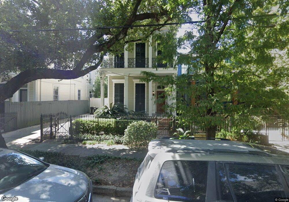
1020 Philip Ave New Orleans, LA 70130
Irish Channel NeighborhoodEstimated Value: $651,000 - $1,200,465
3
Beds
3
Baths
2,668
Sq Ft
$328/Sq Ft
Est. Value
About This Home
This home is located at 1020 Philip Ave, New Orleans, LA 70130 and is currently estimated at $874,866, approximately $327 per square foot. 1020 Philip Ave is a home located in Orleans Parish with nearby schools including ReNEW Laurel Academy, International School of Louisiana - Uptown Campus, and Warren Easton Senior High School.
Ownership History
Date
Name
Owned For
Owner Type
Purchase Details
Closed on
Oct 30, 2002
Sold by
Daniel John W Mc
Bought by
Lessinger Cindy A
Current Estimated Value
Home Financials for this Owner
Home Financials are based on the most recent Mortgage that was taken out on this home.
Original Mortgage
$243,280
Outstanding Balance
$102,124
Interest Rate
6.05%
Estimated Equity
$772,742
Create a Home Valuation Report for This Property
The Home Valuation Report is an in-depth analysis detailing your home's value as well as a comparison with similar homes in the area
Home Values in the Area
Average Home Value in this Area
Purchase History
| Date | Buyer | Sale Price | Title Company |
|---|---|---|---|
| Lessinger Cindy A | $466,600 | -- |
Source: Public Records
Mortgage History
| Date | Status | Borrower | Loan Amount |
|---|---|---|---|
| Open | Lessinger Cindy A | $243,280 |
Source: Public Records
Tax History Compared to Growth
Tax History
| Year | Tax Paid | Tax Assessment Tax Assessment Total Assessment is a certain percentage of the fair market value that is determined by local assessors to be the total taxable value of land and additions on the property. | Land | Improvement |
|---|---|---|---|---|
| 2025 | $9,842 | $81,410 | $18,630 | $62,780 |
| 2024 | $9,737 | $72,270 | $18,630 | $53,640 |
| 2023 | $6,965 | $72,270 | $7,990 | $64,280 |
| 2022 | $6,965 | $69,060 | $7,990 | $61,070 |
| 2021 | $6,320 | $72,270 | $7,990 | $64,280 |
| 2020 | $5,338 | $43,550 | $7,990 | $35,560 |
| 2019 | $5,544 | $43,550 | $7,990 | $35,560 |
| 2018 | $5,652 | $43,550 | $7,990 | $35,560 |
| 2017 | $5,382 | $43,550 | $7,990 | $35,560 |
| 2016 | $5,354 | $42,260 | $9,820 | $32,440 |
| 2015 | $5,246 | $42,260 | $9,820 | $32,440 |
| 2014 | -- | $42,260 | $9,820 | $32,440 |
| 2013 | -- | $42,260 | $9,820 | $32,440 |
Source: Public Records
Map
Nearby Homes
- 1020 Philip St
- 1022 24 Phillip St
- 1022 Philip St
- 1024 Philip St
- 1010 Philip St Unit Lower
- 1010 Philip St Unit Upper
- 2317 19 Constance St
- 2317 Constance St
- 1004 Philip St Unit Back
- 1004 Philip St
- 1019 Philip St
- 2301 Constance St
- 2323 25 Constance St
- 2323 Constance St
- 2312 Magazine St
- 2310 Magazine St
- 2310 12 Magazine St
- 2310 23 Magazine St
- 2319 Constance St
- 2320 Magazine St