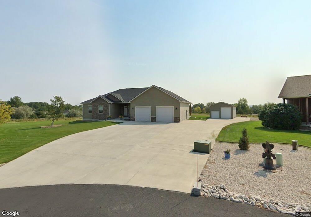
1020 Rockfork Cir Laurel, MT 59044
Estimated Value: $770,000 - $895,000
5
Beds
4
Baths
3,700
Sq Ft
$219/Sq Ft
Est. Value
About This Home
This home is located at 1020 Rockfork Cir, Laurel, MT 59044 and is currently estimated at $811,578, approximately $219 per square foot. 1020 Rockfork Cir is a home with nearby schools including Fred W. Graff School, West School, and Laurel Middle School.
Ownership History
Date
Name
Owned For
Owner Type
Purchase Details
Closed on
Oct 24, 2016
Sold by
Leach Irvin R and Leach Sandra S
Bought by
Leach Irvin R and Leach Sandra S
Current Estimated Value
Purchase Details
Closed on
Jul 11, 2013
Sold by
Amish Heritage Homes Inc
Bought by
Leach Irvin R and Brooks Sandra S
Home Financials for this Owner
Home Financials are based on the most recent Mortgage that was taken out on this home.
Original Mortgage
$363,920
Outstanding Balance
$263,163
Interest Rate
3.79%
Mortgage Type
New Conventional
Estimated Equity
$548,415
Purchase Details
Closed on
Jul 24, 2012
Sold by
Pawiroredjo Kai
Bought by
Amish Heritage Homes Inc
Purchase Details
Closed on
Apr 23, 2012
Sold by
Pawiroredjo Angela
Bought by
Pawiroredjo Kai
Create a Home Valuation Report for This Property
The Home Valuation Report is an in-depth analysis detailing your home's value as well as a comparison with similar homes in the area
Home Values in the Area
Average Home Value in this Area
Purchase History
| Date | Buyer | Sale Price | Title Company |
|---|---|---|---|
| Leach Irvin R | -- | None Available | |
| Leach Irvin R | -- | None Available | |
| Amish Heritage Homes Inc | -- | None Available | |
| Pawiroredjo Kai | -- | None Available |
Source: Public Records
Mortgage History
| Date | Status | Borrower | Loan Amount |
|---|---|---|---|
| Open | Leach Irvin R | $363,920 |
Source: Public Records
Tax History Compared to Growth
Tax History
| Year | Tax Paid | Tax Assessment Tax Assessment Total Assessment is a certain percentage of the fair market value that is determined by local assessors to be the total taxable value of land and additions on the property. | Land | Improvement |
|---|---|---|---|---|
| 2025 | $4,318 | $742,000 | $155,629 | $586,371 |
| 2024 | $4,318 | $624,500 | $92,851 | $531,649 |
| 2023 | $4,317 | $624,500 | $92,851 | $531,649 |
| 2022 | $3,652 | $514,500 | $0 | $0 |
| 2021 | $3,640 | $514,500 | $0 | $0 |
| 2020 | $3,665 | $500,400 | $0 | $0 |
| 2019 | $3,529 | $500,400 | $0 | $0 |
| 2018 | $3,888 | $478,200 | $0 | $0 |
| 2017 | $3,132 | $478,200 | $0 | $0 |
| 2016 | $3,403 | $465,100 | $0 | $0 |
| 2015 | $3,352 | $465,100 | $0 | $0 |
| 2014 | $2,490 | $180,571 | $0 | $0 |
Source: Public Records
Map
Nearby Homes
- 1336 Pennsylvania Ave
- 1718 Pinyon Dr
- 802-816 Date Ave
- 810 Piper Loop
- 109 E 12th St
- 1805 E Maryland Ln
- 1004 E 8th St
- 1104 E 8th St
- 1108 E 8th St
- 1115 Sunhaven Dr
- 1008 Sunhaven Dr
- 1006 Sunhaven Dr
- 1003 Montana Ave
- 611 Elm Ave
- 518 Date Ave
- 1665 Wild Lupine Ln
- 717 E 5th, 506 Alder Ave
- 403 Grandview Blvd
- 512 W 14th St
- 801 E 4th St
- 0 Rockfork Cir
- 985 Rockfork Cir
- 1000 Rockfork Cir
- 980 Rockfork Cir
- 975 Rockfork Cir
- 1436 Hill Crest Ave
- 1455 Green Bluff Ave
- 1405 Green Bluff Ave
- 1422 Hill Crest Ave
- 1518 Hill Crest Ave
- 1515 Green Bluff Ave
- 1370 Hill Crest Ave
- 0 Green Bluff Ave
- 1404 Hill Crest Ave
- 1505 Green Bluff Ave
- 1532 Hill Crest Ave
- 1115 Longview Rd
- 1338 Hill Crest Ave
- 1440 Green Bluff Ave
- 1433 Hill Crest Ave