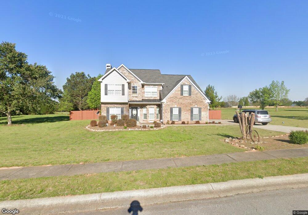
1020 Talus St Unit 1B Bogart, GA 30622
Estimated Value: $585,917 - $687,000
4
Beds
3
Baths
2,712
Sq Ft
$230/Sq Ft
Est. Value
About This Home
This home is located at 1020 Talus St Unit 1B, Bogart, GA 30622 and is currently estimated at $624,479, approximately $230 per square foot. 1020 Talus St Unit 1B is a home located in Oconee County with nearby schools including Rocky Branch Elementary School, Malcom Bridge Middle School, and North Oconee High School.
Ownership History
Date
Name
Owned For
Owner Type
Purchase Details
Closed on
Aug 31, 2016
Sold by
Davis Jeffrey
Bought by
Lipka Bryan M and Lipka Kimberly A
Current Estimated Value
Home Financials for this Owner
Home Financials are based on the most recent Mortgage that was taken out on this home.
Original Mortgage
$256,405
Outstanding Balance
$204,250
Interest Rate
3.43%
Mortgage Type
New Conventional
Estimated Equity
$420,229
Purchase Details
Closed on
May 8, 2014
Sold by
Davis Aymee
Bought by
Davis Jeffrey
Purchase Details
Closed on
Dec 22, 2005
Sold by
Star Home Builders Inc
Bought by
Davis Jeffrey P and Davis Aymee L
Home Financials for this Owner
Home Financials are based on the most recent Mortgage that was taken out on this home.
Original Mortgage
$195,000
Interest Rate
5.38%
Mortgage Type
New Conventional
Create a Home Valuation Report for This Property
The Home Valuation Report is an in-depth analysis detailing your home's value as well as a comparison with similar homes in the area
Home Values in the Area
Average Home Value in this Area
Purchase History
| Date | Buyer | Sale Price | Title Company |
|---|---|---|---|
| Lipka Bryan M | $269,900 | -- | |
| Davis Jeffrey | -- | -- | |
| Davis Jeffrey P | $245,000 | -- |
Source: Public Records
Mortgage History
| Date | Status | Borrower | Loan Amount |
|---|---|---|---|
| Open | Lipka Bryan M | $256,405 | |
| Previous Owner | Davis Jeffrey P | $195,000 |
Source: Public Records
Tax History Compared to Growth
Tax History
| Year | Tax Paid | Tax Assessment Tax Assessment Total Assessment is a certain percentage of the fair market value that is determined by local assessors to be the total taxable value of land and additions on the property. | Land | Improvement |
|---|---|---|---|---|
| 2024 | $3,388 | $183,634 | $36,000 | $147,634 |
| 2023 | $3,435 | $167,790 | $30,000 | $137,790 |
| 2022 | $3,051 | $142,282 | $26,000 | $116,282 |
| 2021 | $2,777 | $120,161 | $16,000 | $104,161 |
| 2020 | $2,604 | $112,542 | $16,000 | $96,542 |
| 2019 | $2,363 | $102,160 | $16,000 | $86,160 |
| 2018 | $2,332 | $98,714 | $16,000 | $82,714 |
| 2017 | $2,358 | $97,835 | $16,000 | $81,835 |
| 2016 | $2,208 | $91,469 | $15,200 | $76,269 |
| 2015 | $2,036 | $84,038 | $15,200 | $68,838 |
| 2014 | $2,111 | $85,221 | $16,000 | $69,221 |
| 2013 | -- | $81,556 | $16,000 | $65,556 |
Source: Public Records
Map
Nearby Homes
- 1090 Talus St
- 4100 Monroe Hwy
- 4400 Monroe Hwy Unit PARCEL 1-7
- 1250 Pete Dickens Rd
- 3240 Monroe Hwy
- 1120 Pearl Way
- 1060 Cobblestone Ln
- 1180 Summerfield Ln
- 1145 Summerfield Ln
- 00 Ruth Jackson Rd
- 0 Ruth Jackson Rd Unit 10582108
- 2130 Keeneland Dr
- 1640 Madison Ct
- 2130 Keeneland Dr
- 2986 Coralbell Dr
- 1811 McNutt Creek Rd
- 1851 McNutt Creek Rd
- 1020 Talus St
- 1021 Talus St Unit 5A
- 1021 Talus St
- 1040 Talus St
- 1041 Talus St Unit 1100
- 1041 Talus St Unit 1000
- 1041 Talus St Unit 900
- 1041 Talus St
- 1141 Ruby Way Unit 3B
- 1141 Ruby Way
- 1051 Sunstone Dr Unit 4A
- 1051 Sunstone Dr
- 1061 Talus St
- 1060 Garland Dr Unit 100
- 1060 Garland Dr
- 1151 Ruby Way Unit 4B
- 1151 Ruby Way
- 1070 Sunstone Dr Unit 9C
- 1070 Sunstone Dr
- 1131 Ruby Way Unit 2B