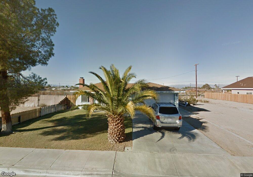
1020 W Vulcan Ave Ridgecrest, CA 93555
Estimated Value: $210,000 - $233,000
3
Beds
2
Baths
1,161
Sq Ft
$192/Sq Ft
Est. Value
About This Home
This home is located at 1020 W Vulcan Ave, Ridgecrest, CA 93555 and is currently estimated at $222,797, approximately $191 per square foot. 1020 W Vulcan Ave is a home located in Kern County with nearby schools including Faller Elementary School, James Monroe Middle School, and Burroughs High School.
Ownership History
Date
Name
Owned For
Owner Type
Purchase Details
Closed on
Dec 10, 2019
Sold by
Donohue Kyle P and Donohue Alexandria
Bought by
List Stephen O
Current Estimated Value
Home Financials for this Owner
Home Financials are based on the most recent Mortgage that was taken out on this home.
Original Mortgage
$155,200
Outstanding Balance
$137,098
Interest Rate
3.7%
Mortgage Type
New Conventional
Estimated Equity
$85,699
Purchase Details
Closed on
Nov 1, 2013
Sold by
Powers Trina D
Bought by
Donohue Kyle P and Kratz Alexandria
Home Financials for this Owner
Home Financials are based on the most recent Mortgage that was taken out on this home.
Original Mortgage
$111,250
Interest Rate
4.18%
Mortgage Type
New Conventional
Purchase Details
Closed on
Feb 10, 2004
Sold by
Beayrd Audrey H and Collard Audrey H
Bought by
Powers Trina D
Home Financials for this Owner
Home Financials are based on the most recent Mortgage that was taken out on this home.
Original Mortgage
$64,424
Interest Rate
5.64%
Mortgage Type
FHA
Purchase Details
Closed on
Jun 15, 1995
Sold by
Collard Audrey H
Bought by
Yslas George P and Collard Audrey H
Home Financials for this Owner
Home Financials are based on the most recent Mortgage that was taken out on this home.
Original Mortgage
$51,021
Interest Rate
8.51%
Mortgage Type
FHA
Purchase Details
Closed on
Apr 26, 1995
Sold by
Hud
Bought by
Collard Audrey H
Home Financials for this Owner
Home Financials are based on the most recent Mortgage that was taken out on this home.
Original Mortgage
$51,021
Interest Rate
8.51%
Mortgage Type
FHA
Purchase Details
Closed on
Jul 27, 1994
Sold by
Bankers Trust Company Of California Na
Bought by
Hud
Purchase Details
Closed on
Jul 12, 1994
Sold by
Professional Foreclosure Corp
Bought by
Bankers Trust Company Of California Na
Create a Home Valuation Report for This Property
The Home Valuation Report is an in-depth analysis detailing your home's value as well as a comparison with similar homes in the area
Home Values in the Area
Average Home Value in this Area
Purchase History
| Date | Buyer | Sale Price | Title Company |
|---|---|---|---|
| List Stephen O | $160,000 | First American Title Company | |
| Donohue Kyle P | $125,000 | Placer Title Company | |
| Powers Trina D | $65,000 | First American Title | |
| Yslas George P | -- | -- | |
| Collard Audrey H | $50,000 | Heritage Title Co | |
| Hud | -- | First American Title Company | |
| Bankers Trust Company Of California Na | $71,359 | First American Title Company |
Source: Public Records
Mortgage History
| Date | Status | Borrower | Loan Amount |
|---|---|---|---|
| Open | List Stephen O | $155,200 | |
| Previous Owner | Donohue Kyle P | $111,250 | |
| Previous Owner | Powers Trina D | $64,424 | |
| Previous Owner | Collard Audrey H | $51,021 |
Source: Public Records
Tax History Compared to Growth
Tax History
| Year | Tax Paid | Tax Assessment Tax Assessment Total Assessment is a certain percentage of the fair market value that is determined by local assessors to be the total taxable value of land and additions on the property. | Land | Improvement |
|---|---|---|---|---|
| 2025 | $2,446 | $174,979 | $27,340 | $147,639 |
| 2024 | $2,446 | $171,549 | $26,804 | $144,745 |
| 2023 | $2,376 | $168,186 | $26,279 | $141,907 |
| 2022 | $2,329 | $164,889 | $25,764 | $139,125 |
| 2021 | $2,256 | $161,657 | $25,259 | $136,398 |
| 2020 | $2,203 | $160,000 | $25,000 | $135,000 |
| 2019 | $1,955 | $139,993 | $22,415 | $117,578 |
| 2018 | $2,030 | $134,559 | $21,546 | $113,013 |
| 2017 | $2,024 | $131,922 | $21,124 | $110,798 |
| 2016 | $1,953 | $129,336 | $20,710 | $108,626 |
| 2015 | $1,925 | $127,394 | $20,399 | $106,995 |
| 2014 | $1,784 | $124,900 | $20,000 | $104,900 |
Source: Public Records
Map
Nearby Homes
- 917 S Yorktown St
- 0 S Yorktown St
- 509-090-25 W Vulcan Ave
- 509-090-26 W Vulcan Ave
- 927 W Vulcan Ave
- 1020 S Farragut St
- 509-090-30 Bowman Rd
- 343-351-01 Bowman Rd
- 343-351-07 Bowman Rd
- 0 Apn 08120213001 Unit 9993264
- 1 W Bowman Rd
- 0 W Perch Ave Unit 15 250035441
- 0 W Coronado Ave Unit 25003301
- 0 W Coronado Ave Unit SR25097540
- 921 Porter St
- 0 W Boston Ave
- 1304 Porter St
- 915 W Coral Ave
- 1205 S Farragut St
- 0 S Mahan St Unit 202408514
- 1028 W Vulcan Ave
- 1016 W Vulcan Ave
- 1012 W Vulcan Ave
- 913 S Yorktown St
- 1032 W Vulcan Ave
- 912 S Yorktown St
- 1008 W Vulcan Ave
- 1036 W Vulcan Ave
- 1004 W Vulcan Ave
- 1033 W Vulcan Ave
- 916 S Yorktown St
- 921 S Yorktown St
- 1000 W Vulcan Ave
- 1040 W Vulcan Ave
- 908 S Mccall St
- 925 S Yorktown St
- 917 S Ranger St
- 1044 W Vulcan Ave
- 921 S Ranger St
- 928 S Yorktown St