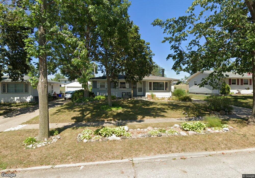
1020 Westview Dr Unit 10TH Marion, IA 52302
Estimated Value: $204,000 - $211,000
3
Beds
1
Bath
988
Sq Ft
$210/Sq Ft
Est. Value
About This Home
This home is located at 1020 Westview Dr Unit 10TH, Marion, IA 52302 and is currently estimated at $207,792, approximately $210 per square foot. 1020 Westview Dr Unit 10TH is a home located in Linn County with nearby schools including Starry Elementary School, Francis Marion Intermediate School, and Vernon Middle School.
Ownership History
Date
Name
Owned For
Owner Type
Purchase Details
Closed on
May 11, 2021
Sold by
Mohling Andrew W and Mohling Heather L
Bought by
Peska Neil
Current Estimated Value
Purchase Details
Closed on
Jun 21, 2017
Sold by
Antolik Sherie K
Bought by
Mohling Andrew W
Home Financials for this Owner
Home Financials are based on the most recent Mortgage that was taken out on this home.
Original Mortgage
$113,050
Interest Rate
3.19%
Mortgage Type
New Conventional
Create a Home Valuation Report for This Property
The Home Valuation Report is an in-depth analysis detailing your home's value as well as a comparison with similar homes in the area
Home Values in the Area
Average Home Value in this Area
Purchase History
| Date | Buyer | Sale Price | Title Company |
|---|---|---|---|
| Peska Neil | $160,000 | None Available | |
| Mohling Andrew W | $119,000 | None Available |
Source: Public Records
Mortgage History
| Date | Status | Borrower | Loan Amount |
|---|---|---|---|
| Previous Owner | Mohling Andrew W | $113,050 |
Source: Public Records
Tax History Compared to Growth
Tax History
| Year | Tax Paid | Tax Assessment Tax Assessment Total Assessment is a certain percentage of the fair market value that is determined by local assessors to be the total taxable value of land and additions on the property. | Land | Improvement |
|---|---|---|---|---|
| 2025 | $3,112 | $185,500 | $20,300 | $165,200 |
| 2024 | $2,724 | $176,000 | $20,300 | $155,700 |
| 2023 | $2,724 | $176,000 | $20,300 | $155,700 |
| 2022 | $2,594 | $131,600 | $20,300 | $111,300 |
| 2021 | $2,480 | $131,600 | $20,300 | $111,300 |
| 2020 | $2,480 | $118,700 | $20,300 | $98,400 |
| 2019 | $2,332 | $111,900 | $20,300 | $91,600 |
| 2018 | $2,238 | $111,900 | $20,300 | $91,600 |
| 2017 | $2,328 | $107,900 | $20,300 | $87,600 |
| 2016 | $2,328 | $107,900 | $20,300 | $87,600 |
| 2015 | $2,321 | $107,900 | $20,300 | $87,600 |
| 2014 | $2,134 | $107,900 | $20,300 | $87,600 |
| 2013 | $2,032 | $107,900 | $20,300 | $87,600 |
Source: Public Records
Map
Nearby Homes
- 1020 Westview Dr
- 1020 Westview Dr Unit 8TH
- 1020 Westview Dr Unit 9TH
- 1040 Westview Dr
- 1040 Westview Dr Unit 8TH
- 1040 Westview Dr Unit 9TH
- 1040 Westview Dr Unit 10TH
- 1000 Westview Dr Unit 8TH
- 1000 Westview Dr Unit 9TH
- 1000 Westview Dr
- 1000 Westview Dr Unit 10TH
- 1000 Westview Dr Unit 14TH
- 1025 Orchard Rd
- 1060 Westview Dr
- 1060 Westview Dr Unit 8TH
- 1060 Westview Dr Unit 9TH
- 1060 Westview Dr Unit 10TH
- 1060 Westview Dr Unit 14TH
- 980 Westview Dr Unit 8TH
- 980 Westview Dr Unit 9TH