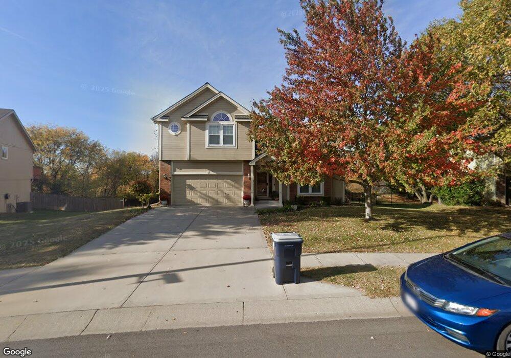
10200 N Spruce Ave Kansas City, MO 64156
Northland NeighborhoodEstimated Value: $367,000 - $428,000
3
Beds
3
Baths
1,789
Sq Ft
$222/Sq Ft
Est. Value
About This Home
This home is located at 10200 N Spruce Ave, Kansas City, MO 64156 and is currently estimated at $397,833, approximately $222 per square foot. 10200 N Spruce Ave is a home located in Clay County with nearby schools including Rising Hill Elementary, New Mark Middle School, and Staley High School.
Ownership History
Date
Name
Owned For
Owner Type
Purchase Details
Closed on
Sep 29, 2003
Sold by
Cmz Homes Inc
Bought by
Rhoads Ryan P and Rhoads Mary G
Current Estimated Value
Home Financials for this Owner
Home Financials are based on the most recent Mortgage that was taken out on this home.
Original Mortgage
$100,000
Outstanding Balance
$46,762
Interest Rate
6.24%
Mortgage Type
Purchase Money Mortgage
Estimated Equity
$351,071
Purchase Details
Closed on
Jun 10, 2003
Sold by
M & R Land Llc
Bought by
Cmz Homes Inc
Create a Home Valuation Report for This Property
The Home Valuation Report is an in-depth analysis detailing your home's value as well as a comparison with similar homes in the area
Home Values in the Area
Average Home Value in this Area
Purchase History
| Date | Buyer | Sale Price | Title Company |
|---|---|---|---|
| Rhoads Ryan P | -- | United Title Co Inc | |
| Cmz Homes Inc | -- | United Title Company Inc |
Source: Public Records
Mortgage History
| Date | Status | Borrower | Loan Amount |
|---|---|---|---|
| Open | Rhoads Ryan P | $100,000 |
Source: Public Records
Tax History Compared to Growth
Tax History
| Year | Tax Paid | Tax Assessment Tax Assessment Total Assessment is a certain percentage of the fair market value that is determined by local assessors to be the total taxable value of land and additions on the property. | Land | Improvement |
|---|---|---|---|---|
| 2025 | $4,047 | $57,060 | -- | -- |
| 2024 | $4,047 | $50,240 | -- | -- |
| 2023 | $4,012 | $50,240 | $0 | $0 |
| 2022 | $3,515 | $42,070 | $0 | $0 |
| 2021 | $3,519 | $42,066 | $4,940 | $37,126 |
| 2020 | $3,531 | $39,050 | $0 | $0 |
| 2019 | $3,465 | $39,050 | $0 | $0 |
| 2018 | $3,425 | $36,880 | $0 | $0 |
| 2017 | $3,275 | $36,880 | $4,940 | $31,940 |
| 2016 | $3,275 | $35,910 | $4,940 | $30,970 |
| 2015 | $3,273 | $35,910 | $4,940 | $30,970 |
| 2014 | $3,180 | $34,370 | $4,940 | $29,430 |
Source: Public Records
Map
Nearby Homes
- 4303 NE 102nd St
- 10008 N Cypress (Lt 7) Ave
- 10000 N Cypress (Lt 9) Ave
- 10501 NE Staley Rd
- 9900 N Cypress Ave
- 4505 NE 101st St
- 4512 NE 103rd Terrace
- 9905 N Cypress (Lt 1) Ave
- 3526 NE 102nd Terrace
- 10206 N Quincy Ave
- 3423 NE 102nd St
- Monroe Plan at Creekside
- Spruce Plan at Creekside
- Chestnut Plan at Creekside
- The Maple Plan at Creekside
- Redbud Plan at Creekside
- Cypress Plan at Creekside
- McKinley Plan at Creekside
- Hawthorn II Plan at Creekside
- The Brooklyn Plan at Creekside
- 4301 NE 102nd St
- 10202 N Spruce Ave
- 4300 NE 102nd St
- 10204 N Spruce Ave
- 10111 NE Staley Rd
- 10205 N Spruce Ave
- 4304 NE 102nd St
- 4305 NE 102nd St
- 10208 N Spruce Ave
- 10209 N Spruce Ave
- 10045 NE Staley Rd
- 3652 NE 91st Terrace
- 3647 NE 91st Terrace
- 3643 NE 91st Terrace
- 3644 NE 91st Terrace
- 3640 NE 91st Terrace
- 3524 NE 91st Terrace
- 2523 NE 91st Place
- 2512 NE 91st Place
- 3528 NE 91st Terrace