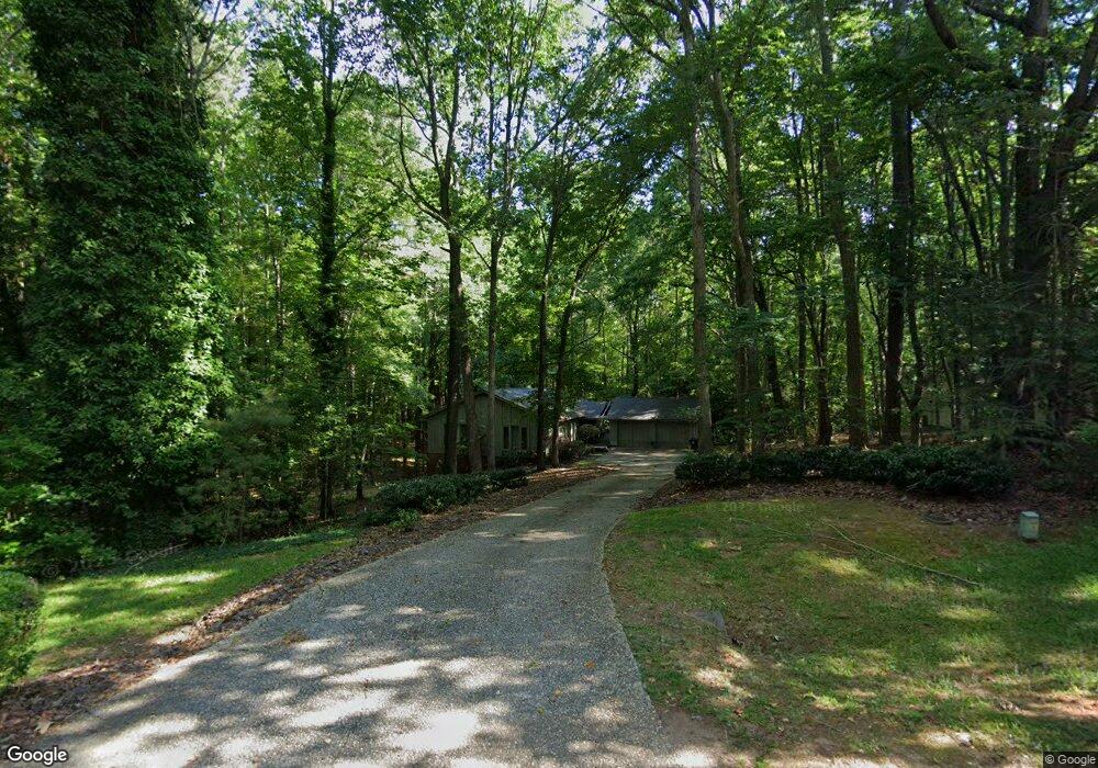
10204 Roadstead Way W Raleigh, NC 27613
Wood Valley NeighborhoodEstimated Value: $749,000 - $793,000
4
Beds
3
Baths
3,306
Sq Ft
$230/Sq Ft
Est. Value
About This Home
This home is located at 10204 Roadstead Way W, Raleigh, NC 27613 and is currently estimated at $761,001, approximately $230 per square foot. 10204 Roadstead Way W is a home located in Wake County with nearby schools including Leesville Road Middle School, Leesville Road High School, and Quest Academy.
Ownership History
Date
Name
Owned For
Owner Type
Purchase Details
Closed on
Aug 3, 2007
Sold by
Beaulieu Gregory J and Beaulieu Kathleen M
Bought by
Lerose Darren and Lerose Karen E
Current Estimated Value
Home Financials for this Owner
Home Financials are based on the most recent Mortgage that was taken out on this home.
Original Mortgage
$286,000
Outstanding Balance
$180,803
Interest Rate
6.63%
Mortgage Type
Purchase Money Mortgage
Estimated Equity
$580,198
Purchase Details
Closed on
Oct 28, 1999
Sold by
Treadway Donna J
Bought by
Beaulieu Gregory J and Beaulieu Kathleen M
Home Financials for this Owner
Home Financials are based on the most recent Mortgage that was taken out on this home.
Original Mortgage
$225,150
Interest Rate
7.81%
Create a Home Valuation Report for This Property
The Home Valuation Report is an in-depth analysis detailing your home's value as well as a comparison with similar homes in the area
Home Values in the Area
Average Home Value in this Area
Purchase History
| Date | Buyer | Sale Price | Title Company |
|---|---|---|---|
| Lerose Darren | $357,500 | None Available | |
| Beaulieu Gregory J | $237,000 | -- |
Source: Public Records
Mortgage History
| Date | Status | Borrower | Loan Amount |
|---|---|---|---|
| Open | Lerose Darren | $286,000 | |
| Previous Owner | Beaulieu Gregory J | $225,150 |
Source: Public Records
Tax History Compared to Growth
Tax History
| Year | Tax Paid | Tax Assessment Tax Assessment Total Assessment is a certain percentage of the fair market value that is determined by local assessors to be the total taxable value of land and additions on the property. | Land | Improvement |
|---|---|---|---|---|
| 2025 | $4,155 | $646,567 | $210,000 | $436,567 |
| 2024 | $4,035 | $646,567 | $210,000 | $436,567 |
| 2023 | $3,225 | $411,015 | $135,000 | $276,015 |
| 2022 | $2,988 | $411,015 | $135,000 | $276,015 |
| 2021 | $2,908 | $411,015 | $135,000 | $276,015 |
| 2020 | $2,860 | $411,015 | $135,000 | $276,015 |
| 2019 | $3,111 | $378,450 | $135,000 | $243,450 |
| 2018 | $2,860 | $378,450 | $135,000 | $243,450 |
| 2017 | $2,711 | $378,450 | $135,000 | $243,450 |
| 2016 | $2,656 | $378,450 | $135,000 | $243,450 |
| 2015 | $2,678 | $382,761 | $122,000 | $260,761 |
| 2014 | $2,539 | $382,761 | $122,000 | $260,761 |
Source: Public Records
Map
Nearby Homes
- 5009 Wood Valley Dr
- 5020 Red Cedar Rd
- 11804 Mountbatten Way
- 11953 Eagle Cliff Ct
- Harlow Plan at Bayberry
- 5528 Hawthorne Park
- 8717 Little Deer Ln
- 7942 Berry Crest Ave
- 6108 Dunzo Dr
- 5906 Dunzo Dr
- 5900 Dunzo Dr
- 5952 Dunzo Dr
- 5902 Dunzo Dr
- 5956 Dunzo Dr
- 5904 Dunzo Dr
- 10906 Bayflower Way
- 5950 Dunzo Dr
- 10900 Bayflower Way
- 10917 Bayflower Way
- 10907 Bayflower Way
- 10200 Roadstead Way W
- 10208 Roadstead Way W
- 10205 Roadstead Way W
- 10201 Roadstead Way W
- 10300 Roadstead Way W
- 10211 Roadstead Way W
- 10400 Roadstead Way W
- 10213 Roadstead Way W
- 10104 Roadstead Way E
- 10105 Boxelder Dr
- 5301 Woodlaurel Ct
- 10316 Roadstead Way W
- 5305 Woodlaurel Ct
- 10104 Boxelder Dr
- 10101 Boxelder Dr
- 10301 Roadstead Way W
- 10208 Touchwood Place
- 5300 Woodlaurel Ct
- 10009 Boxelder Dr Unit A
- 10409 Roadstead Way W