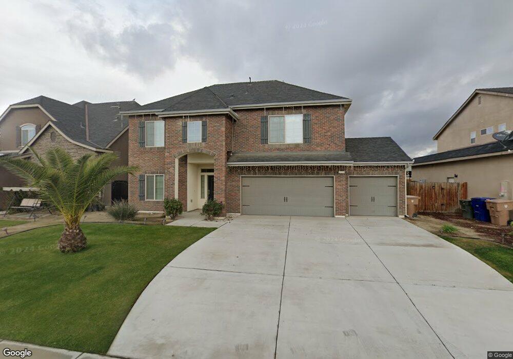
10206 Hillgate Ave Bakersfield, CA 93311
Old River NeighborhoodEstimated Value: $543,014 - $618,000
4
Beds
4
Baths
1,094
Sq Ft
$525/Sq Ft
Est. Value
About This Home
This home is located at 10206 Hillgate Ave, Bakersfield, CA 93311 and is currently estimated at $574,754, approximately $525 per square foot. 10206 Hillgate Ave is a home with nearby schools including Lakeside School, General Shafter Elementary School, and Independence High School.
Ownership History
Date
Name
Owned For
Owner Type
Purchase Details
Closed on
Feb 24, 2016
Sold by
Kaur Rajinder
Bought by
Singh Lakhwinder
Current Estimated Value
Purchase Details
Closed on
Dec 14, 2015
Sold by
Lennar Homes Of California Inc
Bought by
Singh Lakhwinder
Home Financials for this Owner
Home Financials are based on the most recent Mortgage that was taken out on this home.
Original Mortgage
$266,350
Interest Rate
3.72%
Mortgage Type
New Conventional
Create a Home Valuation Report for This Property
The Home Valuation Report is an in-depth analysis detailing your home's value as well as a comparison with similar homes in the area
Home Values in the Area
Average Home Value in this Area
Purchase History
| Date | Buyer | Sale Price | Title Company |
|---|---|---|---|
| Singh Lakhwinder | -- | North American Title Co Inc | |
| Singh Lakhwinder | $336,500 | North American Title Company |
Source: Public Records
Mortgage History
| Date | Status | Borrower | Loan Amount |
|---|---|---|---|
| Previous Owner | Singh Lakhwinder | $266,350 |
Source: Public Records
Tax History
| Year | Tax Paid | Tax Assessment Tax Assessment Total Assessment is a certain percentage of the fair market value that is determined by local assessors to be the total taxable value of land and additions on the property. | Land | Improvement |
|---|---|---|---|---|
| 2025 | $5,269 | $397,749 | $59,186 | $338,563 |
| 2024 | $5,149 | $389,951 | $58,026 | $331,925 |
| 2023 | $5,149 | $382,306 | $56,889 | $325,417 |
| 2022 | $5,049 | $374,811 | $55,774 | $319,037 |
| 2021 | $4,929 | $367,463 | $54,681 | $312,782 |
| 2020 | $4,864 | $363,696 | $54,121 | $309,575 |
| 2019 | $4,772 | $363,696 | $54,121 | $309,575 |
| 2018 | $4,653 | $349,574 | $52,020 | $297,554 |
| 2017 | $4,599 | $342,720 | $51,000 | $291,720 |
| 2016 | $2,948 | $208,445 | $26,445 | $182,000 |
Source: Public Records
Map
Nearby Homes
- 10303 Fort Sanders Ave
- 10012 Fort Sanders Ave
- 9912 Alondra Dr
- 9827 Fort Sanders Ave
- 9820 Fort Sanders Ave
- 10026 Murfreesboro Dr
- 10609 Montemar Dr
- 6500 Cordell Way
- 10702 Montemar Dr
- 9826 Pocohontas Ln
- 6501 Balmorhea St
- 10619 Alondra Dr
- 9801 Biscayne Dr
- 7318 Chetco River St
- 9713 Blountsville Dr
- 7311 Koyuk River St
- 10207 Yukon River Ave
- 10811 Alondra Dr
- 6911 Catalina Creek Way
- 10306 Breitenbush Ave
- 10202 Hillgate Ave
- 10210 Hillgate Ave
- 10214 Hillgate Ave
- 10205 Hillgate Ave
- 10209 Hillgate Ave
- 10119 Fort Sanders Ave Unit 2
- 10119 Fort Sanders Ave
- 10201 Hillgate Ave
- 10218 Hillgate Ave
- 10115 Fort Sanders Ave Unit 1
- 10115 Fort Sanders Ave
- 10201 Fort Sanders Ave Unit 3
- 10201 Fort Sanders Ave
- 10213 Hillgate Ave
- 10107 Hillgate Ave
- 10205 Fort Sanders Ave Unit 4
- 10205 Fort Sanders Ave
- 10300 Hillgate Ave
- 10217 Hillgate Ave
- 10103 Hillgate Ave
Your Personal Tour Guide
Ask me questions while you tour the home.