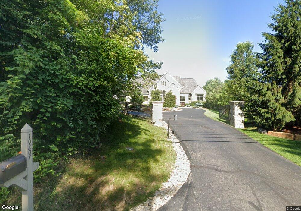
10207 Humphrey Rd Cincinnati, OH 45242
Estimated Value: $1,617,000 - $2,677,000
6
Beds
8
Baths
5,729
Sq Ft
$395/Sq Ft
Est. Value
About This Home
This home is located at 10207 Humphrey Rd, Cincinnati, OH 45242 and is currently estimated at $2,264,389, approximately $395 per square foot. 10207 Humphrey Rd is a home with nearby schools including Edwin H Greene Intermediate Middle School, Sycamore Junior High School, and Sycamore High School.
Ownership History
Date
Name
Owned For
Owner Type
Purchase Details
Closed on
Mar 20, 2014
Sold by
Daniel Wade Keith and Daneil Maria Elaine
Bought by
Samad Jacob G and The Humphrey Road Revocable Real Estate
Current Estimated Value
Purchase Details
Closed on
Jul 15, 2011
Sold by
Dollin Edward C and Dollin Gail M
Bought by
Daniel Wade Keith and Daniel Maria Elaine
Purchase Details
Closed on
Jun 8, 1999
Sold by
Towne Land Company An Ohio Corporation
Bought by
Dollin Edward C and Dollin Gail M
Home Financials for this Owner
Home Financials are based on the most recent Mortgage that was taken out on this home.
Original Mortgage
$148,000
Interest Rate
7.5%
Create a Home Valuation Report for This Property
The Home Valuation Report is an in-depth analysis detailing your home's value as well as a comparison with similar homes in the area
Home Values in the Area
Average Home Value in this Area
Purchase History
| Date | Buyer | Sale Price | Title Company |
|---|---|---|---|
| Samad Jacob G | -- | Attorney | |
| Daniel Wade Keith | -- | -- | |
| Daniel Wade Keith | -- | -- | |
| Dollin Edward C | $185,000 | Tri-Star Title Agency Inc |
Source: Public Records
Mortgage History
| Date | Status | Borrower | Loan Amount |
|---|---|---|---|
| Previous Owner | Dollin Edward C | $148,000 |
Source: Public Records
Tax History
| Year | Tax Paid | Tax Assessment Tax Assessment Total Assessment is a certain percentage of the fair market value that is determined by local assessors to be the total taxable value of land and additions on the property. | Land | Improvement |
|---|---|---|---|---|
| 2025 | $36,968 | $737,892 | $154,270 | $583,622 |
| 2024 | $35,947 | $737,892 | $154,270 | $583,622 |
| 2023 | $35,691 | $737,892 | $154,270 | $583,622 |
| 2022 | $37,934 | $638,106 | $148,547 | $489,559 |
| 2021 | $37,434 | $638,106 | $148,547 | $489,559 |
| 2020 | $37,585 | $638,106 | $148,547 | $489,559 |
| 2019 | $36,294 | $590,839 | $137,543 | $453,296 |
| 2018 | $34,913 | $590,839 | $137,543 | $453,296 |
| 2017 | $32,826 | $590,839 | $137,543 | $453,296 |
| 2016 | $27,405 | $473,025 | $120,204 | $352,821 |
| 2015 | $24,512 | $473,025 | $120,204 | $352,821 |
| 2014 | $23,862 | $473,025 | $120,204 | $352,821 |
| 2013 | $24,494 | $446,250 | $113,400 | $332,850 |
Source: Public Records
Map
Nearby Homes
- 10564 Stablehand Dr
- 9274 Solon Dr
- 8905 Hopewell Rd
- 9248 Link Rd
- 10514 Hopewoods Ct
- 8736 Tiburon Dr
- 9561 Loveland Madeira Rd
- 9068 Link Rd
- 8866 Humphrey St
- 6705 Branch Hill Guinea Pike
- 382 Brier Creek Dr
- 9325 Loveland Madeira Rd
- 8765 Weller Rd
- 6533 Conner Ln
- 330 Whispering Pines Dr
- 9424 Kemper Grove Ln
- 8714 Weller Rd
- 6207 Branch Hill Miamiville Rd
- 9970 Washington Ave
- 8363 Shadowpoint Ct
- 13 Johnston Ln
- 10221 Humphrey Rd Unit 2
- 10221 Humphrey Rd
- 9207 Johnston Ln
- 10220 Stablehand Dr
- 9219 Johnston Ln
- 10230 Stablehand Dr
- 10239 Humphrey Rd Unit 2
- 10239 Humphrey Rd Unit 1
- 10239 Humphrey Rd
- 10172 Humphrey Rd
- 9150 Brokensound Ln
- 10219 Stablehand Dr
- 9227 Johnston Ln
- 10200 Humphrey Rd
- 1017 Humphrey Rd
- 9210 Liberty Hill Ct
- 10236 Stablehand Dr
- 10227 Stablehand Dr
- 9120 Whisperinghill Dr
Your Personal Tour Guide
Ask me questions while you tour the home.