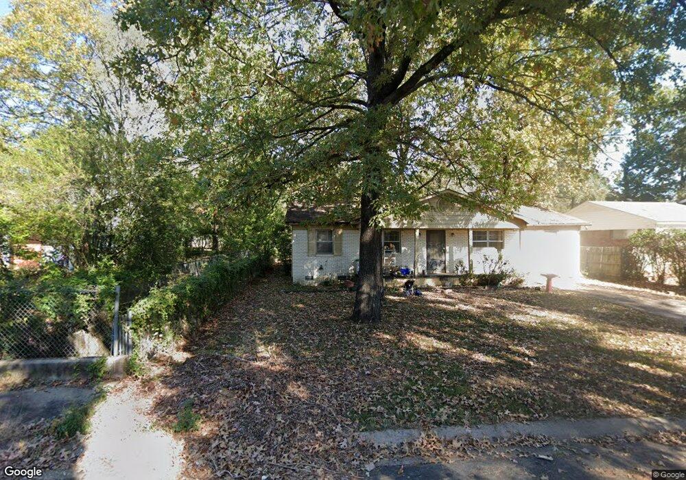
10208 Ronald Dr Little Rock, AR 72205
West Markham NeighborhoodEstimated Value: $120,157 - $171,000
--
Bed
3
Baths
1,400
Sq Ft
$103/Sq Ft
Est. Value
About This Home
This home is located at 10208 Ronald Dr, Little Rock, AR 72205 and is currently estimated at $144,039, approximately $102 per square foot. 10208 Ronald Dr is a home located in Pulaski County with nearby schools including McDermott Elementary School, J.A. Fair K8 Preparatory School, and Henderson Middle School.
Ownership History
Date
Name
Owned For
Owner Type
Purchase Details
Closed on
Sep 29, 2023
Sold by
Gephardt Lori
Bought by
Mid-Ark Property & Investments Inc
Current Estimated Value
Purchase Details
Closed on
May 31, 2018
Sold by
Smith Nancy Carolyn and Denora Gilliam Estate
Bought by
Smith Nancy Carolyn and Gephardt Lori
Create a Home Valuation Report for This Property
The Home Valuation Report is an in-depth analysis detailing your home's value as well as a comparison with similar homes in the area
Home Values in the Area
Average Home Value in this Area
Purchase History
| Date | Buyer | Sale Price | Title Company |
|---|---|---|---|
| Mid-Ark Property & Investments Inc | $70,000 | West Little Rock Title Company | |
| Smith Nancy Carolyn | -- | None Available |
Source: Public Records
Tax History Compared to Growth
Tax History
| Year | Tax Paid | Tax Assessment Tax Assessment Total Assessment is a certain percentage of the fair market value that is determined by local assessors to be the total taxable value of land and additions on the property. | Land | Improvement |
|---|---|---|---|---|
| 2025 | $1,428 | $20,393 | $4,400 | $15,993 |
| 2024 | $892 | $20,393 | $4,400 | $15,993 |
| 2023 | $892 | $20,393 | $4,400 | $15,993 |
| 2022 | $892 | $20,393 | $4,400 | $15,993 |
| 2021 | $899 | $18,820 | $3,050 | $15,770 |
| 2020 | $517 | $18,820 | $3,050 | $15,770 |
| 2019 | $517 | $18,820 | $3,050 | $15,770 |
| 2018 | $542 | $18,820 | $3,050 | $15,770 |
| 2017 | $542 | $18,820 | $3,050 | $15,770 |
| 2016 | $542 | $19,020 | $4,600 | $14,420 |
| 2015 | $894 | $12,747 | $4,600 | $8,147 |
| 2014 | $894 | $12,747 | $4,600 | $8,147 |
Source: Public Records
Map
Nearby Homes
- 201 Natural Resources Dr
- Lot 10 Ellia's Cove
- 605 Vinson St
- 9605 Brooks Ct
- 31 Meadowbrook Dr
- 19 Mcgovern Dr
- 9516 Wiggins Place
- 411 Burnside Dr
- 5 Mcgovern Dr
- 41 Brookridge Dr
- 507 Mimi Ln
- 11121 Beverly Hills Dr
- 504 and 506 Mimi Ln
- 9320 Cloverhill Rd
- 9317 Cynthia Dr
- 4 Brookridge Cove
- 812 N Shackleford Rd
- 10702 Breckenridge Dr
- 504 Green Mountain Dr
- 11 Walnut Valley Dr
- 10214 Ronald Dr
- 10202 Ronald Dr
- 10209 Raymond Dr
- 10200 Ronald Dr
- 10218 Ronald Dr
- 10203 Raymond Dr
- 10215 Raymond Dr
- 10209 Ronald Dr
- 10015 Raymond Dr
- 10219 Raymond Dr
- 10203 Ronald Dr
- 10016 Ronald Dr
- 10219 Ronald Dr
- 10023 Ronald Dr
- 10009 Raymond Dr
- 10225 Raymond Dr
- 0 Raymond Dr
- 0 Ronald
- 10012 Ronald Dr
- 10225 Ronald Dr