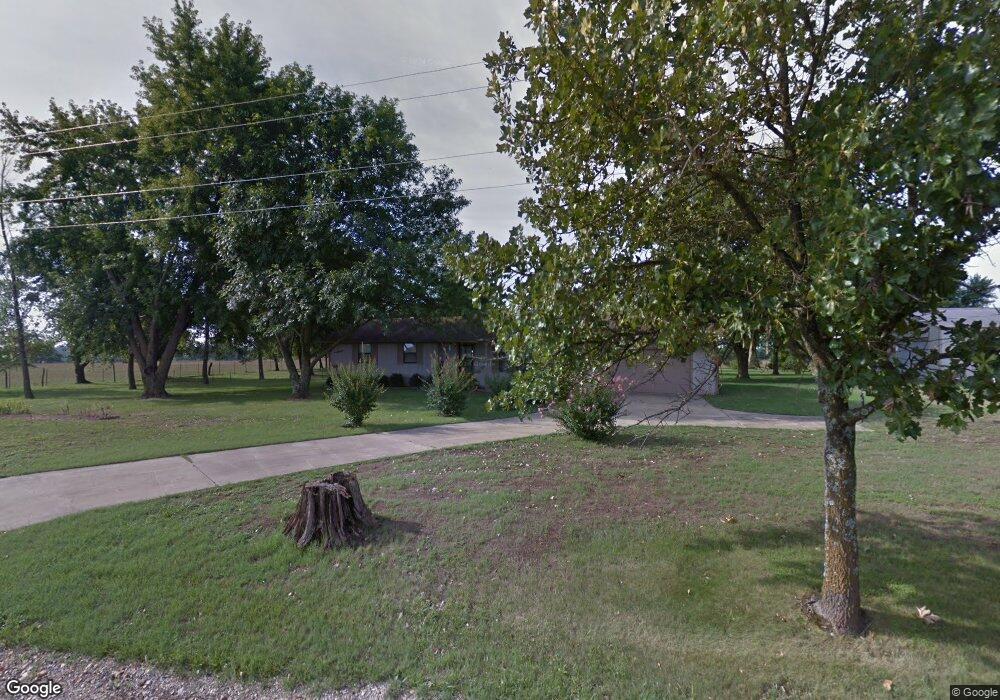
10209 Andy Buck Rd Pea Ridge, AR 72751
Estimated Value: $285,000 - $391,000
--
Bed
2
Baths
1,400
Sq Ft
$230/Sq Ft
Est. Value
About This Home
This home is located at 10209 Andy Buck Rd, Pea Ridge, AR 72751 and is currently estimated at $321,496, approximately $229 per square foot. 10209 Andy Buck Rd is a home located in Benton County with nearby schools including Pea Ridge Primary School, Pea Ridge Intermediate School, and Pea Ridge Junior High School.
Ownership History
Date
Name
Owned For
Owner Type
Purchase Details
Closed on
Nov 15, 2013
Sold by
Dover Scott A and Dover Sheila M
Bought by
Dover Scott A and Dover Sheila M
Current Estimated Value
Purchase Details
Closed on
Jul 24, 2002
Bought by
Dover
Purchase Details
Closed on
Aug 28, 1998
Bought by
Crider
Purchase Details
Closed on
Jul 24, 1992
Bought by
Hainline
Purchase Details
Closed on
Sep 24, 1991
Bought by
Bank Of Pr
Purchase Details
Closed on
May 31, 1985
Bought by
Goins
Create a Home Valuation Report for This Property
The Home Valuation Report is an in-depth analysis detailing your home's value as well as a comparison with similar homes in the area
Home Values in the Area
Average Home Value in this Area
Purchase History
| Date | Buyer | Sale Price | Title Company |
|---|---|---|---|
| Dover Scott A | -- | Waco | |
| Dover | $93,000 | -- | |
| Crider | $85,000 | -- | |
| Hainline | $57,000 | -- | |
| Bank Of Pr | -- | -- | |
| Goins | $4,000 | -- |
Source: Public Records
Tax History Compared to Growth
Tax History
| Year | Tax Paid | Tax Assessment Tax Assessment Total Assessment is a certain percentage of the fair market value that is determined by local assessors to be the total taxable value of land and additions on the property. | Land | Improvement |
|---|---|---|---|---|
| 2025 | $1,768 | $58,143 | $19,700 | $38,443 |
| 2024 | $1,688 | $58,143 | $19,700 | $38,443 |
| 2023 | $1,607 | $37,390 | $7,490 | $29,900 |
| 2022 | $1,236 | $37,390 | $7,490 | $29,900 |
| 2021 | $1,159 | $37,390 | $7,490 | $29,900 |
| 2020 | $1,127 | $26,920 | $2,960 | $23,960 |
| 2019 | $1,127 | $26,920 | $2,960 | $23,960 |
| 2018 | $1,126 | $26,920 | $2,960 | $23,960 |
| 2017 | $903 | $26,920 | $2,960 | $23,960 |
| 2016 | $903 | $26,920 | $2,960 | $23,960 |
| 2015 | $1,194 | $23,000 | $1,770 | $21,230 |
| 2014 | $844 | $23,000 | $1,770 | $21,230 |
Source: Public Records
Map
Nearby Homes
- 2716 Kane St
- 2721 Kane St
- 2705 Kane St
- 2700 Kane St
- 2704 Kane St
- 2812 Kane St
- 2821 Evans St
- 2824 Evans St
- 2816 Kane St
- 2800 Kane St
- 2709 Bass St
- 2809 Elliott St
- 2800 Elliott St
- 2378 John W Montgomery Cir
- 2720 Murphy St
- 2652 Reynolds St
- 20.74 Acres N Highway 94
- 8.23 AC N Highway 94
- 2460 D J Duvall Dr
- 2741 Biddie St
- 10181 Andy Buck Rd
- 10194 Andy Buck Rd
- 10194 Andy Buck Rd
- 10148 Andy Buck Rd
- 45.34 acres Andy Buck
- 10107 Andy Buck Rd
- 10257 Andy Buck Rd
- 10280 Andy Buck Rd
- 2652 Bass St
- 10067 Andy Buck Rd
- 10067 Andy Buck Rd
- 15918 Mariano Rd
- 2821 Gorman St
- 2653 Gorman St
- 2665 Gorman St
- 2649 Gorman St
- 2657 Gorman St
- 2661 Gorman St
- 2600 Chittick St
- 2351 John Montgomery Cir