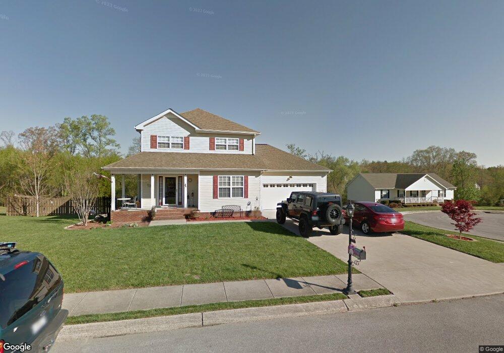
10209 Sovereign Pointe Dr Soddy Daisy, TN 37379
Estimated Value: $363,000 - $392,840
3
Beds
3
Baths
1,640
Sq Ft
$230/Sq Ft
Est. Value
About This Home
This home is located at 10209 Sovereign Pointe Dr, Soddy Daisy, TN 37379 and is currently estimated at $377,210, approximately $230 per square foot. 10209 Sovereign Pointe Dr is a home located in Hamilton County with nearby schools including Loftis Middle School.
Ownership History
Date
Name
Owned For
Owner Type
Purchase Details
Closed on
Jun 29, 2006
Sold by
Cemel Jeffrey S and Cemel Krista A
Bought by
Carden William A and Carden Alison A
Current Estimated Value
Home Financials for this Owner
Home Financials are based on the most recent Mortgage that was taken out on this home.
Original Mortgage
$168,500
Outstanding Balance
$99,481
Interest Rate
6.55%
Mortgage Type
Purchase Money Mortgage
Estimated Equity
$277,729
Purchase Details
Closed on
Nov 19, 2004
Sold by
Mcguire Jeffrey R
Bought by
Cemel Jeffrey S and Cemel Krista A
Home Financials for this Owner
Home Financials are based on the most recent Mortgage that was taken out on this home.
Original Mortgage
$131,120
Interest Rate
5.77%
Mortgage Type
Purchase Money Mortgage
Purchase Details
Closed on
Jul 15, 2003
Sold by
Freytag Bryan D and Howard Jason Lamar
Bought by
Mcguire Jeffrey R
Create a Home Valuation Report for This Property
The Home Valuation Report is an in-depth analysis detailing your home's value as well as a comparison with similar homes in the area
Home Values in the Area
Average Home Value in this Area
Purchase History
| Date | Buyer | Sale Price | Title Company |
|---|---|---|---|
| Carden William A | $168,500 | Legal Title | |
| Cemel Jeffrey S | $163,900 | Northgate Title Escrow Inc | |
| Mcguire Jeffrey R | $21,000 | Northgate Title Escrow Inc |
Source: Public Records
Mortgage History
| Date | Status | Borrower | Loan Amount |
|---|---|---|---|
| Open | Carden William A | $168,500 | |
| Previous Owner | Cemel Jeffrey S | $131,120 | |
| Closed | Cemel Jeffrey S | $32,780 |
Source: Public Records
Tax History Compared to Growth
Tax History
| Year | Tax Paid | Tax Assessment Tax Assessment Total Assessment is a certain percentage of the fair market value that is determined by local assessors to be the total taxable value of land and additions on the property. | Land | Improvement |
|---|---|---|---|---|
| 2024 | $1,316 | $58,825 | $0 | $0 |
| 2023 | $1,325 | $58,825 | $0 | $0 |
| 2022 | $1,325 | $58,825 | $0 | $0 |
| 2021 | $1,325 | $58,825 | $0 | $0 |
| 2020 | $1,411 | $50,700 | $0 | $0 |
| 2019 | $1,411 | $50,700 | $0 | $0 |
| 2018 | $1,411 | $50,700 | $0 | $0 |
| 2017 | $1,411 | $50,700 | $0 | $0 |
| 2016 | $1,349 | $0 | $0 | $0 |
| 2015 | $1,349 | $48,450 | $0 | $0 |
| 2014 | $1,349 | $0 | $0 | $0 |
Source: Public Records
Map
Nearby Homes
- 10496 Sovereign Pointe Dr
- 10627 Jeneva Ln
- 10428 Jeneva Ln
- 1008 Trojan Run Dr
- 1055 Apollo Dr
- 1270 Jacob Dr
- 1052 Trojan Run Dr
- 1524 Green Pond Rd
- 1230 Green Pond Rd
- 10224 Tommys Ln
- 11036 High River Dr
- 11015 High River Dr
- 11008 Lovell Rd
- 10947 High River Dr
- 874 Ponderosa Dr
- 11312 Hixson Pike
- 2110 Autumn River Dr
- 9607 Barbee Rd Unit 87
- 814 Sneed Rd
- 10280 Card Rd
- 10151 Sovereign Pointe Dr
- 10235 Sovereign Pointe Dr
- 10224 Sovereign Pointe Dr
- 10202 Sovereign Pointe Dr
- 10194 Sovereign Pointe Dr
- 10150 Sovereign Pointe Dr
- 1263 Stonesthrow Way
- 10253 Sovereign Pointe Dr
- 1241 Stonesthrow Way
- 1314 Old Thatcher Rd
- 1304 Old Thatcher Rd
- 10312 Sovereign Pointe Dr
- 1312 Old Thatcher Rd
- 10338 Sovereign Pointe Dr
- 1212 Old Thatcher Rd
- 1218 Old Thatcher Rd
- 1215 Stonesthrow Way
- 1214 Stonesthrow Way
- 10347 Sovereign Pointe Dr
- 1206 Old Thatcher Rd