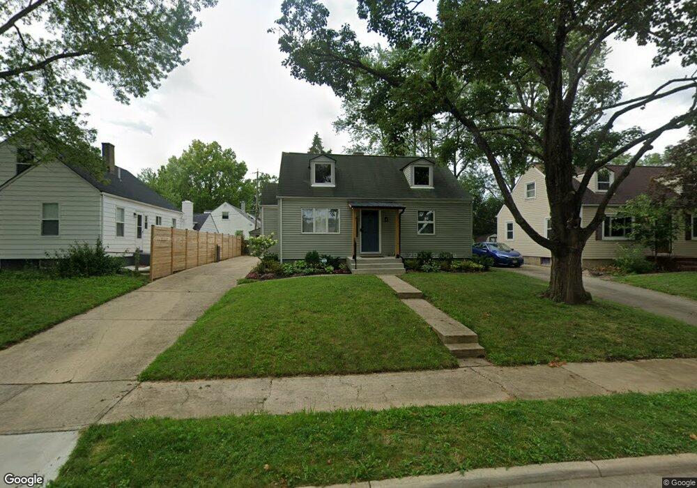
1021 Carlisle Ave Columbus, OH 43224
North Linden NeighborhoodEstimated Value: $164,511 - $240,000
4
Beds
2
Baths
1,506
Sq Ft
$144/Sq Ft
Est. Value
About This Home
This home is located at 1021 Carlisle Ave, Columbus, OH 43224 and is currently estimated at $216,128, approximately $143 per square foot. 1021 Carlisle Ave is a home located in Franklin County with nearby schools including Como Elementary School, Dominion Middle School, and Whetstone High School.
Ownership History
Date
Name
Owned For
Owner Type
Purchase Details
Closed on
Jan 24, 2024
Sold by
1902 Slaton Llc
Bought by
Pontiac Park Llc
Current Estimated Value
Purchase Details
Closed on
Jul 26, 2023
Sold by
Sheriff Of Franklin County
Bought by
1902 Slaton Llc
Purchase Details
Closed on
May 10, 2006
Sold by
Estate Of Basil S Stafford
Bought by
Roberts Mary E
Home Financials for this Owner
Home Financials are based on the most recent Mortgage that was taken out on this home.
Original Mortgage
$105,560
Interest Rate
6.39%
Mortgage Type
FHA
Purchase Details
Closed on
Oct 14, 1999
Sold by
Stafford Basil S and Stafford Nora J
Bought by
Stafford Basil S and Stafford Nora Jean
Create a Home Valuation Report for This Property
The Home Valuation Report is an in-depth analysis detailing your home's value as well as a comparison with similar homes in the area
Home Values in the Area
Average Home Value in this Area
Purchase History
| Date | Buyer | Sale Price | Title Company |
|---|---|---|---|
| Pontiac Park Llc | -- | None Listed On Document | |
| 1902 Slaton Llc | $158,100 | None Listed On Document | |
| Roberts Mary E | $109,000 | None Available | |
| Stafford Basil S | -- | -- |
Source: Public Records
Mortgage History
| Date | Status | Borrower | Loan Amount |
|---|---|---|---|
| Previous Owner | Roberts Mary E | $105,560 |
Source: Public Records
Tax History Compared to Growth
Tax History
| Year | Tax Paid | Tax Assessment Tax Assessment Total Assessment is a certain percentage of the fair market value that is determined by local assessors to be the total taxable value of land and additions on the property. | Land | Improvement |
|---|---|---|---|---|
| 2024 | $974 | $17,330 | $13,130 | $4,200 |
| 2023 | $1,108 | $17,330 | $13,130 | $4,200 |
| 2022 | $1,796 | $34,620 | $6,480 | $28,140 |
| 2021 | $2,050 | $34,620 | $6,480 | $28,140 |
| 2020 | $1,860 | $34,620 | $6,480 | $28,140 |
| 2019 | $1,758 | $28,980 | $5,390 | $23,590 |
| 2018 | $1,843 | $28,980 | $5,390 | $23,590 |
| 2017 | $1,757 | $28,980 | $5,390 | $23,590 |
| 2016 | $2,128 | $32,130 | $3,990 | $28,140 |
| 2015 | $1,932 | $32,130 | $3,990 | $28,140 |
| 2014 | $1,937 | $32,130 | $3,990 | $28,140 |
| 2013 | $1,062 | $35,700 | $4,445 | $31,255 |
Source: Public Records
Map
Nearby Homes
- 3087 Hiawatha St
- 3105 Atwood Terrace
- 2996 Atwood Terrace
- 3129 McGuffey Rd
- 3043 McGuffey Rd
- 826 E Brighton Rd
- 2950 Grasmere Ave
- 2923 Azelda St
- 2899 Howey Rd
- 788 E Brighton Rd
- 2888 Howey Rd
- 1126 Piedmont Rd
- 3071 Karl Rd
- 1247 Weldon Ave
- 1225 Sandlin Ave
- 759 E Longview Ave
- 3268 McGuffey Rd
- 2860 Grasmere Ave
- 3107 Hamilton Ave
- 2816 Azelda St
- 1021 Carlisle Ave Unit A
- 1015 Carlisle Ave
- 1009 Carlisle Ave
- 3113 Hiawatha St
- 3107 Hiawatha St
- 3122 Azelda St
- 1003 Carlisle Ave
- 1022 Carlisle Ave
- 3126 Hiawatha St
- 1028 Carlisle Ave
- 1014 Carlisle Ave
- 3116 Azelda St
- 3101 Hiawatha St
- 1008 Carlisle Ave
- 1047 Carlisle Ave
- 3114 Hiawatha St
- 3108 Azelda St
- 1002 Carlisle Ave
- 3148 Hiawatha St
- 3095 Hiawatha St