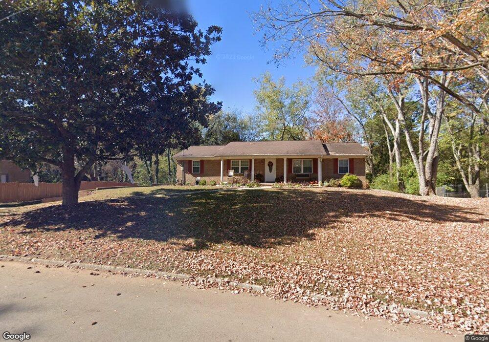
1021 Corning Rd Knoxville, TN 37923
West Knoxville NeighborhoodEstimated Value: $432,000 - $492,124
3
Beds
3
Baths
2,256
Sq Ft
$205/Sq Ft
Est. Value
About This Home
This home is located at 1021 Corning Rd, Knoxville, TN 37923 and is currently estimated at $462,531, approximately $205 per square foot. 1021 Corning Rd is a home located in Knox County with nearby schools including Cedar Bluff Elementary School, Cedar Bluff Middle School, and Hardin Valley Academy.
Ownership History
Date
Name
Owned For
Owner Type
Purchase Details
Closed on
Jan 23, 2024
Sold by
Kvam Danny
Bought by
Kvam Danny and Kvam Traci L
Current Estimated Value
Purchase Details
Closed on
Sep 15, 2006
Sold by
Waldo Timothy A and Waldo Carolyn B
Bought by
Kvam Danny
Home Financials for this Owner
Home Financials are based on the most recent Mortgage that was taken out on this home.
Original Mortgage
$175,610
Interest Rate
6.58%
Mortgage Type
VA
Purchase Details
Closed on
Oct 16, 2000
Sold by
Gordhan Kathrotia
Bought by
Waldo Timothy A and Waldo Carolyn B
Home Financials for this Owner
Home Financials are based on the most recent Mortgage that was taken out on this home.
Original Mortgage
$104,000
Interest Rate
7.61%
Mortgage Type
Purchase Money Mortgage
Create a Home Valuation Report for This Property
The Home Valuation Report is an in-depth analysis detailing your home's value as well as a comparison with similar homes in the area
Home Values in the Area
Average Home Value in this Area
Purchase History
| Date | Buyer | Sale Price | Title Company |
|---|---|---|---|
| Kvam Danny | -- | Southeast Title & Escrow | |
| Kvam Danny | $170,000 | Title Professionals Inc | |
| Waldo Timothy A | $104,000 | -- |
Source: Public Records
Mortgage History
| Date | Status | Borrower | Loan Amount |
|---|---|---|---|
| Previous Owner | Kvam Danny | $175,610 | |
| Previous Owner | Waldo Timothy A | $104,000 |
Source: Public Records
Tax History Compared to Growth
Tax History
| Year | Tax Paid | Tax Assessment Tax Assessment Total Assessment is a certain percentage of the fair market value that is determined by local assessors to be the total taxable value of land and additions on the property. | Land | Improvement |
|---|---|---|---|---|
| 2024 | $1,541 | $99,150 | $0 | $0 |
| 2023 | $1,541 | $99,150 | $0 | $0 |
| 2022 | $1,541 | $99,150 | $0 | $0 |
| 2021 | $967 | $45,625 | $0 | $0 |
| 2020 | $967 | $45,625 | $0 | $0 |
| 2019 | $967 | $45,625 | $0 | $0 |
| 2018 | $967 | $45,625 | $0 | $0 |
| 2017 | $967 | $45,625 | $0 | $0 |
| 2016 | $1,173 | $0 | $0 | $0 |
| 2015 | $1,173 | $0 | $0 | $0 |
| 2014 | $1,173 | $0 | $0 | $0 |
Source: Public Records
Map
Nearby Homes
- 1104 Remington Rd
- 1441 Pheasants Glen Dr
- 8805 Quails Bend Ln
- 1122 Firethorne Way Unit 2
- 1114 Firethorne Way
- 1211 Crest Brook Dr
- 9040 Shallowford Rd
- 9036 Shallowford Rd
- 1301 Chert Pit Rd
- 7307 Jenkins Creek Dr
- 1115 Glenmora Grove Way
- 8903 Ormand Ln
- 8117 Crimson Ln
- 8632 Constance Way
- 1465 Overton Ln
- 1624 Capitol Blvd
- 631 Plainfield Rd
- 1516 Weeping Willow Ct
- 9000 Tall Timber Dr
- 1609 Coventry Park Blvd
- 1025 Corning Rd
- 1017 Corning Rd
- 8901 Barlow Cir
- 8904 Barlow Cir
- 1024 Corning Rd
- 1016 Corning Rd
- 1013 Corning Rd
- 1101 Roderick Rd
- 1012 Corning Rd
- 1109 Roderick Rd
- 8905 Barlow Cir
- 1025 Roderick Rd
- 1009 Corning Rd
- 1113 Roderick Rd
- 1021 Roderick Rd
- 1024 Parrish Rd
- 1008 Corning Rd
- 1018 Parrish Rd
- 1020 Parrish Rd
- 1117 Roderick Rd