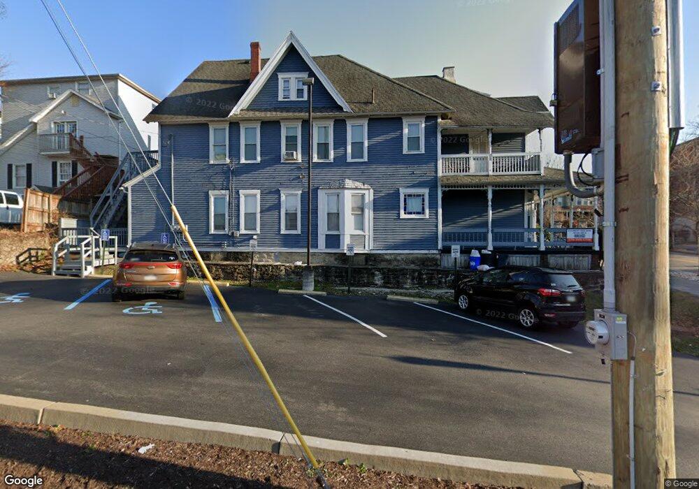
1021 Mulberry St Unit 1023 Scranton, PA 18510
Hill Section NeighborhoodEstimated Value: $238,000 - $381,000
--
Bed
--
Bath
--
Sq Ft
3,528
Sq Ft Lot
About This Home
This home is located at 1021 Mulberry St Unit 1023, Scranton, PA 18510 and is currently estimated at $321,667. 1021 Mulberry St Unit 1023 is a home located in Lackawanna County with nearby schools including Jackson Davis Elementary School, Longdale Elementary School, and Pinchbeck Elementary School.
Ownership History
Date
Name
Owned For
Owner Type
Purchase Details
Closed on
Aug 1, 2013
Sold by
317 Linden Apartments Llc
Bought by
Peoples Neighborhood Bank
Current Estimated Value
Purchase Details
Closed on
Aug 22, 2006
Sold by
Dfm Properties Llc
Bought by
1021 Mulberry Llc
Create a Home Valuation Report for This Property
The Home Valuation Report is an in-depth analysis detailing your home's value as well as a comparison with similar homes in the area
Home Values in the Area
Average Home Value in this Area
Purchase History
| Date | Buyer | Sale Price | Title Company |
|---|---|---|---|
| Peoples Neighborhood Bank | -- | None Available | |
| 1021 Mulberry Llc | -- | None Available |
Source: Public Records
Tax History Compared to Growth
Tax History
| Year | Tax Paid | Tax Assessment Tax Assessment Total Assessment is a certain percentage of the fair market value that is determined by local assessors to be the total taxable value of land and additions on the property. | Land | Improvement |
|---|---|---|---|---|
| 2025 | $6,264 | $17,000 | $6,750 | $10,250 |
| 2024 | $5,778 | $17,000 | $6,750 | $10,250 |
| 2023 | $5,778 | $17,000 | $6,750 | $10,250 |
| 2022 | $5,652 | $17,000 | $6,750 | $10,250 |
| 2021 | $5,652 | $17,000 | $6,750 | $10,250 |
| 2020 | $5,561 | $17,000 | $6,750 | $10,250 |
| 2019 | $5,248 | $17,000 | $6,750 | $10,250 |
| 2018 | $5,248 | $17,000 | $6,750 | $10,250 |
| 2017 | $5,168 | $17,000 | $6,750 | $10,250 |
| 2016 | $0 | $17,000 | $6,750 | $10,250 |
| 2015 | $4,022 | $17,000 | $6,750 | $10,250 |
| 2014 | -- | $17,000 | $6,750 | $10,250 |
Source: Public Records
Map
Nearby Homes
- 432 Taylor Ave
- 316 Taylor Ave
- 550 Clay Ave Unit 8c
- 560 N Webster Ave
- 527 Quincy Ave
- 621 Clay Ave
- 329 Prescott Ave
- 1325 Olive St
- 545 Prescott Ave
- 228 Prescott Ave
- 342 Harrison Ave
- 621 Madison Ave Unit 623
- 610 Moosic St
- 516 Harrison Ave
- 7 Oakwood Place
- 622 Jefferson Ave
- 640 Jefferson Ave
- 715 Prescott Ave Unit L17
- 616-618 Harrison Ave
- 805-807 N Irving Ave
- 405 Clay Ave
- 409 Clay Ave
- 1013-1015 Mulberry St
- 1013 Mulberry St
- 1011 Mulberry St
- 411 Clay Ave Unit 413
- 415 Clay Ave
- 408 410 Quincy Ave
- 421 Clay Ave
- 408 Quincy Ave Unit 410
- 408 Quincy Ave
- 414 Quincy Ave
- 406 Quincy Ave
- 420 Quincy Ave
- 410 Clay Ave
- 425 Clay Ave
- 412 Clay Ave
- 999 Mulberry St
- 422 Quincy Ave Unit 424
- 418 Clay Ave