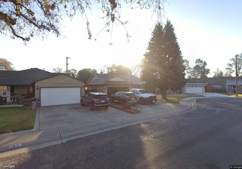
1021 Poplar Ave West Sacramento, CA 95691
South West Capitol to 80 NeighborhoodEstimated Value: $303,000 - $460,000
3
Beds
1
Bath
1,080
Sq Ft
$370/Sq Ft
Est. Value
About This Home
This home is located at 1021 Poplar Ave, West Sacramento, CA 95691 and is currently estimated at $400,053, approximately $370 per square foot. 1021 Poplar Ave is a home located in Yolo County with nearby schools including Westmore Oaks Elementary School, River City High, and Sacramento Valley Charter School.
Ownership History
Date
Name
Owned For
Owner Type
Purchase Details
Closed on
Nov 8, 2007
Sold by
Olivan Victor and Olivan Silvia
Bought by
Olivan Nadia D and Perez Nayomi
Current Estimated Value
Purchase Details
Closed on
Dec 10, 1997
Sold by
Heiser Elsie M Family Trust and Gloria M
Bought by
Olivan Victor and Olivan Silvia
Home Financials for this Owner
Home Financials are based on the most recent Mortgage that was taken out on this home.
Original Mortgage
$92,025
Outstanding Balance
$15,569
Interest Rate
7.23%
Mortgage Type
FHA
Estimated Equity
$384,484
Purchase Details
Closed on
Jan 4, 1997
Sold by
Heiser Elsie M
Bought by
Heiser Elsie Mae and The Elsie Mae Heiser
Create a Home Valuation Report for This Property
The Home Valuation Report is an in-depth analysis detailing your home's value as well as a comparison with similar homes in the area
Home Values in the Area
Average Home Value in this Area
Purchase History
| Date | Buyer | Sale Price | Title Company |
|---|---|---|---|
| Olivan Nadia D | -- | None Available | |
| Olivan Victor | $93,000 | Placer Title Company | |
| Heiser Elsie Mae | -- | -- |
Source: Public Records
Mortgage History
| Date | Status | Borrower | Loan Amount |
|---|---|---|---|
| Open | Olivan Victor | $92,025 |
Source: Public Records
Tax History Compared to Growth
Tax History
| Year | Tax Paid | Tax Assessment Tax Assessment Total Assessment is a certain percentage of the fair market value that is determined by local assessors to be the total taxable value of land and additions on the property. | Land | Improvement |
|---|---|---|---|---|
| 2025 | $1,884 | $148,470 | $39,905 | $108,565 |
| 2023 | $1,884 | $142,706 | $38,356 | $104,350 |
| 2022 | $1,760 | $139,908 | $37,604 | $102,304 |
| 2021 | $1,745 | $137,166 | $36,867 | $100,299 |
| 2020 | $1,665 | $135,760 | $36,489 | $99,271 |
| 2019 | $1,645 | $133,099 | $35,774 | $97,325 |
| 2018 | $1,615 | $130,490 | $35,073 | $95,417 |
| 2017 | $1,598 | $127,933 | $34,386 | $93,547 |
| 2016 | $1,575 | $125,425 | $33,712 | $91,713 |
| 2015 | $1,427 | $123,542 | $33,206 | $90,336 |
| 2014 | $1,427 | $121,123 | $32,556 | $88,567 |
Source: Public Records
Map
Nearby Homes
- 1908 Proctor Ave
- 1021 Sycamore Ave
- 1925 Willow Ave
- 1832 Rockrose Rd
- 1716 Rockrose Rd
- 830 Pecan St
- 2012 Michigan Blvd
- 1712 Ferndale Cir
- 528 Chaparral Way
- 1549 Virginia Ave
- 431 Poplar Ave
- 1826 Maryland Ave
- 417 Westacre Rd Unit 22
- 417 Westacre Rd Unit 2
- 1916 Park Blvd
- 785 Dolomite Ct
- 788 Pearlite Ct
- 1050 W Capitol Ave Unit 10
- 1050 W Capitol Ave Unit 33
- 839 Graphite Ln
- 1017 Poplar Ave
- 1901 Buckeye Dr
- 1013 Poplar Ave
- 1905 Buckeye Dr
- 1009 Poplar Ave
- 1016 Poplar Ave
- 1909 Buckeye Dr
- 1012 Poplar Ave
- 1005 Poplar Ave
- 1913 Buckeye Dr
- 1908 Buckeye Dr
- 1008 Poplar Ave
- 1001 Poplar Ave
- 1004 Poplar Ave
- 1917 Buckeye Dr
- 1013 Balsam St
- 1017 Balsam St
- 0 Buckeye Dr
- 1009 Balsam St
- 1000 Poplar Ave