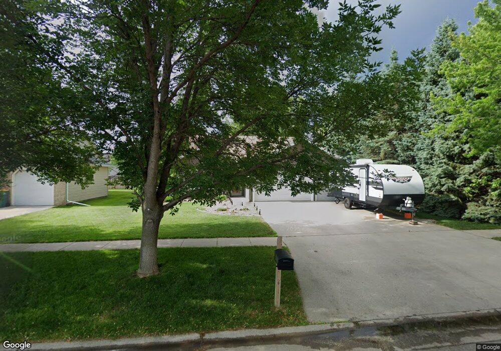
1021 Sommerset Dr West Fargo, ND 58078
Sommerset NeighborhoodEstimated Value: $344,000 - $407,092
4
Beds
3
Baths
2,393
Sq Ft
$156/Sq Ft
Est. Value
About This Home
This home is located at 1021 Sommerset Dr, West Fargo, ND 58078 and is currently estimated at $372,773, approximately $155 per square foot. 1021 Sommerset Dr is a home located in Cass County with nearby schools including L.E. Berger Elementary School, Cheney Middle School, and West Fargo High School.
Ownership History
Date
Name
Owned For
Owner Type
Purchase Details
Closed on
Dec 18, 2020
Sold by
Moen Timothy P and Moen Jan D
Bought by
Ferguson Gary Gene and Ferguson Kristena
Current Estimated Value
Home Financials for this Owner
Home Financials are based on the most recent Mortgage that was taken out on this home.
Original Mortgage
$252,000
Outstanding Balance
$224,355
Interest Rate
2.7%
Mortgage Type
New Conventional
Estimated Equity
$148,418
Purchase Details
Closed on
Jun 24, 2005
Sold by
Schultz Robert E and Schultz Deborah R
Bought by
Moen Timothy P and Moen Jan D
Home Financials for this Owner
Home Financials are based on the most recent Mortgage that was taken out on this home.
Original Mortgage
$201,200
Interest Rate
5.87%
Mortgage Type
Purchase Money Mortgage
Create a Home Valuation Report for This Property
The Home Valuation Report is an in-depth analysis detailing your home's value as well as a comparison with similar homes in the area
Home Values in the Area
Average Home Value in this Area
Purchase History
| Date | Buyer | Sale Price | Title Company |
|---|---|---|---|
| Ferguson Gary Gene | $315,000 | The Title Co | |
| Moen Timothy P | $197,000 | -- |
Source: Public Records
Mortgage History
| Date | Status | Borrower | Loan Amount |
|---|---|---|---|
| Open | Ferguson Gary Gene | $252,000 | |
| Previous Owner | Moen Timothy P | $201,200 |
Source: Public Records
Tax History Compared to Growth
Tax History
| Year | Tax Paid | Tax Assessment Tax Assessment Total Assessment is a certain percentage of the fair market value that is determined by local assessors to be the total taxable value of land and additions on the property. | Land | Improvement |
|---|---|---|---|---|
| 2024 | $3,980 | $170,450 | $23,100 | $147,350 |
| 2023 | $4,294 | $162,800 | $23,100 | $139,700 |
| 2022 | $4,042 | $147,400 | $23,100 | $124,300 |
| 2021 | $4,017 | $141,250 | $17,750 | $123,500 |
| 2020 | $4,049 | $133,950 | $17,750 | $116,200 |
| 2019 | $3,786 | $123,950 | $17,750 | $106,200 |
| 2018 | $3,572 | $120,000 | $17,750 | $102,250 |
| 2017 | $3,466 | $118,350 | $17,750 | $100,600 |
| 2016 | $3,063 | $115,400 | $17,750 | $97,650 |
| 2015 | $3,070 | $110,250 | $14,650 | $95,600 |
| 2014 | $3,013 | $103,050 | $14,650 | $88,400 |
| 2013 | $2,991 | $103,050 | $14,650 | $88,400 |
Source: Public Records
Map
Nearby Homes
- 1059 Sommerset Place
- 1438 Suntree Dr
- 1332 Sandstone Dr
- 921 Homestead Ct
- 1511 11th Ave E
- 1726 2nd Ave E
- 851 12th Ave E
- 2120 4th Ave E
- 426 3rd Ave E
- 4836 9th Ave S
- 437 10th Ave E
- 670 13th Ave E
- 2150 2nd Ave E
- 4704 8th Ave S
- 432 22nd St E
- 987 14th Ave E
- 1221 Cedar Way
- 237 10th Ave E
- 209 1st Ave E
- 245 12th Ave E
- 1027 Sommerset Dr
- 525 10th St E
- 531 10th St E
- 1103 Sommerset Dr
- 1064 Sommerset Place
- 539 10th St E
- 1056 Sommerset Place
- 1020 Sommerset Dr
- 1109 Sommerset Dr
- 1014 Sommerset Dr
- 1026 Sommerset Dr
- 601 10th St E
- 1104 Sommerset Place
- 1104 Sommerset Place
- 1002 Sommerset Dr
- 1102 Sommerset Dr
- 921 Sommerset Dr
- 1115 Sommerset Dr
- 609 10th St E
- 1112 Sommerset Place