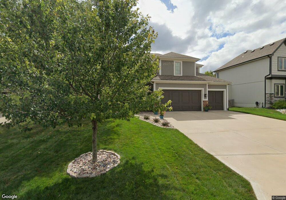
1021 SW Drake Cir Lees Summit, MO 64082
Estimated Value: $531,000 - $598,000
4
Beds
4
Baths
2,816
Sq Ft
$202/Sq Ft
Est. Value
About This Home
This home is located at 1021 SW Drake Cir, Lees Summit, MO 64082 and is currently estimated at $569,711, approximately $202 per square foot. 1021 SW Drake Cir is a home located in Jackson County with nearby schools including Summit Pointe Elementary School, Summit Lakes Middle School, and Lee's Summit West High School.
Ownership History
Date
Name
Owned For
Owner Type
Purchase Details
Closed on
Aug 27, 2015
Sold by
Jace Homes Llc
Bought by
Anson Aaron and Anson Kristen
Current Estimated Value
Home Financials for this Owner
Home Financials are based on the most recent Mortgage that was taken out on this home.
Original Mortgage
$312,550
Outstanding Balance
$245,901
Interest Rate
4.12%
Mortgage Type
New Conventional
Estimated Equity
$323,810
Purchase Details
Closed on
Sep 12, 2013
Sold by
Raintree Ls Llc
Bought by
Jace Homes Llc
Create a Home Valuation Report for This Property
The Home Valuation Report is an in-depth analysis detailing your home's value as well as a comparison with similar homes in the area
Home Values in the Area
Average Home Value in this Area
Purchase History
| Date | Buyer | Sale Price | Title Company |
|---|---|---|---|
| Anson Aaron | -- | First American Title | |
| Jace Homes Llc | -- | Kansas City Title |
Source: Public Records
Mortgage History
| Date | Status | Borrower | Loan Amount |
|---|---|---|---|
| Open | Anson Aaron | $312,550 |
Source: Public Records
Tax History Compared to Growth
Tax History
| Year | Tax Paid | Tax Assessment Tax Assessment Total Assessment is a certain percentage of the fair market value that is determined by local assessors to be the total taxable value of land and additions on the property. | Land | Improvement |
|---|---|---|---|---|
| 2025 | $6,887 | $94,480 | $17,501 | $76,979 |
| 2024 | $6,887 | $95,380 | $12,179 | $83,201 |
| 2023 | $6,837 | $95,380 | $12,179 | $83,201 |
| 2022 | $5,767 | $71,440 | $13,405 | $58,035 |
| 2021 | $5,886 | $71,440 | $13,405 | $58,035 |
| 2020 | $5,659 | $68,017 | $13,405 | $54,612 |
| 2019 | $5,505 | $68,017 | $13,405 | $54,612 |
| 2018 | $1,869,469 | $63,911 | $9,910 | $54,001 |
| 2017 | $5,458 | $63,911 | $9,910 | $54,001 |
| 2016 | $5,458 | $61,940 | $7,220 | $54,720 |
| 2014 | $195 | $2,166 | $2,166 | $0 |
Source: Public Records
Map
Nearby Homes
- 4400 SW Rivulet Dr
- 4120 SW Flintrock Dr
- 4104 SW Flintrock Dr
- 3923 SW Ward Rd
- Serenade Plan at Stoney Creek - Bliss Collection
- Oasis Plan at Stoney Creek - Bliss Collection
- Devotion Plan at Stoney Creek - Bliss Collection
- Brookside Plan at Stoney Creek - Premier Collection
- Serenity Plan at Stoney Creek - Bliss Collection
- Avalon Plan at Stoney Creek - Premier Collection
- Harmony Plan at Stoney Creek - Bliss Collection
- 1937 SW Merryman Dr
- Lexington Plan at Stoney Creek - Premier Collection
- Crestwood Plan at Stoney Creek - Premier Collection
- 1022 SW Cheshire Dr
- 1021 SW Cheshire Dr
- 4605 SW Olympia Cir
- 4510 SW Fenwick Rd
- 1520 SW 41st St
- 4520 SW Berkshire Dr
- 1025 SW Drake Cir
- 1017 SW Drake Cir
- 1013 SW Drake Cir
- 1029 SW Drake Cir
- 1020 SW Whistle Dr
- 1016 SW Whistle Dr
- 1009 SW Drake Cir
- 1016 SW Drake Cir
- 1020 SW Drake Cir
- 1012 SW Drake Cir
- 4201 SW Briarbrook Dr
- 1028 SW Whistle Dr
- 4205 SW Briarbrook Dr
- 1024 SW Drake Cir
- 1012 SW Whistle Dr
- 1008 SW Whistle Dr
- 1028 SW Drake Cir
- 1008 SW Drake Cir
- 1005 SW Drake Cir
- 1032 SW Whistle Dr