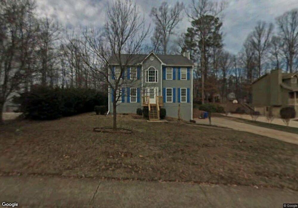
1021 Trestle Dr Unit 1 Austell, GA 30106
Estimated Value: $319,649 - $370,000
3
Beds
3
Baths
2,064
Sq Ft
$170/Sq Ft
Est. Value
About This Home
This home is located at 1021 Trestle Dr Unit 1, Austell, GA 30106 and is currently estimated at $350,662, approximately $169 per square foot. 1021 Trestle Dr Unit 1 is a home located in Cobb County with nearby schools including Deerwood Elementary School, Russell Elementary School, and Floyd Middle School.
Ownership History
Date
Name
Owned For
Owner Type
Purchase Details
Closed on
Feb 10, 1999
Sold by
Askey Carl D
Bought by
Davis Frederick R and Davis Lyndia
Current Estimated Value
Home Financials for this Owner
Home Financials are based on the most recent Mortgage that was taken out on this home.
Original Mortgage
$118,338
Outstanding Balance
$27,637
Interest Rate
6.84%
Mortgage Type
New Conventional
Estimated Equity
$323,025
Create a Home Valuation Report for This Property
The Home Valuation Report is an in-depth analysis detailing your home's value as well as a comparison with similar homes in the area
Home Values in the Area
Average Home Value in this Area
Purchase History
| Date | Buyer | Sale Price | Title Company |
|---|---|---|---|
| Davis Frederick R | $119,900 | -- |
Source: Public Records
Mortgage History
| Date | Status | Borrower | Loan Amount |
|---|---|---|---|
| Open | Davis Frederick R | $118,338 |
Source: Public Records
Tax History Compared to Growth
Tax History
| Year | Tax Paid | Tax Assessment Tax Assessment Total Assessment is a certain percentage of the fair market value that is determined by local assessors to be the total taxable value of land and additions on the property. | Land | Improvement |
|---|---|---|---|---|
| 2025 | $2,861 | $127,740 | $22,000 | $105,740 |
| 2024 | $2,864 | $127,740 | $22,000 | $105,740 |
| 2023 | $2,321 | $127,740 | $22,000 | $105,740 |
| 2022 | $2,136 | $93,432 | $16,000 | $77,432 |
| 2021 | $1,788 | $77,552 | $16,000 | $61,552 |
| 2020 | $1,788 | $77,552 | $16,000 | $61,552 |
| 2019 | $1,607 | $69,264 | $12,800 | $56,464 |
| 2018 | $1,607 | $69,264 | $12,800 | $56,464 |
| 2017 | $1,412 | $62,636 | $12,800 | $49,836 |
| 2016 | $1,415 | $62,636 | $12,800 | $49,836 |
| 2015 | $1,187 | $51,048 | $12,000 | $39,048 |
| 2014 | $1,196 | $51,048 | $0 | $0 |
Source: Public Records
Map
Nearby Homes
- 936 Tyrell Dr
- 895 Tyrell Dr
- 1097 Trestle Dr
- 4072 Elsdon Dr
- 3869 Merryweather Trail
- 1021 Wisteria Dr SW
- 1240 Parktown Dr Unit 4
- 4187 Alaina Cir Unit 18
- 1078 Hibiscus Way SW
- 4201 Regal Ridge Rd
- 960 Verlander Trail
- 3712 Auldyn Dr
- 971 Verlander Trail
- 4569 Moray Dr
- 4581 Moray Dr
- Kaufman Plan at Wilkins Walk
- Bryson Plan at Wilkins Walk
- Brooks Plan at Wilkins Walk
- 1146 Silvergate Ln
- 4589 Moray Dr
- 1025 Trestle Dr Unit 1
- 1017 Trestle Dr
- 1014 Trestle Dr Unit 1
- 1029 Trestle Dr
- 964 Tyrell Dr
- 1016 Trestle Dr Unit 1
- 1010 Trestle Dr
- 968 Tyrell Dr Unit Basement apartment
- 968 Tyrell Dr
- 960 Tyrell Dr
- 1033 Trestle Dr
- 1009 Trestle Dr
- 1009 Trestle Dr
- 1020 Trestle Dr
- 1006 Trestle Dr
- 1037 Trestle Dr Unit 1
- 956 Tyrell Dr Unit N/A
- 956 Tyrell Dr
- 1063 Whistle Dr
- 1059 Whistle Dr