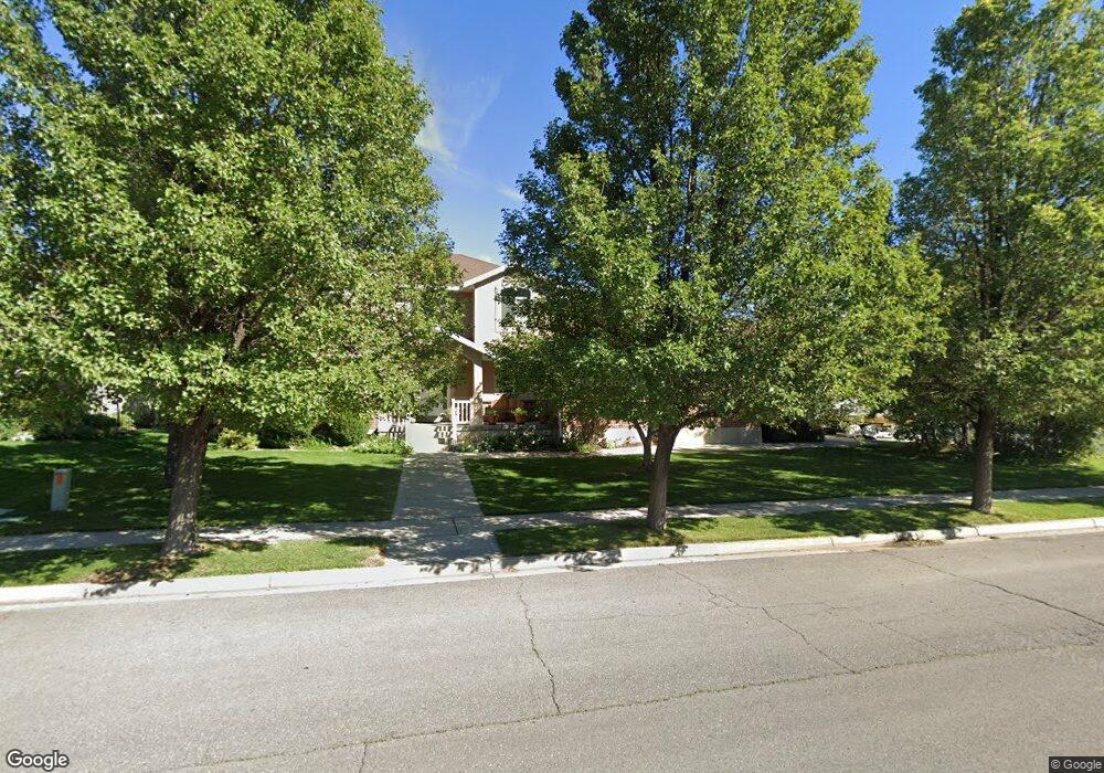
10212 N 6580 W Highland, UT 84003
Estimated Value: $803,000 - $1,048,000
4
Beds
4
Baths
2,477
Sq Ft
$368/Sq Ft
Est. Value
About This Home
This home is located at 10212 N 6580 W, Highland, UT 84003 and is currently estimated at $911,366, approximately $367 per square foot. 10212 N 6580 W is a home located in Utah County with nearby schools including Freedom Elementary School, Mountain Ridge Junior High School, and American Fork High School.
Ownership History
Date
Name
Owned For
Owner Type
Purchase Details
Closed on
Mar 18, 2002
Sold by
Jdd Investments
Bought by
Sandstrom Michael and Sandstrom Tamra
Current Estimated Value
Home Financials for this Owner
Home Financials are based on the most recent Mortgage that was taken out on this home.
Original Mortgage
$248,000
Outstanding Balance
$102,064
Interest Rate
6.85%
Estimated Equity
$809,302
Create a Home Valuation Report for This Property
The Home Valuation Report is an in-depth analysis detailing your home's value as well as a comparison with similar homes in the area
Home Values in the Area
Average Home Value in this Area
Purchase History
| Date | Buyer | Sale Price | Title Company |
|---|---|---|---|
| Sandstrom Michael | -- | Associated Title Company |
Source: Public Records
Mortgage History
| Date | Status | Borrower | Loan Amount |
|---|---|---|---|
| Open | Sandstrom Michael | $248,000 |
Source: Public Records
Tax History Compared to Growth
Tax History
| Year | Tax Paid | Tax Assessment Tax Assessment Total Assessment is a certain percentage of the fair market value that is determined by local assessors to be the total taxable value of land and additions on the property. | Land | Improvement |
|---|---|---|---|---|
| 2025 | $3,408 | $464,585 | $361,100 | $483,600 |
| 2024 | $3,408 | $420,970 | $0 | $0 |
| 2023 | $3,160 | $421,025 | $0 | $0 |
| 2022 | $3,275 | $423,115 | $0 | $0 |
| 2021 | $2,898 | $557,700 | $192,700 | $365,000 |
| 2020 | $2,636 | $497,400 | $167,600 | $329,800 |
| 2019 | $2,449 | $483,500 | $167,600 | $315,900 |
| 2018 | $2,330 | $437,200 | $160,600 | $276,600 |
| 2017 | $2,087 | $209,055 | $0 | $0 |
| 2016 | $2,226 | $208,395 | $0 | $0 |
| 2015 | $2,306 | $204,545 | $0 | $0 |
| 2014 | $2,217 | $194,920 | $0 | $0 |
Source: Public Records
Map
Nearby Homes
- 6399 W 10150 N
- 9967 N 6670 W
- 9924 N 6630 W Unit 9
- 10434 N 6400 W
- 6372 W 10400 N
- 6692 W 9770 N
- 6373 W 10500 N
- 6190 W 10050 N
- 11337 N 5950 W Unit 7
- 5973 W 9960 N
- 1438 N 400 W
- 9780 N 6000 W
- 6271 W 10830 St N
- 975 E 2125 N
- 1602 E Center Pointe Dr
- 1602 E Center Pointe Dr Unit 1
- 1610 E Center Pointe Dr
- 9435 N Aspen Hollow Cir
- 859 E 2125 N
- 356 W 1300 N
- 10212 N 6580 W Unit 51
- 6593 W 10200 N Unit 8
- 6562 W 10200 N Unit 3
- 10228 N 6580 W
- 10228 N 6580 W Unit 52
- 10246 6580 W Unit 53
- 10262 6580 W Unit 54
- 10262 6580 W Unit 1
- 5958 W 10200 N
- 10184 N 6580 W
- 10184 N 6580 W Unit 50
- 6592 W 10200 N
- 10236 N 6580 W
- 10185 N 6580 W
- 10183 N 6530 W
- 10241 N 6580 W
- 10241 N 6580 W Unit 2
- 6608 W 10200 N
- 6608 W 10200 N Unit 4
- 10168 N 6580 W