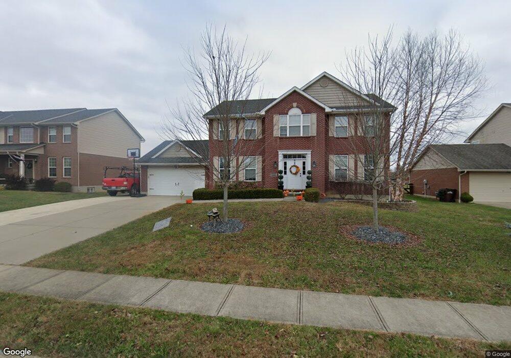
10219 Desmond Ct Unit 128 Covington, KY 41015
Estimated Value: $469,052 - $521,000
4
Beds
3
Baths
2,652
Sq Ft
$185/Sq Ft
Est. Value
About This Home
This home is located at 10219 Desmond Ct Unit 128, Covington, KY 41015 and is currently estimated at $490,263, approximately $184 per square foot. 10219 Desmond Ct Unit 128 is a home located in Kenton County with nearby schools including Ryland Heights Elementary School, Woodland Middle School, and Scott High School.
Ownership History
Date
Name
Owned For
Owner Type
Purchase Details
Closed on
Sep 19, 2018
Sold by
Agoston Joseph P and Agoston Diana C
Bought by
Mardis Adam Joseph and Mardis Nicole Marie
Current Estimated Value
Home Financials for this Owner
Home Financials are based on the most recent Mortgage that was taken out on this home.
Original Mortgage
$255,606
Outstanding Balance
$221,521
Interest Rate
4.5%
Mortgage Type
New Conventional
Estimated Equity
$268,742
Purchase Details
Closed on
Jan 18, 2011
Sold by
Alan Schmidt Construction Inc
Bought by
Agoston Joseph P and Agoston Diana C
Home Financials for this Owner
Home Financials are based on the most recent Mortgage that was taken out on this home.
Original Mortgage
$234,650
Interest Rate
4.82%
Mortgage Type
New Conventional
Purchase Details
Closed on
Sep 28, 2009
Sold by
Mills Road Llc
Bought by
Alan Schmidt Construction Inc
Create a Home Valuation Report for This Property
The Home Valuation Report is an in-depth analysis detailing your home's value as well as a comparison with similar homes in the area
Home Values in the Area
Average Home Value in this Area
Purchase History
| Date | Buyer | Sale Price | Title Company |
|---|---|---|---|
| Mardis Adam Joseph | $281,000 | Springdale Title Llc | |
| Agoston Joseph P | $234,650 | Lawyers Title Cincinnati Inc | |
| Alan Schmidt Construction Inc | $36,975 | Kentucky Land Title Agency |
Source: Public Records
Mortgage History
| Date | Status | Borrower | Loan Amount |
|---|---|---|---|
| Open | Mardis Adam Joseph | $255,606 | |
| Previous Owner | Agoston Joseph P | $234,650 |
Source: Public Records
Tax History Compared to Growth
Tax History
| Year | Tax Paid | Tax Assessment Tax Assessment Total Assessment is a certain percentage of the fair market value that is determined by local assessors to be the total taxable value of land and additions on the property. | Land | Improvement |
|---|---|---|---|---|
| 2025 | $4,423 | $380,300 | $45,000 | $335,300 |
| 2024 | $3,442 | $281,000 | $40,000 | $241,000 |
| 2023 | $3,546 | $281,000 | $40,000 | $241,000 |
| 2022 | $3,600 | $281,000 | $40,000 | $241,000 |
| 2021 | $3,654 | $281,000 | $40,000 | $241,000 |
| 2020 | $3,731 | $281,000 | $40,000 | $241,000 |
| 2019 | $3,741 | $281,000 | $40,000 | $241,000 |
| 2018 | $3,153 | $234,600 | $40,000 | $194,600 |
| 2017 | $3,066 | $234,600 | $40,000 | $194,600 |
| 2015 | $2,981 | $234,600 | $36,900 | $197,700 |
| 2014 | $2,939 | $234,600 | $36,900 | $197,700 |
Source: Public Records
Map
Nearby Homes
- HIALEAH Plan at Ashford Village
- QUENTIN Plan at Ashford Village
- VALE Plan at Ashford Village
- ALWICK Plan at Ashford Village
- BEACHWOOD Plan at Ashford Village
- ALDEN Plan at Ashford Village
- ASHTON Plan at Ashford Village
- BUCHANAN Plan at Ashford Village
- 10080 Marshall Rd
- 10171 Desmond Ct
- 3563 Capel Ct
- 3668 Mills Rd
- 451 Spencely Ct
- 10263 Decoursey Pike
- Yosemite Plan at Villages of Decoursey - Maple Street Collection
- Harper Plan at Villages of Decoursey - Maple Street Collection
- Cumberland Plan at Villages of Decoursey - Maple Street Collection
- Danville Plan at Villages of Decoursey - Maple Street Collection
- Beacon Plan at Villages of Decoursey - Maple Street Collection
- Breckenridge Plan at Villages of Decoursey - Maple Street Collection
- 10219 Desmond Ct
- 10219 Desmond Dr Unit 128
- 10223 Desmond Ct Unit 127
- 10223 Desmond Ct
- 10223 Desmond Ct Unit 127
- 10215 Desmond Ct Unit 129
- 10215 Desmond Ct
- 10215 Desmond Ct
- 10215 Desmond Ct Unit 129
- 10211 Desmond Ct Unit 130
- 10211 Desmond Ct
- 10355 Limerick Cir Unit 68
- 10355 Limerick Cir
- 10355 Limerick Cir Unit 68
- 10359 Limerick Cir Unit 67
- 10227 Desmond Ct
- 10351 Limerick Cir
- 10222 Desmond Ct Unit 121
- 10222 Desmond Ct
- 10359 Limerick Cir