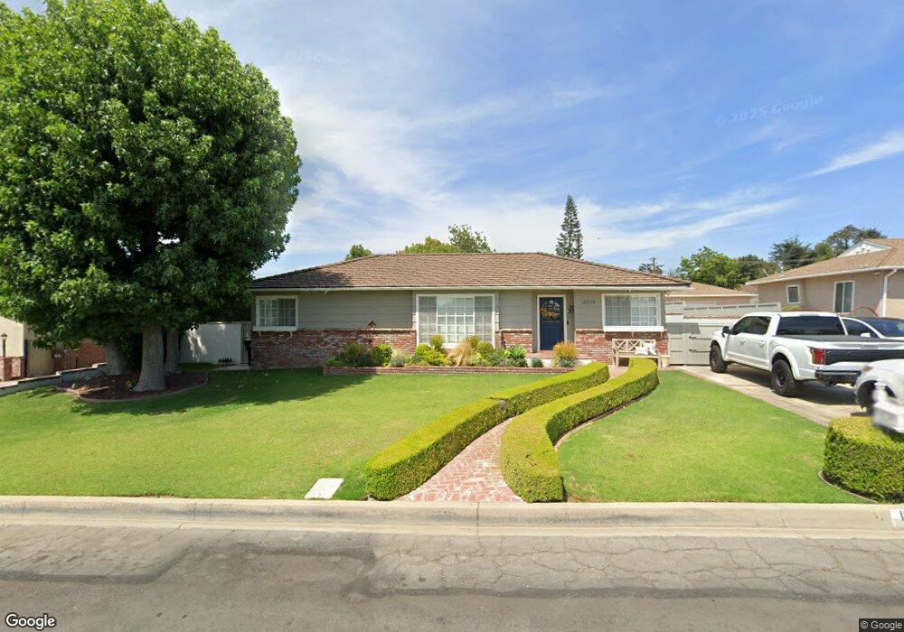
10219 Lundene Dr Whittier, CA 90601
West Whittier NeighborhoodEstimated Value: $900,000 - $1,017,000
3
Beds
2
Baths
1,735
Sq Ft
$549/Sq Ft
Est. Value
About This Home
This home is located at 10219 Lundene Dr, Whittier, CA 90601 and is currently estimated at $952,918, approximately $549 per square foot. 10219 Lundene Dr is a home located in Los Angeles County with nearby schools including Mill Elementary School, Walter F. Dexter Middle School, and Whittier High School.
Ownership History
Date
Name
Owned For
Owner Type
Purchase Details
Closed on
Dec 18, 2007
Sold by
Gonzalez George
Bought by
Gonzalez Faviola
Current Estimated Value
Home Financials for this Owner
Home Financials are based on the most recent Mortgage that was taken out on this home.
Original Mortgage
$600,000
Outstanding Balance
$371,247
Interest Rate
5.87%
Mortgage Type
New Conventional
Estimated Equity
$581,671
Purchase Details
Closed on
Mar 29, 1996
Sold by
Kugel Mark W
Bought by
Gonzalez George and Gonzalez Faviola
Create a Home Valuation Report for This Property
The Home Valuation Report is an in-depth analysis detailing your home's value as well as a comparison with similar homes in the area
Home Values in the Area
Average Home Value in this Area
Purchase History
| Date | Buyer | Sale Price | Title Company |
|---|---|---|---|
| Gonzalez Faviola | -- | Chicago Title Company | |
| Gonzalez George | $38,700 | American Title |
Source: Public Records
Mortgage History
| Date | Status | Borrower | Loan Amount |
|---|---|---|---|
| Open | Gonzalez Faviola | $600,000 |
Source: Public Records
Tax History Compared to Growth
Tax History
| Year | Tax Paid | Tax Assessment Tax Assessment Total Assessment is a certain percentage of the fair market value that is determined by local assessors to be the total taxable value of land and additions on the property. | Land | Improvement |
|---|---|---|---|---|
| 2025 | $5,204 | $403,658 | $179,735 | $223,923 |
| 2024 | $5,204 | $395,744 | $176,211 | $219,533 |
| 2023 | $5,113 | $387,985 | $172,756 | $215,229 |
| 2022 | $5,012 | $380,378 | $169,369 | $211,009 |
| 2021 | $4,909 | $372,921 | $166,049 | $206,872 |
| 2019 | $4,827 | $361,862 | $161,125 | $200,737 |
| 2018 | $4,605 | $354,767 | $157,966 | $196,801 |
| 2016 | $4,417 | $340,993 | $151,833 | $189,160 |
| 2015 | $4,327 | $335,872 | $149,553 | $186,319 |
| 2014 | $4,269 | $329,294 | $146,624 | $182,670 |
Source: Public Records
Map
Nearby Homes
- 5107 Vista Verde Way
- 5115 Castelotte Ct
- 10605 Cordoba Ct
- 9900 Tagus St Unit 30
- 5523 Pioneer Blvd Unit 30
- 9943 Noyes St
- 5577 Pioneer Blvd Unit 5
- 5593 Pioneer Blvd Unit 12
- 5593 Pioneer Blvd Unit 18
- 5315 Bihr Ct
- 5307 Woodward Ln
- 3930 Miguel Ave
- 10050 Obregon St
- 11511 Beverly Dr
- 3956 Amistad Ave
- 4512 Workman Mill Rd Unit 128
- 4512 Workman Mill Rd Unit 215
- 11759 S Circle Dr
- 0 San Gabriel River Pkwy
- 5729 Juarez Ave
- 10225 Lundene Dr
- 10209 Lundene Dr
- 10203 Lundene Dr
- 10233 Lundene Dr
- 10216 Strong Ave
- 10226 Strong Ave
- 10216 Lundene Dr
- 10224 Lundene Dr
- 10208 Strong Ave
- 10234 Strong Ave
- 10241 Lundene Dr
- 10202 Lundene Dr
- 10232 Lundene Dr
- 10249 Lundene Dr
- 10240 Lundene Dr
- 10300 Strong Ave
- 10215 Deveron Dr
- 10223 Deveron Dr
- 10209 Deveron Dr
- 10229 Deveron Dr