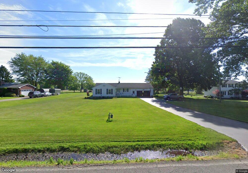
10219 New Buffalo Rd Canfield, OH 44406
Estimated Value: $240,521 - $297,000
3
Beds
2
Baths
1,389
Sq Ft
$189/Sq Ft
Est. Value
About This Home
This home is located at 10219 New Buffalo Rd, Canfield, OH 44406 and is currently estimated at $263,130, approximately $189 per square foot. 10219 New Buffalo Rd is a home located in Mahoning County with nearby schools including South Range Elementary School, South Range Middle School, and South Range High School.
Ownership History
Date
Name
Owned For
Owner Type
Purchase Details
Closed on
Aug 30, 2021
Sold by
Davison Marjorie A and Todd Harriett A
Bought by
Davison Alfred A and Davison Marjorie A
Current Estimated Value
Purchase Details
Closed on
May 12, 2005
Sold by
Todd Harriett A
Bought by
Todd Harriett A and The Harriett A Todd Revocable Trust
Purchase Details
Closed on
Mar 18, 2005
Sold by
Estate Of John F Todd
Bought by
Todd Harriett A
Purchase Details
Closed on
Jan 1, 1999
Bought by
Todd Harriett A Trustee
Purchase Details
Closed on
Feb 27, 1963
Bought by
Todd John F
Create a Home Valuation Report for This Property
The Home Valuation Report is an in-depth analysis detailing your home's value as well as a comparison with similar homes in the area
Home Values in the Area
Average Home Value in this Area
Purchase History
| Date | Buyer | Sale Price | Title Company |
|---|---|---|---|
| Davison Alfred A | -- | None Available | |
| Todd Harriett A | -- | -- | |
| Todd Harriett A | -- | -- | |
| Todd Harriett A Trustee | -- | -- | |
| Todd John F | -- | -- |
Source: Public Records
Tax History Compared to Growth
Tax History
| Year | Tax Paid | Tax Assessment Tax Assessment Total Assessment is a certain percentage of the fair market value that is determined by local assessors to be the total taxable value of land and additions on the property. | Land | Improvement |
|---|---|---|---|---|
| 2024 | $1,987 | $60,540 | $6,650 | $53,890 |
| 2023 | $2,946 | $60,540 | $6,650 | $53,890 |
| 2022 | $2,874 | $51,310 | $6,120 | $45,190 |
| 2021 | $2,413 | $51,310 | $6,120 | $45,190 |
| 2020 | $2,423 | $51,310 | $6,120 | $45,190 |
| 2019 | $2,051 | $43,780 | $6,120 | $37,660 |
| 2018 | $2,023 | $43,780 | $6,120 | $37,660 |
| 2017 | $2,020 | $43,780 | $6,120 | $37,660 |
| 2016 | $1,786 | $38,930 | $4,900 | $34,030 |
| 2015 | $1,754 | $38,930 | $4,900 | $34,030 |
| 2014 | $1,774 | $38,930 | $4,900 | $34,030 |
| 2013 | $1,759 | $38,930 | $4,900 | $34,030 |
Source: Public Records
Map
Nearby Homes
- 9757 New Buffalo Rd
- 9501 New Buffalo Rd
- 11160 Detwiler Rd
- 1482 Lake Front Blvd
- 1486 Lake Front Blvd
- 1190 Calla Rd W
- 635 Berklee Dr
- Lot 36 Berklee Dr
- 107 Berklee Dr
- 11695 Basinger Rd
- 517 Berklee Dr
- 0 Sharrott Rd Unit 5174987
- 400 Calla Rd W
- 9264 Sharrott Rd Unit 1803
- 9264 Sharrott Rd Unit 1001
- 9264 Sharrott Rd Unit 104
- 9264 Sharrott Rd Unit 1002
- 8516 Hitchcock Rd
- 1242 W Western Reserve Rd
- 3555 W South Range Rd
- 10247 New Buffalo Rd
- 10191 New Buffalo Rd
- 10277 New Buffalo Rd
- 10161 New Buffalo Rd
- 10202 New Buffalo Rd
- 10230 New Buffalo Rd
- 10190 New Buffalo Rd
- 10250 New Buffalo Rd
- 10160 New Buffalo Rd
- 10135 New Buffalo Rd
- 10299 New Buffalo Rd
- 10268 New Buffalo Rd
- 10286 New Buffalo Rd
- 10302 New Buffalo Rd
- 10116 New Buffalo Rd
- 10090 New Buffalo Rd
- 10070 New Buffalo Rd
- 2895 W Calla Rd
- 2885 W Calla Rd
- 2921 W Calla Rd