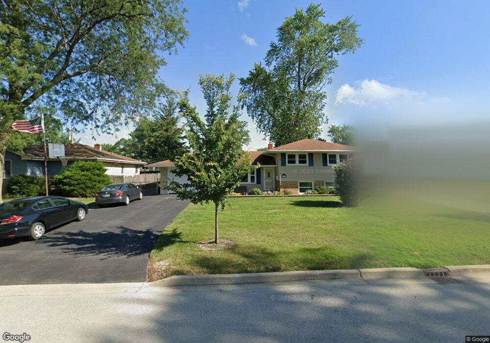
1022 Maple Ct Unit 5B Lockport, IL 60441
Estimated Value: $291,000 - $341,000
Studio
--
Bath
--
Sq Ft
8,276
Sq Ft Lot Lot
About This Home
This home is located at 1022 Maple Ct Unit 5B, Lockport, IL 60441 and is currently estimated at $308,037. 1022 Maple Ct Unit 5B is a home located in Will County with nearby schools including Milne Grove Elementary School, Kelvin Grove Jr High School, and Lockport Township High School East.
Ownership History
Date
Name
Owned For
Owner Type
Purchase Details
Closed on
Sep 14, 2023
Sold by
Ulm Michael J and Ulm Francine M
Bought by
Michael J Ulm And Francine M Ulm Living Trust and Ulm
Current Estimated Value
Purchase Details
Closed on
Jun 12, 1998
Sold by
Blogg William J and Blogg Laura F
Bought by
Ulm Michael J and Ulm Francine M
Home Financials for this Owner
Home Financials are based on the most recent Mortgage that was taken out on this home.
Original Mortgage
$122,000
Interest Rate
7.22%
Create a Home Valuation Report for This Property
The Home Valuation Report is an in-depth analysis detailing your home's value as well as a comparison with similar homes in the area
Home Values in the Area
Average Home Value in this Area
Purchase History
We collect this data history from publicly available records. To have your information removed, we recommend requesting removal directly through your county’s website.
| Date | Buyer | Sale Price | Title Company |
|---|---|---|---|
| Michael J Ulm And Francine M Ulm Living Trust | -- | None Listed On Document | |
| Ulm Michael J | $190,333 | Land Title Group Inc |
Source: Public Records
Mortgage History
We collect this data history from publicly available records. To have your information removed, we recommend requesting removal directly through your county’s website.
| Date | Status | Borrower | Loan Amount |
|---|---|---|---|
| Previous Owner | Ulm Michael J | $122,000 |
Source: Public Records
Tax History
| Year | Tax Paid | Tax Assessment Tax Assessment Total Assessment is a certain percentage of the fair market value that is determined by local assessors to be the total taxable value of land and additions on the property. | Land | Improvement |
|---|---|---|---|---|
| 2024 | $7,641 | $96,995 | $23,568 | $73,427 |
| 2023 | $7,641 | $87,077 | $21,158 | $65,919 |
| 2022 | $6,723 | $79,029 | $19,736 | $59,293 |
| 2021 | $6,363 | $74,268 | $18,547 | $55,721 |
| 2020 | $6,197 | $71,826 | $17,937 | $53,889 |
| 2019 | $5,879 | $68,082 | $17,002 | $51,080 |
| 2018 | $5,584 | $63,562 | $15,873 | $47,689 |
| 2017 | $5,367 | $60,003 | $14,984 | $45,019 |
| 2016 | $5,520 | $60,146 | $15,020 | $45,126 |
| 2015 | $5,447 | $57,227 | $14,291 | $42,936 |
| 2014 | $5,447 | $55,560 | $13,875 | $41,685 |
| 2013 | $5,447 | $56,694 | $14,158 | $42,536 |
Source: Public Records
Map
Nearby Homes
- 1106 Maple Ct
- 1011 Maitland Dr
- 1002 Runyan Dr
- 1125 Darin Dr
- 1005 Valley Ln
- 1107 Valley Ln
- 1117 Michael St
- 1222 Cleveland St
- 1526 Peachtree Ln
- 809 E Division St
- 1603 Grove Ct
- 1611 Grove Ct
- 16326 S Jannel Ct
- 1758 S Briggs St
- 16736 Karen Springs Dr
- 16448 S Rowley Ln
- 1509 East St Unit ST1511
- 1505 East St
- 203 Macgregor Rd
- 17009 Mendota Dr
- 1018 Maple Ct
- 1026 Maple Ct
- 1025 Holly Ct
- 1014 Maple Ct
- 1030 Maple Ct Unit 5B
- 1017 Holly Ct
- 1029 Holly Ct
- 1013 Holly Ct Unit 5B
- 1023 Maple Ct
- 1010 Maple Ct
- 1034 Maple Ct
- 1019 Maple Ct
- 1025 Maple Ct
- 1015 Maple Ct
- 1033 Holly Ct
- 1029 Maple Ct
- 1009 Holly Ct
- 1006 Maple Ct Unit 5B
- 1038 Maple Ct
- 1011 Maple Ct
Your Personal Tour Guide
Ask me questions while you tour the home.