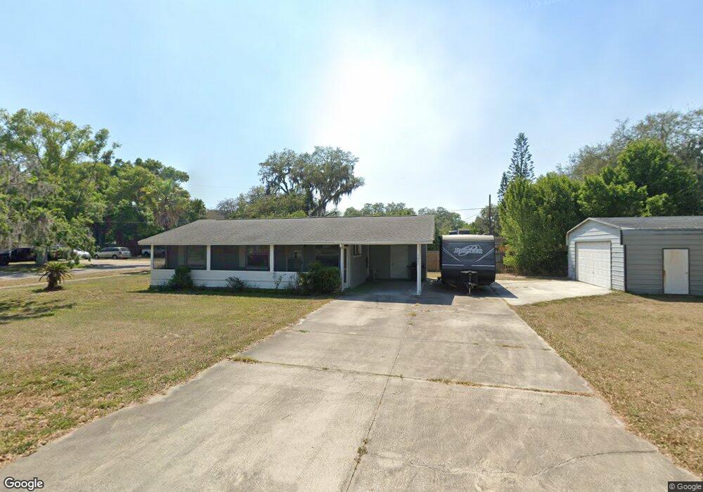
1022 Mississippi Ave Saint Cloud, FL 34769
Downtown Saint Cloud NeighborhoodEstimated Value: $223,000 - $243,000
--
Bed
1
Bath
1,044
Sq Ft
$224/Sq Ft
Est. Value
About This Home
This home is located at 1022 Mississippi Ave, Saint Cloud, FL 34769 and is currently estimated at $233,750, approximately $223 per square foot. 1022 Mississippi Ave is a home located in Osceola County with nearby schools including Michigan Avenue Elementary School, St. Cloud High School, and St. Cloud Middle School.
Ownership History
Date
Name
Owned For
Owner Type
Purchase Details
Closed on
Jul 22, 2008
Sold by
Farris Esker J and Farris Edrie
Bought by
Micheals Jeffrey William
Current Estimated Value
Home Financials for this Owner
Home Financials are based on the most recent Mortgage that was taken out on this home.
Original Mortgage
$99,000
Outstanding Balance
$64,512
Interest Rate
6.27%
Mortgage Type
Purchase Money Mortgage
Estimated Equity
$169,238
Purchase Details
Closed on
Jul 7, 2006
Sold by
Farris Esker J and Farris Edrie
Bought by
Farris Esker J and Farris Edrie
Create a Home Valuation Report for This Property
The Home Valuation Report is an in-depth analysis detailing your home's value as well as a comparison with similar homes in the area
Home Values in the Area
Average Home Value in this Area
Purchase History
| Date | Buyer | Sale Price | Title Company |
|---|---|---|---|
| Micheals Jeffrey William | $110,000 | Stewart Approved Title Inc | |
| Farris Esker J | -- | None Available |
Source: Public Records
Mortgage History
| Date | Status | Borrower | Loan Amount |
|---|---|---|---|
| Open | Micheals Jeffrey William | $99,000 |
Source: Public Records
Tax History Compared to Growth
Tax History
| Year | Tax Paid | Tax Assessment Tax Assessment Total Assessment is a certain percentage of the fair market value that is determined by local assessors to be the total taxable value of land and additions on the property. | Land | Improvement |
|---|---|---|---|---|
| 2024 | $539 | $67,362 | -- | -- |
| 2023 | $539 | $65,400 | $0 | $0 |
| 2022 | $529 | $63,496 | $0 | $0 |
| 2021 | $533 | $61,647 | $0 | $0 |
| 2020 | $533 | $60,796 | $0 | $0 |
| 2019 | $533 | $59,430 | $0 | $0 |
| 2018 | $532 | $58,322 | $0 | $0 |
| 2017 | $536 | $57,123 | $0 | $0 |
| 2016 | $534 | $55,949 | $0 | $0 |
| 2015 | $543 | $55,561 | $0 | $0 |
| 2014 | $543 | $55,121 | $0 | $0 |
Source: Public Records
Map
Nearby Homes
- 1204 Eastern Ave
- 0 13th Ave Unit MFRS5104406
- 196 13th St Unit W-39
- 196 13th St Unit E45
- 196 13th St Unit W14
- 196 13th St Unit W8
- 196 13th St
- 0 Delaware Ave Unit 11505775
- 0 Delaware Ave Unit MFRO6209200
- 0 Delaware Ave Unit MFRS5127764
- 1103 Grape Ave
- 0 14th St Unit MFRTB8416358
- 402 10th St
- 6301 E Irlo Bronson Memorial Hwy
- 1418 Delaware Ave
- 1612 Eastern Ave
- 443 Wyoming Ave
- 1409 Virginia Ave
- 413 Eastern Ave
- 500 16th St
- 6 11th St
- 1025 Mississippi Ave
- 1010 Mississippi Ave
- 1019 Mississippi Ave
- 1021 Oregon Ave
- 1007 Mississippi Ave
- 51 10th St
- 1011 Oregon Ave
- 57 10th St
- 91 10th St
- 1101 Mississippi Ave
- 1001 Mississippi Ave
- 1107 Oregon Ave
- 3 11th St
- 99 10th St
- 1115 Mississippi Ave
- 1109 Oregon Ave
- 1115 Oregon Ave
- 10 10th St