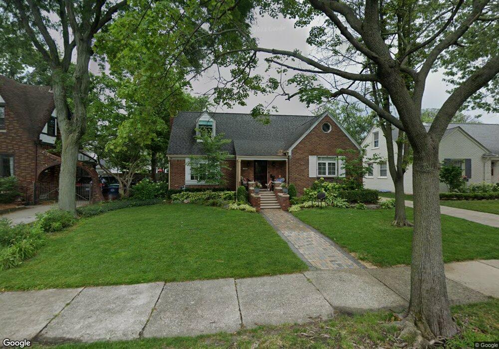
1022 Nottingham Rd Grosse Pointe Park, MI 48230
Estimated Value: $402,661 - $536,000
--
Bed
--
Bath
1,768
Sq Ft
$258/Sq Ft
Est. Value
About This Home
This home is located at 1022 Nottingham Rd, Grosse Pointe Park, MI 48230 and is currently estimated at $456,415, approximately $258 per square foot. 1022 Nottingham Rd is a home located in Wayne County with nearby schools including George Defer Elementary School, Pierce Middle School, and Grosse Pointe South High School.
Ownership History
Date
Name
Owned For
Owner Type
Purchase Details
Closed on
Apr 27, 2018
Sold by
Hoffman Doreen L
Bought by
Chaplin Robert A
Current Estimated Value
Purchase Details
Closed on
Jun 15, 2004
Sold by
Wilson Henry A and Wilson Mildred R
Bought by
Hoffman Doreen L
Purchase Details
Closed on
Jul 24, 2003
Sold by
Wilson Henry A and Wilson Mildred
Bought by
Flagship Mortgage Corp
Purchase Details
Closed on
Jun 6, 2002
Sold by
Wilson Henry A
Bought by
Citibank
Create a Home Valuation Report for This Property
The Home Valuation Report is an in-depth analysis detailing your home's value as well as a comparison with similar homes in the area
Home Values in the Area
Average Home Value in this Area
Purchase History
| Date | Buyer | Sale Price | Title Company |
|---|---|---|---|
| Chaplin Robert A | $299,000 | Ata Natl Title Group Llc | |
| Hoffman Doreen L | $280,000 | Lamont Title Company | |
| Flagship Mortgage Corp | $204,725 | -- | |
| Citibank | $172,037 | -- |
Source: Public Records
Tax History Compared to Growth
Tax History
| Year | Tax Paid | Tax Assessment Tax Assessment Total Assessment is a certain percentage of the fair market value that is determined by local assessors to be the total taxable value of land and additions on the property. | Land | Improvement |
|---|---|---|---|---|
| 2025 | $3,810 | $164,200 | $0 | $0 |
| 2024 | $3,810 | $159,600 | $0 | $0 |
| 2023 | $3,638 | $155,700 | $0 | $0 |
| 2022 | $3,457 | $142,300 | $0 | $0 |
| 2021 | $6,816 | $136,800 | $0 | $0 |
| 2019 | $7,014 | $130,500 | $0 | $0 |
| 2018 | $2,336 | $114,600 | $0 | $0 |
| 2017 | $7,653 | $69,000 | $0 | $0 |
| 2016 | $6,518 | $100,400 | $0 | $0 |
| 2015 | $8,743 | $102,600 | $0 | $0 |
| 2013 | $8,470 | $86,200 | $0 | $0 |
| 2012 | $2,404 | $90,700 | $31,300 | $59,400 |
Source: Public Records
Map
Nearby Homes
- 1032 Beaconsfield Ave
- 1048 Lakepointe St Unit A
- 1058 Lakepointe St
- 74 Pointe Park Place Unit 311
- 54 Pointe Park Place Unit 208
- 1083 Lakepointe St
- 976 Lakepointe St
- 875 Balfour St
- 1308 Ashland St
- 1254 Beaconsfield Ave
- 2568 Alter Rd
- 2140 Alter Rd
- 908 Manistique St
- 1306 Beaconsfield Ave Unit 1308
- 1148 Devonshire Rd
- 877 Manistique St
- 14536 E Jefferson Ave
- 1316 Maryland St
- 847 Barrington Rd
- 709 Ashland St
- 1024 Nottingham Rd
- 1020 Nottingham Rd
- 1031 Somerset Ave
- 1018 Nottingham Rd
- 1026 Nottingham Rd
- 1035 Somerset Ave
- 1025 Somerset Ave
- 1027 Somerset Ave
- 1023 Nottingham Rd
- 1039 Somerset Ave
- 1021 Nottingham Rd
- 1025 Nottingham Rd
- 1028 Nottingham Rd
- 1023 Somerset Ave
- 1016 Nottingham Rd
- 1019 Nottingham Rd
- 1027 Nottingham Rd
- 1043 Somerset Ave
- 1019 Somerset Ave
- 1030 Nottingham Rd