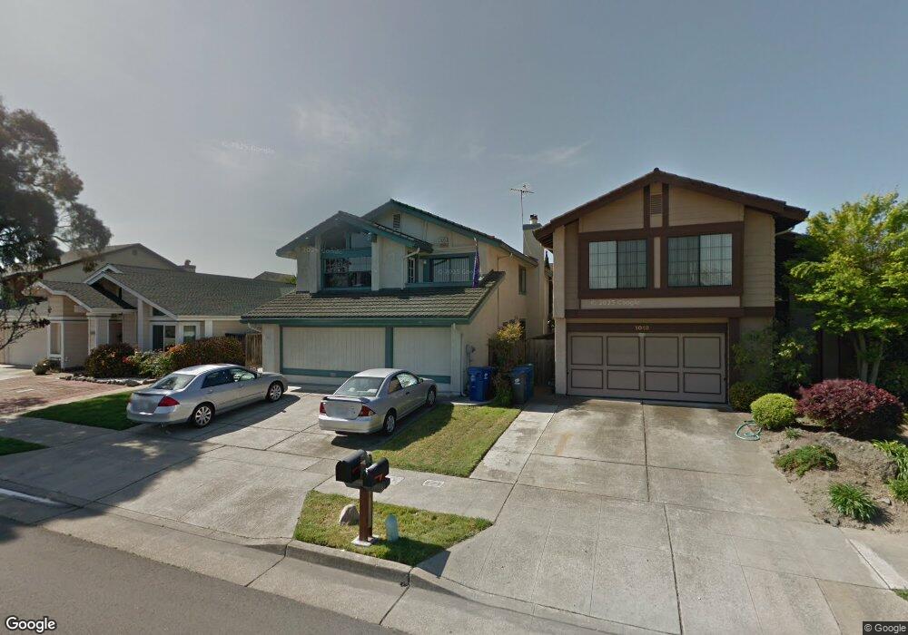
1022 Otis Dr Alameda, CA 94501
South Shore NeighborhoodEstimated Value: $1,598,000 - $1,744,069
3
Beds
3
Baths
2,842
Sq Ft
$591/Sq Ft
Est. Value
About This Home
This home is located at 1022 Otis Dr, Alameda, CA 94501 and is currently estimated at $1,680,517, approximately $591 per square foot. 1022 Otis Dr is a home located in Alameda County with nearby schools including William G. Paden Elementary School, Will C. Wood Middle School, and Encinal Junior/Senior High.
Ownership History
Date
Name
Owned For
Owner Type
Purchase Details
Closed on
Jul 22, 2013
Sold by
Leung David K and Leung Alice Y
Bought by
Deleon Jonathan and Deleon Bernadette B
Current Estimated Value
Home Financials for this Owner
Home Financials are based on the most recent Mortgage that was taken out on this home.
Original Mortgage
$640,000
Outstanding Balance
$465,374
Interest Rate
3.92%
Mortgage Type
New Conventional
Estimated Equity
$1,215,143
Purchase Details
Closed on
Jan 16, 2008
Sold by
Leung Alice Y and Leung David K
Bought by
Leung David K and Leung Alice Y
Home Financials for this Owner
Home Financials are based on the most recent Mortgage that was taken out on this home.
Original Mortgage
$400,000
Interest Rate
6.07%
Mortgage Type
New Conventional
Create a Home Valuation Report for This Property
The Home Valuation Report is an in-depth analysis detailing your home's value as well as a comparison with similar homes in the area
Home Values in the Area
Average Home Value in this Area
Purchase History
| Date | Buyer | Sale Price | Title Company |
|---|---|---|---|
| Deleon Jonathan | $800,000 | Fidelity National Title Co | |
| Leung David K | -- | First American Title |
Source: Public Records
Mortgage History
| Date | Status | Borrower | Loan Amount |
|---|---|---|---|
| Open | Deleon Jonathan | $640,000 | |
| Previous Owner | Leung David K | $400,000 |
Source: Public Records
Tax History Compared to Growth
Tax History
| Year | Tax Paid | Tax Assessment Tax Assessment Total Assessment is a certain percentage of the fair market value that is determined by local assessors to be the total taxable value of land and additions on the property. | Land | Improvement |
|---|---|---|---|---|
| 2025 | $14,482 | $980,647 | $294,194 | $686,453 |
| 2024 | $14,482 | $961,423 | $288,427 | $672,996 |
| 2023 | $13,946 | $942,575 | $282,772 | $659,803 |
| 2022 | $13,647 | $924,095 | $277,228 | $646,867 |
| 2021 | $13,323 | $905,983 | $271,795 | $634,188 |
| 2020 | $13,169 | $896,695 | $269,008 | $627,687 |
| 2019 | $12,297 | $879,120 | $263,736 | $615,384 |
| 2018 | $11,995 | $861,887 | $258,566 | $603,321 |
| 2017 | $11,447 | $844,991 | $253,497 | $591,494 |
| 2016 | $11,472 | $828,423 | $248,527 | $579,896 |
| 2015 | $11,441 | $815,983 | $244,795 | $571,188 |
| 2014 | $10,920 | $800,000 | $240,000 | $560,000 |
Source: Public Records
Map
Nearby Homes
- 955 Shorepoint Ct Unit 110
- 955 Shorepoint Ct Unit 200
- 950 Shorepoint Ct Unit 100
- 965 Shorepoint Ct
- 933 Shoreline Dr Unit 203
- 1001 Shoreline Dr Unit 301
- 901 San Antonio Ave
- 1220 9th St
- 1301 9th St
- 404 Coral Reef Rd
- 608 Fortress Isle
- 1305 Webster St Unit C309
- 1305 Webster St Unit C102
- 1203 Benton St
- 1321 Webster St Unit D119
- 1321 Webster St Unit D116
- 1321 Webster St Unit D303
- 1333 Webster St Unit A107
- 1512 Mozart St
- 1059 Santa Clara Ave
- 1018 Otis Dr
- 1026 Otis Dr
- 1014 Otis Dr
- 1023 Rosewood Way
- 1030 Otis Dr
- 1019 Rosewood Way
- 1027 Rosewood Way
- 1015 Rosewood Way
- 1031 Rosewood Way
- 1010 Otis Dr
- 1034 Otis Dr
- 1011 Rosewood Way
- 1035 Rosewood Way
- 1021 Otis Dr
- 607 Sand Hook Isle
- 1006 Otis Dr
- 1007 Rosewood Way
- 1015 Otis Dr
- 600 Sand Hook Isle
- 1039 Rosewood Way
