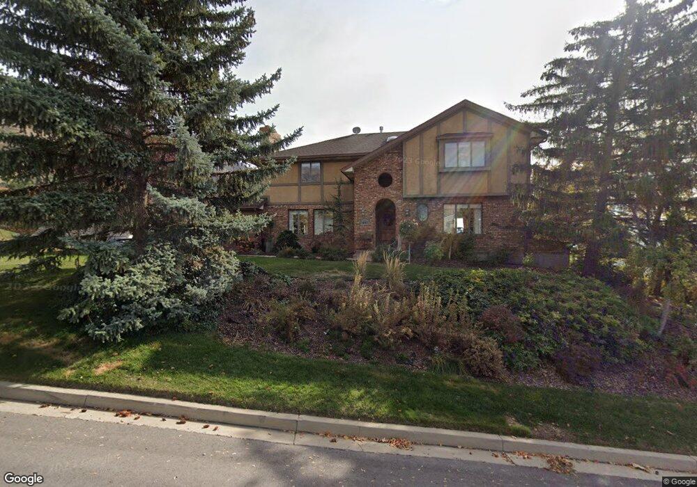
1022 Windsor Dr Provo, UT 84604
Rock Canyon NeighborhoodEstimated Value: $806,709 - $1,006,000
5
Beds
3
Baths
3,030
Sq Ft
$309/Sq Ft
Est. Value
About This Home
This home is located at 1022 Windsor Dr, Provo, UT 84604 and is currently estimated at $935,927, approximately $308 per square foot. 1022 Windsor Dr is a home located in Utah County with nearby schools including Canyon Crest Elementary School, Centennial Middle School, and Timpview High School.
Ownership History
Date
Name
Owned For
Owner Type
Purchase Details
Closed on
Jan 3, 2022
Sold by
Carol Rutherford Family Trust and Rutherford Carol W
Bought by
Carol Rutherford Family Trust and Rutherford
Current Estimated Value
Home Financials for this Owner
Home Financials are based on the most recent Mortgage that was taken out on this home.
Original Mortgage
$1,204,500
Outstanding Balance
$482,676
Interest Rate
1.2%
Mortgage Type
Reverse Mortgage Home Equity Conversion Mortgage
Estimated Equity
$453,251
Purchase Details
Closed on
May 1, 2013
Sold by
Hutherford Larry and Hutherford Carol
Bought by
Rutherford Carol W and The Carol Rutherford Family Tr
Home Financials for this Owner
Home Financials are based on the most recent Mortgage that was taken out on this home.
Original Mortgage
$597,000
Interest Rate
3.54%
Mortgage Type
Reverse Mortgage Home Equity Conversion Mortgage
Purchase Details
Closed on
Dec 14, 2007
Sold by
Rutherford Carol W
Bought by
Rutherford Carol W and The Carol Rutherford Family Tr
Create a Home Valuation Report for This Property
The Home Valuation Report is an in-depth analysis detailing your home's value as well as a comparison with similar homes in the area
Home Values in the Area
Average Home Value in this Area
Purchase History
| Date | Buyer | Sale Price | Title Company |
|---|---|---|---|
| Carol Rutherford Family Trust | -- | Utah First Title | |
| Rutherford Carol W | -- | Fidelity Title | |
| Rutherford Larry | -- | Fidelity Title | |
| Rutherford Carol W | -- | None Available |
Source: Public Records
Mortgage History
| Date | Status | Borrower | Loan Amount |
|---|---|---|---|
| Open | Carol Rutherford Family Trust | $1,204,500 | |
| Closed | Carol Rutherford Family Trust | $1,204,500 | |
| Previous Owner | Rutherford Larry | $597,000 |
Source: Public Records
Tax History Compared to Growth
Tax History
| Year | Tax Paid | Tax Assessment Tax Assessment Total Assessment is a certain percentage of the fair market value that is determined by local assessors to be the total taxable value of land and additions on the property. | Land | Improvement |
|---|---|---|---|---|
| 2025 | $4,088 | $402,985 | $259,100 | $473,600 |
| 2024 | $4,088 | $402,435 | $0 | $0 |
| 2023 | $4,242 | $411,675 | $0 | $0 |
| 2022 | $3,962 | $387,640 | $0 | $0 |
| 2021 | $3,149 | $537,400 | $175,300 | $362,100 |
| 2020 | $3,132 | $501,100 | $146,100 | $355,000 |
| 2019 | $3,012 | $501,100 | $146,100 | $355,000 |
| 2018 | $2,710 | $457,300 | $146,100 | $311,200 |
| 2017 | $2,577 | $238,920 | $0 | $0 |
| 2016 | $2,636 | $227,810 | $0 | $0 |
| 2015 | $2,587 | $225,995 | $0 | $0 |
| 2014 | -- | $207,735 | $0 | $0 |
Source: Public Records
Map
Nearby Homes
- 4612 N Bristol Cir
- 4606 Brookshire Cir
- 924 Redford Dr
- 4365 Bedford Dr
- 4601 Foothill Dr
- 4299 Ivy Ln
- 981 Waterford Dr Unit 5&6
- 4077 N Devonshire Cir
- 4093 Imperial Way
- 4839 N 350 E
- 3985 N 850 St E
- 645 Foothill Dr
- 3943 Foothill Dr
- 3936 Foothill Dr
- 221 E 4735 N
- 209 E 4735 N
- 4161 N Canyon Rd Unit 2
- 3702 N 920 E
- 3811 N Devonshire Dr E
- 299 E 4000 N
- 4551 N Victoria Cir Unit 159
- 4573 N Victoria Cir Unit 158
- 4591 Victoria Cir
- 977 E 4500 N
- 1040 Windsor Dr
- 1029 Windsor Dr
- 4624 Hillside Dr
- 969 E 4500 N
- 4573 Victoria Cir Unit 158
- 4594 Victoria Cir
- 976 E 4500 N
- 4634 Hillside Dr
- 4634 Hillside Dr Unit 7
- 1037 Windsor Dr
- 961 E 4500 N
- 4621 Bristol Cir
- 1057 Windsor Dr Unit 170
- 1057 Windsor Dr Unit 170
- 1057 Windsor Dr
- 1002 Hillside Dr