Estimated Value: $240,838 - $258,000
--
Bed
2
Baths
2,109
Sq Ft
$119/Sq Ft
Est. Value
About This Home
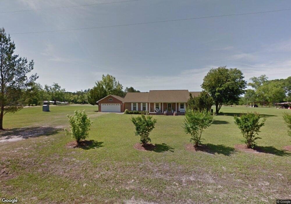
This home is located at 10220 Manningtown Rd, Jesup, GA 31546 and is currently estimated at $251,960, approximately $119 per square foot. 10220 Manningtown Rd is a home located in Wayne County with nearby schools including Jesup Elementary School, Arthur Williams Middle School, and Wayne County High School.
Ownership History
Date
Name
Owned For
Owner Type
Purchase Details
Closed on
Jun 21, 2013
Sold by
Smith Vera Ann
Bought by
Manning Manuel Joseph
Current Estimated Value
Purchase Details
Closed on
Mar 1, 2001
Sold by
Manning Manuel Joseph
Bought by
Manning Manuel Joseph and Manning Betty
Create a Home Valuation Report for This Property
The Home Valuation Report is an in-depth analysis detailing your home's value as well as a comparison with similar homes in the area
Home Values in the Area
Average Home Value in this Area
Purchase History
| Date | Buyer | Sale Price | Title Company |
|---|---|---|---|
| Manning Manuel Joseph | -- | -- | |
| Manning Manuel Joseph | -- | -- | |
| Manning Manuel Joseph | -- | -- |
Source: Public Records
Tax History Compared to Growth
Tax History
| Year | Tax Paid | Tax Assessment Tax Assessment Total Assessment is a certain percentage of the fair market value that is determined by local assessors to be the total taxable value of land and additions on the property. | Land | Improvement |
|---|---|---|---|---|
| 2024 | $2,001 | $80,527 | $2,240 | $78,287 |
| 2023 | $2,138 | $71,270 | $2,240 | $69,030 |
| 2022 | $1,678 | $58,308 | $2,240 | $56,068 |
| 2021 | $1,674 | $54,636 | $2,240 | $52,396 |
| 2020 | $1,733 | $54,676 | $2,280 | $52,396 |
| 2019 | $1,785 | $54,676 | $2,280 | $52,396 |
| 2018 | $1,785 | $54,676 | $2,280 | $52,396 |
| 2017 | $1,536 | $54,676 | $2,280 | $52,396 |
| 2016 | $1,486 | $54,676 | $2,280 | $52,396 |
| 2014 | $1,491 | $54,676 | $2,280 | $52,396 |
| 2013 | -- | $54,676 | $2,280 | $52,396 |
Source: Public Records
Map
Nearby Homes
- 7256 Manningtown Rd
- 5100 Flowers Branch Rd
- 1554 Flowers Break Rd
- 0 Johns Rd
- 0 Rogers Break Unit 1656131
- 6911 Old Hortense Rd
- 301 Broadhurst Rd
- 603 Cumberland Rd
- 6406 Mount Pleasant Rd
- 176 Covey Way Rd
- 255 Spell Landing Rd
- 6432 Mount Pleasant Rd
- 0 Us Highway 301
- 0N E Rd
- 17082 Hwy 341
- 288 Rattler Run
- 0 Rattler Run
- 694 Overstreet Rd
- 11211 Georgia 110
- 0 Humpback Rd
- 47 James St
- 36 James St
- Tract 2 Mannningtown Rd
- 45 James St
- 10340 Manningtown Rd
- 10180 Manningtown Rd
- 230 Ron Rd
- 94 Spradley Rd
- 159 James St
- 10360 Manningtown Rd
- 95 Allen St
- 0 Allen St Unit 239443
- 0 Allen St Unit 8913038
- 0 Allen St
- 105 Mathis Dr
- 149 Allen St
- 10520 Manningtown Rd
- 71 Woodrow Dr
- 0 Ron Rd Unit 10012037
- 0 Ron Rd Unit 240351