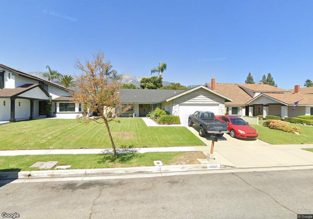
10224 Ring Ave Rancho Cucamonga, CA 91737
Alta Loma NeighborhoodEstimated Value: $676,824 - $774,000
3
Beds
2
Baths
1,504
Sq Ft
$493/Sq Ft
Est. Value
About This Home
This home is located at 10224 Ring Ave, Rancho Cucamonga, CA 91737 and is currently estimated at $741,956, approximately $493 per square foot. 10224 Ring Ave is a home located in San Bernardino County with nearby schools including Deer Canyon Elementary, Vineyard Junior High, and Los Osos High.
Ownership History
Date
Name
Owned For
Owner Type
Purchase Details
Closed on
Apr 20, 2023
Sold by
Espinoza Deborah
Bought by
Deborah Espinoza Vasquez Living Trust
Current Estimated Value
Purchase Details
Closed on
Dec 15, 2005
Sold by
Espinoza William S
Bought by
Espinoza Deborah
Purchase Details
Closed on
Sep 30, 2003
Sold by
Espinoza William
Bought by
Espinoza William S and Espinoza Eva
Create a Home Valuation Report for This Property
The Home Valuation Report is an in-depth analysis detailing your home's value as well as a comparison with similar homes in the area
Home Values in the Area
Average Home Value in this Area
Purchase History
| Date | Buyer | Sale Price | Title Company |
|---|---|---|---|
| Deborah Espinoza Vasquez Living Trust | -- | None Listed On Document | |
| Espinoza Deborah | -- | -- | |
| Espinoza William S | -- | -- |
Source: Public Records
Tax History
| Year | Tax Paid | Tax Assessment Tax Assessment Total Assessment is a certain percentage of the fair market value that is determined by local assessors to be the total taxable value of land and additions on the property. | Land | Improvement |
|---|---|---|---|---|
| 2025 | $2,472 | $211,331 | $62,156 | $149,175 |
| 2024 | $2,413 | $207,187 | $60,937 | $146,250 |
| 2023 | $2,361 | $203,124 | $59,742 | $143,382 |
| 2022 | $2,355 | $199,142 | $58,571 | $140,571 |
| 2021 | $2,354 | $195,238 | $57,423 | $137,815 |
| 2020 | $2,262 | $193,236 | $56,834 | $136,402 |
| 2019 | $2,287 | $189,447 | $55,720 | $133,727 |
| 2018 | $2,238 | $185,732 | $54,627 | $131,105 |
| 2017 | $2,142 | $182,090 | $53,556 | $128,534 |
| 2016 | $2,087 | $178,520 | $52,506 | $126,014 |
| 2015 | $2,074 | $175,838 | $51,717 | $124,121 |
| 2014 | $2,019 | $172,394 | $50,704 | $121,690 |
Source: Public Records
Map
Nearby Homes
- 6600 Montresor Place
- 6449 Mayberry Ave
- 10456 Hamilton St
- 10088 Goldenrod Ct
- 6770 Berkshire Ave
- 10576 Valinda Ct
- 10399 Monte Vista St
- 6270 Kinlock Ave
- 7021 Mesada St
- 6433 Aleatico Place
- 10655 Lemon Ave
- 10655 Lemon Ave Unit 3704
- 10655 Lemon Ave Unit 1001
- 10655 Lemon Ave Unit 3107
- 10655 Lemon Ave Unit 1508
- 10655 Lemon Ave Unit 4009
- 9728 Woodleaf Dr
- 10350 Baseline Rd Unit 55
- 6949 Laguna Place Unit B1
- 10210 Baseline Rd Unit 263
- 10234 Ring Ave
- 10214 Ring Ave
- 10223 Heather St
- 10244 Ring Ave
- 10206 Ring Ave
- 10233 Heather St
- 10213 Heather St
- 10243 Heather St
- 10225 Ring Ave
- 10254 Ring Ave
- 10204 Ring Ave
- 10215 Ring Ave
- 10235 Ring Ave
- 10203 Heather St
- 10205 Ring Ave
- 10253 Heather St
- 10245 Ring Ave
- 10201 Heather St
- 10201 Heather St
- 10264 Ring Ave
Your Personal Tour Guide
Ask me questions while you tour the home.