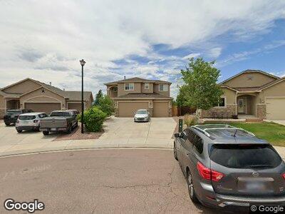
10226 Abrams Dr Colorado Springs, CO 80925
Lorson Ranch NeighborhoodEstimated Value: $542,799 - $570,000
5
Beds
4
Baths
2,393
Sq Ft
$230/Sq Ft
Est. Value
About This Home
This home is located at 10226 Abrams Dr, Colorado Springs, CO 80925 and is currently estimated at $551,200, approximately $230 per square foot. 10226 Abrams Dr is a home with nearby schools including Grand Mountain School, Mesa Ridge High School, and Valley Christian Academy.
Ownership History
Date
Name
Owned For
Owner Type
Purchase Details
Closed on
Apr 17, 2020
Sold by
Montevirgen Lorryn and Montevirgen Neil M
Bought by
Clark Andrew D and Clark Cheryl F
Current Estimated Value
Home Financials for this Owner
Home Financials are based on the most recent Mortgage that was taken out on this home.
Original Mortgage
$410,000
Interest Rate
3.2%
Mortgage Type
VA
Purchase Details
Closed on
Jul 31, 2013
Sold by
Windsor Ridge Homes Llc
Bought by
Montevirgen Lorryn and Montevirgen Neil M
Home Financials for this Owner
Home Financials are based on the most recent Mortgage that was taken out on this home.
Original Mortgage
$321,934
Interest Rate
4.34%
Mortgage Type
VA
Create a Home Valuation Report for This Property
The Home Valuation Report is an in-depth analysis detailing your home's value as well as a comparison with similar homes in the area
Home Values in the Area
Average Home Value in this Area
Purchase History
| Date | Buyer | Sale Price | Title Company |
|---|---|---|---|
| Clark Andrew D | $410,000 | Unified Title Co | |
| Montevirgen Lorryn | $311,700 | Empire Title Co Springs Llc |
Source: Public Records
Mortgage History
| Date | Status | Borrower | Loan Amount |
|---|---|---|---|
| Open | Clark Andrew D | $412,000 | |
| Closed | Clark Andrew D | $410,000 | |
| Previous Owner | Montevirgen Lorryn | $346,100 | |
| Previous Owner | Montevirgen Neil M | $320,000 | |
| Previous Owner | Montevirgen Lorryn | $321,934 | |
| Previous Owner | Windsor Ridge Homes Llc | $236,000 |
Source: Public Records
Tax History Compared to Growth
Tax History
| Year | Tax Paid | Tax Assessment Tax Assessment Total Assessment is a certain percentage of the fair market value that is determined by local assessors to be the total taxable value of land and additions on the property. | Land | Improvement |
|---|---|---|---|---|
| 2024 | $4,002 | $37,340 | $6,040 | $31,300 |
| 2022 | $2,724 | $26,630 | $4,810 | $21,820 |
| 2021 | $3,839 | $27,400 | $4,950 | $22,450 |
| 2020 | $3,783 | $26,720 | $4,330 | $22,390 |
| 2019 | $3,771 | $26,720 | $4,330 | $22,390 |
| 2018 | $3,235 | $22,570 | $4,360 | $18,210 |
| 2017 | $3,303 | $22,570 | $4,360 | $18,210 |
| 2016 | $3,132 | $24,200 | $4,380 | $19,820 |
| 2015 | $3,299 | $24,200 | $4,380 | $19,820 |
| 2014 | $3,285 | $24,200 | $4,290 | $19,910 |
Source: Public Records
Map
Nearby Homes
- 10311 Declaration Dr
- 6429 Tranters Creek Way
- 6878 Alliance Loop
- 6558 Alliance Loop
- 10171 Seawolf Dr
- 10178 Intrepid Way
- 10749 Deer Meadow Cir
- 6375 White Wolf Point
- 10340 Abrams Dr
- 6559 Tranters Creek Way
- 10251 Intrepid Way
- 6285 White Wolf Point
- 10384 Declaration Dr
- 6244 Roundup Butte St
- 6255 White Wolf Point
- 10188 Winter Gem Grove
- 10218 Intrepid Way
- 6235 White Wolf Point
- 6351 Old Glory Dr
- 6253 Saddlebred Way
- 10226 Abrams Dr
- 10232 Abrams Dr
- 10220 Abrams Dr
- 10214 Abrams Dr
- 10238 Abrams Dr
- 10208 Abrams Dr
- 10237R Abrams Dr
- 10237 Abrams Dr
- 10207 Abrams Dr
- 10250 Abrams Dr
- 10066 Intrepid Way
- 10202 Abrams Dr
- 10249 Abrams Dr
- 10058 Intrepid Way
- 10256 Abrams Dr
- 10201 Abrams Dr
- 10074 Intrepid Way
- 10868 Deer Meadow Cir
- 10255 Abrams Dr
- 10262 Abrams Dr