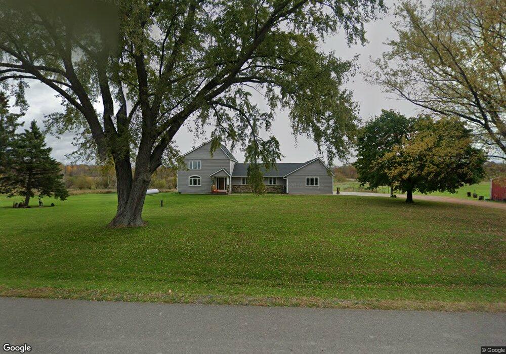
10226 Day Rd Marshfield, WI 54449
Estimated Value: $302,000 - $471,000
Studio
--
Bath
--
Sq Ft
87,120
Sq Ft Lot
About This Home
This home is located at 10226 Day Rd, Marshfield, WI 54449 and is currently estimated at $374,213. 10226 Day Rd is a home located in Wood County with nearby schools including Auburndale Elementary School, Auburndale High School, and St. Mary School.
Ownership History
Date
Name
Owned For
Owner Type
Purchase Details
Closed on
Feb 24, 2014
Sold by
Niehaus Pamela and Carol A Larson Md Revocable Tr
Bought by
Berdan Michael P and Berdan Diana S
Current Estimated Value
Home Financials for this Owner
Home Financials are based on the most recent Mortgage that was taken out on this home.
Original Mortgage
$200,000
Outstanding Balance
$102,923
Interest Rate
4.54%
Mortgage Type
Purchase Money Mortgage
Estimated Equity
$271,290
Create a Home Valuation Report for This Property
The Home Valuation Report is an in-depth analysis detailing your home's value as well as a comparison with similar homes in the area
Purchase History
| Date | Buyer | Sale Price | Title Company |
|---|---|---|---|
| Berdan Michael P | $235,000 | None Available |
Source: Public Records
Mortgage History
| Date | Status | Borrower | Loan Amount |
|---|---|---|---|
| Open | Berdan Michael P | $200,000 |
Source: Public Records
Tax History
| Year | Tax Paid | Tax Assessment Tax Assessment Total Assessment is a certain percentage of the fair market value that is determined by local assessors to be the total taxable value of land and additions on the property. | Land | Improvement |
|---|---|---|---|---|
| 2025 | $4,829 | $437,900 | $24,000 | $413,900 |
| 2024 | $3,628 | $213,300 | $17,000 | $196,300 |
| 2023 | $3,408 | $213,300 | $17,000 | $196,300 |
| 2022 | $3,385 | $213,300 | $17,000 | $196,300 |
| 2021 | $3,198 | $213,300 | $17,000 | $196,300 |
| 2020 | $3,017 | $213,300 | $17,000 | $196,300 |
| 2019 | $3,023 | $213,300 | $17,000 | $196,300 |
| 2018 | $2,922 | $176,100 | $15,000 | $161,100 |
| 2017 | $2,929 | $176,100 | $15,000 | $161,100 |
| 2016 | $2,981 | $176,100 | $15,000 | $161,100 |
| 2015 | $3,282 | $176,100 | $15,000 | $161,100 |
Source: Public Records
Map
Nearby Homes
- 10758 W 9th St
- 8188 County Road Ee
- 5772 Main St
- 10477 County Road A Unit Parcels 0300051,0300
- 2104 S Cottonwood Ave Unit GR35
- 10145 S Washington Ave
- 36.97 Heritage Dr
- 8201 County Road Y
- 1405 E 29th St
- 1540 E 20th St
- 1501 E 23rd St
- 1504 E 23rd St
- 1503 E 23rd St Unit GR40
- 2200 S Cottonwood Ave Unit GR37
- 2106 S Cottonwood Ave
- 2107 Ironwood Dr Unit GR42
- 2109 Ironwood Dr Unit GR41
- 2103 Ironwood Dr Unit GR44
- 1507 Green Acres Dr
- 1513 E 20th St
- 10295 Day Rd
- Lot #2 Mill Creek Dr
- 7382 Mill Creek Dr
- 10390 Day Rd
- 10036 Day Rd
- 10055 Day Rd
- 7429 Mill Creek Dr
- 10018 Day Rd
- 7498 Mill Creek Dr
- 10164 Rock Inn Rd
- 7475 Mill Creek Dr
- Lot 8 & 9 River Edge Ln
- 9980 Day Rd
- 7501 Marshfield Rd
- 7527 Mill Creek Dr
- 9951 Day Rd
- 7533 Mill Creek Dr
- 7545 Mill Creek Dr
- 10380 Rock Inn Rd
- 10389 Rock Inn Rd
Your Personal Tour Guide
Ask me questions while you tour the home.