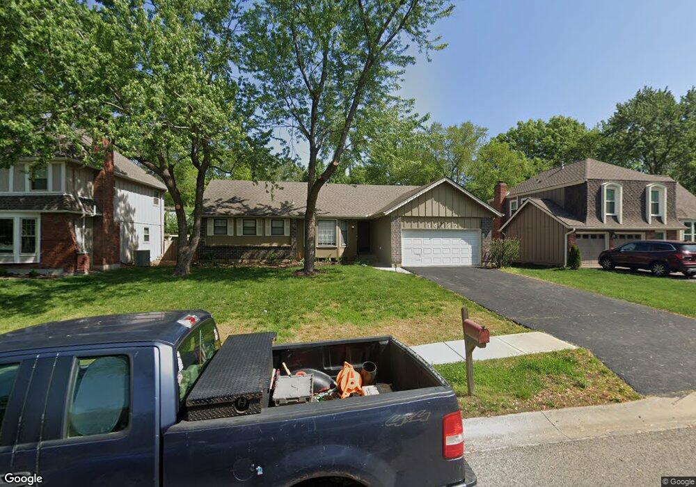
10227 Noland Rd Lenexa, KS 66215
Oak Park NeighborhoodEstimated Value: $366,000 - $382,000
3
Beds
2
Baths
1,543
Sq Ft
$243/Sq Ft
Est. Value
About This Home
This home is located at 10227 Noland Rd, Lenexa, KS 66215 and is currently estimated at $374,347, approximately $242 per square foot. 10227 Noland Rd is a home located in Johnson County with nearby schools including Rosehill Elementary School, Indian Woods Middle School, and Shawnee Mission South High School.
Ownership History
Date
Name
Owned For
Owner Type
Purchase Details
Closed on
Sep 22, 2022
Sold by
Mundy Kevin L and Mundy Janet A
Bought by
Vaughan Neal
Current Estimated Value
Purchase Details
Closed on
Oct 5, 2007
Sold by
Mcginnis Jody Ann
Bought by
Mundy Kevin L
Home Financials for this Owner
Home Financials are based on the most recent Mortgage that was taken out on this home.
Original Mortgage
$115,000
Interest Rate
6.55%
Mortgage Type
New Conventional
Create a Home Valuation Report for This Property
The Home Valuation Report is an in-depth analysis detailing your home's value as well as a comparison with similar homes in the area
Home Values in the Area
Average Home Value in this Area
Purchase History
| Date | Buyer | Sale Price | Title Company |
|---|---|---|---|
| Vaughan Neal | -- | Secured Title Of Kansas City | |
| Mundy Kevin L | -- | Chicago Title Ins Co |
Source: Public Records
Mortgage History
| Date | Status | Borrower | Loan Amount |
|---|---|---|---|
| Previous Owner | Mundy Kevin L | $115,000 |
Source: Public Records
Tax History
| Year | Tax Paid | Tax Assessment Tax Assessment Total Assessment is a certain percentage of the fair market value that is determined by local assessors to be the total taxable value of land and additions on the property. | Land | Improvement |
|---|---|---|---|---|
| 2025 | $4,178 | $39,548 | $7,723 | $31,825 |
| 2023 | $4,060 | $36,052 | $7,354 | $28,698 |
| 2022 | $3,737 | $33,143 | $6,688 | $26,455 |
| 2021 | $3,638 | $30,567 | $6,075 | $24,492 |
| 2020 | $3,159 | $26,220 | $5,526 | $20,694 |
| 2019 | $2,954 | $24,484 | $4,607 | $19,877 |
| 2018 | $2,766 | $24,760 | $4,607 | $20,153 |
| 2017 | $2,824 | $22,471 | $4,184 | $18,287 |
| 2016 | $2,676 | $21,010 | $3,836 | $17,174 |
| 2015 | $2,520 | $19,906 | $3,836 | $16,070 |
| 2013 | -- | $18,768 | $3,836 | $14,932 |
Source: Public Records
Map
Nearby Homes
- 12721 W 100th St
- 10200 Pflumm Rd
- 12514 W 101st St
- 12712 W 100th St
- 10020 Century Ln
- 9938 Fair Lane Rd
- 10401 Westgate St
- 10226 Century Ln
- 9901 Countryside Rd
- 12407 W 102nd St
- 9914 Westgate Ln
- 10580 Noland Rd
- 12325 W 100th St
- 10409 Oakmont St
- 12120 W 100th St
- 10139 Earnshaw St
- 12746 W 108th Place
- 10854 Rosehill Rd
- 12757 W 109th St
- 10863 Rosehill Rd
- 10229 Noland Rd
- 10217 Noland Rd
- 13031 W 102nd Terrace
- 13029 W 102nd Terrace
- 13039 W 102nd Terrace
- 10231 Noland Rd
- 13021 W 102nd Terrace
- 10228 Noland Rd
- 10226 Noland Rd
- 10230 Noland Rd
- 10233 Noland Rd
- 10224 Noland Rd
- 13017 W 102nd Terrace
- 10218 Noland Rd
- 10216 Noland Rd
- 10220 Noland Rd
- 10214 Noland Rd
- 10234 Noland Rd
- 13005 W 102nd Terrace
- 13032 W 102nd Terrace
Your Personal Tour Guide
Ask me questions while you tour the home.