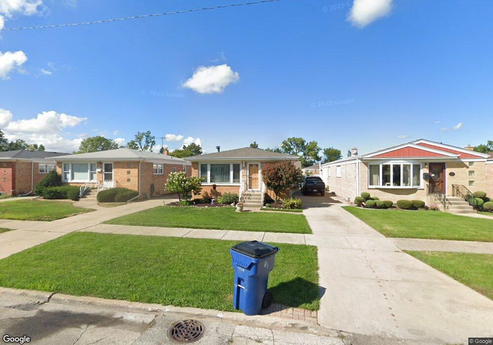
10228 Mcnerney Dr Franklin Park, IL 60131
Estimated Value: $332,013 - $398,000
3
Beds
1
Bath
1,091
Sq Ft
$326/Sq Ft
Est. Value
About This Home
This home is located at 10228 Mcnerney Dr, Franklin Park, IL 60131 and is currently estimated at $356,003, approximately $326 per square foot. 10228 Mcnerney Dr is a home located in Cook County with nearby schools including John F Kennedy Elementary School, Washington Elementary School, and Lincoln Middle School.
Ownership History
Date
Name
Owned For
Owner Type
Purchase Details
Closed on
Oct 22, 2004
Sold by
Addari Michelle and Kurash Michelle
Bought by
Addari Anthony
Current Estimated Value
Home Financials for this Owner
Home Financials are based on the most recent Mortgage that was taken out on this home.
Original Mortgage
$220,000
Outstanding Balance
$107,671
Interest Rate
5.91%
Mortgage Type
New Conventional
Estimated Equity
$248,332
Purchase Details
Closed on
Jul 17, 1997
Sold by
Rudy Albert P and Rudy Jacqueline E
Bought by
Addari Anthony and Kurash Michelle
Home Financials for this Owner
Home Financials are based on the most recent Mortgage that was taken out on this home.
Original Mortgage
$132,300
Interest Rate
7.56%
Create a Home Valuation Report for This Property
The Home Valuation Report is an in-depth analysis detailing your home's value as well as a comparison with similar homes in the area
Home Values in the Area
Average Home Value in this Area
Purchase History
| Date | Buyer | Sale Price | Title Company |
|---|---|---|---|
| Addari Anthony | -- | Cti | |
| Addari Anthony | $98,000 | Attorneys Natl Title Network |
Source: Public Records
Mortgage History
| Date | Status | Borrower | Loan Amount |
|---|---|---|---|
| Open | Addari Anthony | $220,000 | |
| Closed | Addari Anthony | $132,300 |
Source: Public Records
Tax History
| Year | Tax Paid | Tax Assessment Tax Assessment Total Assessment is a certain percentage of the fair market value that is determined by local assessors to be the total taxable value of land and additions on the property. | Land | Improvement |
|---|---|---|---|---|
| 2025 | $7,228 | $30,000 | $5,984 | $24,016 |
| 2024 | $7,228 | $26,000 | $4,896 | $21,104 |
| 2023 | $7,163 | $26,000 | $4,896 | $21,104 |
| 2022 | $7,163 | $26,000 | $4,896 | $21,104 |
| 2021 | $5,582 | $17,949 | $3,536 | $14,413 |
| 2020 | $5,510 | $17,949 | $3,536 | $14,413 |
| 2019 | $5,473 | $20,282 | $3,536 | $16,746 |
| 2018 | $6,330 | $20,543 | $2,992 | $17,551 |
| 2017 | $6,348 | $20,543 | $2,992 | $17,551 |
| 2016 | $6,244 | $20,543 | $2,992 | $17,551 |
| 2015 | $5,855 | $18,613 | $2,720 | $15,893 |
| 2014 | $5,829 | $18,613 | $2,720 | $15,893 |
| 2013 | $5,609 | $18,613 | $2,720 | $15,893 |
Source: Public Records
Map
Nearby Homes
- 10224 Mcnerney Dr
- 3639 Dora St
- 3529 George St
- 3519 Louis St
- 10123 Hartford Ct Unit GC
- 3640 Hawthorne St
- 3880 Scott St
- 3719 Hawthorne St
- 3516 Elder Ln
- 3631 Elder Ln
- 4034 Denley Ave
- 3706 Ruby St
- 3822 Ruby St Unit 2E
- 9850 Garden Ct
- 9741 Lonnquist Dr
- 3108 Lincoln St
- 3013 Lincoln St
- 3021 Louis St
- 4137 Ruby St
- 4043 Wagner Ave
- 10232 Mcnerney Dr
- 10220 Mcnerney Dr
- 10236 Mcnerney Dr
- 10216 Mcnerney Dr
- 10240 Mcnerney Dr
- 10229 Panoramic Dr
- 10225 Panoramic Dr
- 10233 Panoramic Dr
- 10221 Panoramic Dr
- 10237 Panoramic Dr
- 10244 Mcnerney Dr
- 10212 Mcnerney Dr
- 10217 Panoramic Dr
- 10241 Panoramic Dr
- 10248 Mcnerney Dr
- 10208 Mcnerney Dr
- 10221 Mcnerney Dr
- 10225 Mcnerney Dr
- 10217 Mcnerney Dr
- 10245 Panoramic Dr
Your Personal Tour Guide
Ask me questions while you tour the home.