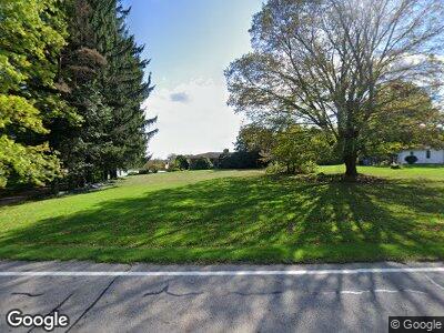
10228 State Route 82 Windham, OH 44288
Estimated Value: $138,000 - $190,000
3
Beds
2
Baths
1,300
Sq Ft
$131/Sq Ft
Est. Value
About This Home
This home is located at 10228 State Route 82, Windham, OH 44288 and is currently estimated at $169,685, approximately $130 per square foot. 10228 State Route 82 is a home located in Portage County with nearby schools including Katherine Thomas Elementary School, Windham Junior High School, and Windham High School.
Ownership History
Date
Name
Owned For
Owner Type
Purchase Details
Closed on
Jan 23, 2007
Sold by
Miller Virginia H
Bought by
Millers Sand & Gravel Inc
Current Estimated Value
Purchase Details
Closed on
Jul 21, 2003
Sold by
Estate Of Donald M Miller
Bought by
Miller Family Trust
Purchase Details
Closed on
May 21, 2003
Sold by
Miller Virginia H
Bought by
The Virginia Family Trust
Create a Home Valuation Report for This Property
The Home Valuation Report is an in-depth analysis detailing your home's value as well as a comparison with similar homes in the area
Home Values in the Area
Average Home Value in this Area
Purchase History
| Date | Buyer | Sale Price | Title Company |
|---|---|---|---|
| Millers Sand & Gravel Inc | -- | Attorney | |
| Miller Family Trust | -- | -- | |
| The Virginia Family Trust | -- | -- | |
| Miller Virginia H | -- | -- |
Source: Public Records
Tax History Compared to Growth
Tax History
| Year | Tax Paid | Tax Assessment Tax Assessment Total Assessment is a certain percentage of the fair market value that is determined by local assessors to be the total taxable value of land and additions on the property. | Land | Improvement |
|---|---|---|---|---|
| 2024 | $2,458 | $56,740 | $6,760 | $49,980 |
| 2023 | $2,129 | $43,610 | $5,670 | $37,940 |
| 2022 | $2,039 | $43,610 | $5,670 | $37,940 |
| 2021 | $2,014 | $43,610 | $5,670 | $37,940 |
| 2020 | $1,978 | $40,150 | $5,670 | $34,480 |
| 2019 | $2,027 | $40,150 | $5,670 | $34,480 |
| 2018 | $1,831 | $36,440 | $5,670 | $30,770 |
| 2017 | $1,831 | $36,440 | $5,670 | $30,770 |
| 2016 | $1,817 | $36,440 | $5,670 | $30,770 |
| 2015 | $1,817 | $36,440 | $5,670 | $30,770 |
| 2014 | $1,352 | $36,440 | $5,670 | $30,770 |
| 2013 | $1,337 | $36,440 | $5,670 | $30,770 |
Source: Public Records
Map
Nearby Homes
- 9581 Colton Rd
- 9067 Horn Rd
- 9019 Horn Rd
- 10303 Newell Ledge Rd
- V/L Parkman Rd
- 9507 Wolf Rd
- 9300 N Main St
- 9140 Maple Grove Rd
- 5552 Nelson Mosier Rd
- 9245 N Main St
- 9502 E Center St
- 8935 S Main St
- 0 Bryant & Sr 82
- 9132 Hampshire St Unit 5
- 9313 W Center St
- 10453 Windham Parkman Rd
- 0 Bryant Rd
- 10860 Bloom Rd
- 10571 Hopkins Rd
- 10981 Bloom Rd
