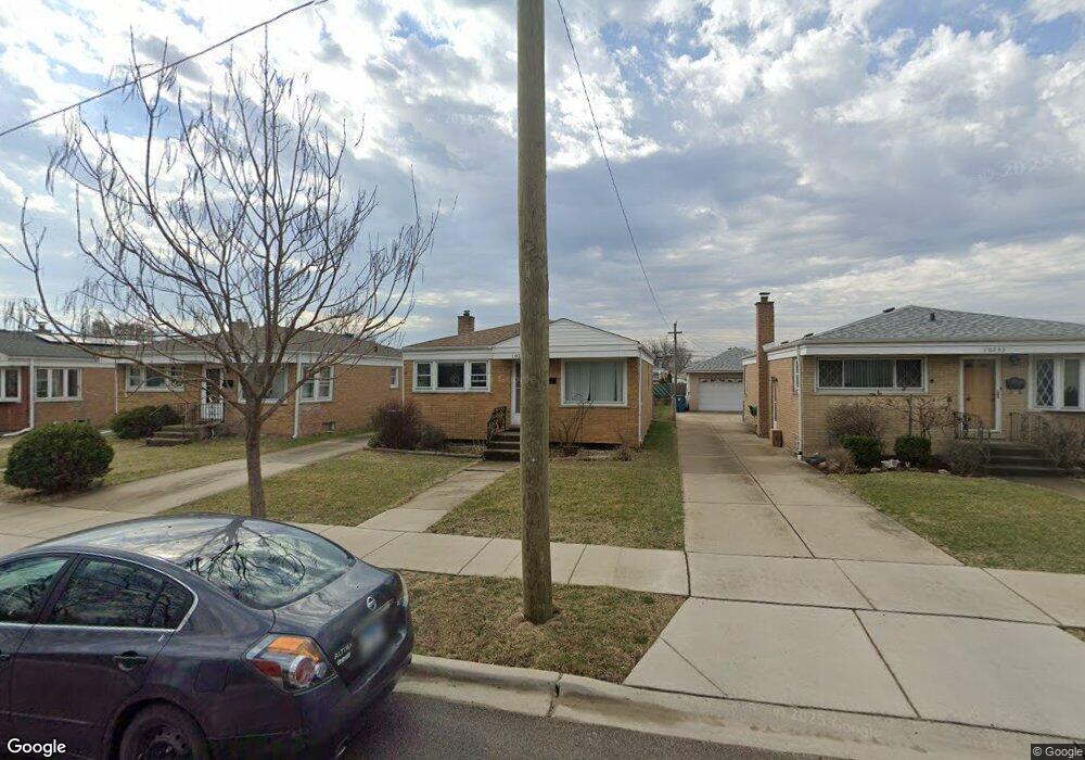
10229 Panoramic Dr Franklin Park, IL 60131
Estimated Value: $337,806 - $371,000
2
Beds
1
Bath
1,025
Sq Ft
$341/Sq Ft
Est. Value
About This Home
This home is located at 10229 Panoramic Dr, Franklin Park, IL 60131 and is currently estimated at $349,952, approximately $341 per square foot. 10229 Panoramic Dr is a home located in Cook County with nearby schools including John F Kennedy Elementary School, Washington Elementary School, and Lincoln Middle School.
Ownership History
Date
Name
Owned For
Owner Type
Purchase Details
Closed on
Aug 26, 2010
Sold by
Bubalo Dani A and Bubalo Christine K
Bought by
Bubalo Christine K
Current Estimated Value
Home Financials for this Owner
Home Financials are based on the most recent Mortgage that was taken out on this home.
Original Mortgage
$144,000
Outstanding Balance
$94,701
Interest Rate
4.36%
Mortgage Type
New Conventional
Estimated Equity
$255,251
Purchase Details
Closed on
May 22, 2003
Sold by
Bubalo Dani A and Bubalo Christine K
Bought by
Bubalo Dani A and Bubalo Christine K
Purchase Details
Closed on
Feb 15, 1994
Sold by
Schoenneman John R and Schoenneman Maryann S
Bought by
Bubalo Danie and Bubalo Christine K
Home Financials for this Owner
Home Financials are based on the most recent Mortgage that was taken out on this home.
Original Mortgage
$100,800
Interest Rate
7.32%
Create a Home Valuation Report for This Property
The Home Valuation Report is an in-depth analysis detailing your home's value as well as a comparison with similar homes in the area
Home Values in the Area
Average Home Value in this Area
Purchase History
| Date | Buyer | Sale Price | Title Company |
|---|---|---|---|
| Bubalo Christine K | -- | None Available | |
| Bubalo Dani A | -- | Oconnor Title Services Inc | |
| Bubalo Danie | $84,000 | -- |
Source: Public Records
Mortgage History
| Date | Status | Borrower | Loan Amount |
|---|---|---|---|
| Open | Bubalo Christine K | $144,000 | |
| Closed | Bubalo Danie | $100,800 |
Source: Public Records
Tax History Compared to Growth
Tax History
| Year | Tax Paid | Tax Assessment Tax Assessment Total Assessment is a certain percentage of the fair market value that is determined by local assessors to be the total taxable value of land and additions on the property. | Land | Improvement |
|---|---|---|---|---|
| 2024 | $6,591 | $24,000 | $4,752 | $19,248 |
| 2023 | $6,528 | $24,000 | $4,752 | $19,248 |
| 2022 | $6,528 | $24,000 | $4,752 | $19,248 |
| 2021 | $5,418 | $17,520 | $3,432 | $14,088 |
| 2020 | $5,351 | $17,520 | $3,432 | $14,088 |
| 2019 | $5,316 | $19,797 | $3,432 | $16,365 |
| 2018 | $5,109 | $17,244 | $2,904 | $14,340 |
| 2017 | $5,128 | $17,244 | $2,904 | $14,340 |
| 2016 | $6,028 | $19,918 | $2,904 | $17,014 |
| 2015 | $5,582 | $17,867 | $2,640 | $15,227 |
| 2014 | $5,558 | $17,867 | $2,640 | $15,227 |
| 2013 | $5,347 | $17,867 | $2,640 | $15,227 |
Source: Public Records
Map
Nearby Homes
- 10330 Addison Ave
- 3535 Ernst St
- 10345 Mcnerney Dr
- 3522 George St
- 3516 Dora St
- 3519 Louis St
- 3515 Louis St
- 3507 Louis St
- 3652 Hawthorne St
- 3623 Hawthorne St
- 4001 Denley Ave
- 4034 Denley Ave
- 3709 Emerson St
- 3821 Emerson Dr
- 3421 Elder Ln
- 3706 Ruby St
- 9875 Soreng Ave
- 3721 Ruby St Unit 103S
- 9770 Ivanhoe Ave
- 3137 Sunset Ln
- 10233 Panoramic Dr
- 10225 Panoramic Dr
- 10237 Panoramic Dr
- 10221 Panoramic Dr
- 10241 Panoramic Dr
- 10217 Panoramic Dr
- 10228 Mcnerney Dr
- 10232 Mcnerney Dr
- 10224 Mcnerney Dr
- 10236 Mcnerney Dr
- 10220 Mcnerney Dr
- 10245 Panoramic Dr
- 10240 Mcnerney Dr
- 10216 Mcnerney Dr
- 10249 Panoramic Dr
- 10209 Panoramic Dr
- 10244 Mcnerney Dr
- 10212 Mcnerney Dr
- 10253 Panoramic Dr
- 10205 Panoramic Dr