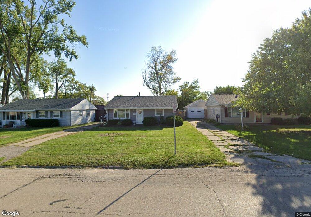
1023 18th St SW Cedar Rapids, IA 52404
Cleveland Area NeighborhoodEstimated Value: $129,000 - $147,000
2
Beds
1
Bath
768
Sq Ft
$177/Sq Ft
Est. Value
About This Home
This home is located at 1023 18th St SW, Cedar Rapids, IA 52404 and is currently estimated at $135,595, approximately $176 per square foot. 1023 18th St SW is a home located in Linn County with nearby schools including Junction City Elementary School, Cleveland Elementary School, and Kentucky Tech - Ashland Reg Tech Center.
Ownership History
Date
Name
Owned For
Owner Type
Purchase Details
Closed on
Mar 12, 2021
Sold by
Mullin Mark D and Mease Tamara
Bought by
Mullin Mark D and Mease Tamara
Current Estimated Value
Home Financials for this Owner
Home Financials are based on the most recent Mortgage that was taken out on this home.
Original Mortgage
$61,050
Interest Rate
2.7%
Mortgage Type
FHA
Create a Home Valuation Report for This Property
The Home Valuation Report is an in-depth analysis detailing your home's value as well as a comparison with similar homes in the area
Home Values in the Area
Average Home Value in this Area
Purchase History
| Date | Buyer | Sale Price | Title Company |
|---|---|---|---|
| Mullin Mark D | -- | None Available |
Source: Public Records
Mortgage History
| Date | Status | Borrower | Loan Amount |
|---|---|---|---|
| Closed | Mullin Mark D | $61,050 |
Source: Public Records
Tax History Compared to Growth
Tax History
| Year | Tax Paid | Tax Assessment Tax Assessment Total Assessment is a certain percentage of the fair market value that is determined by local assessors to be the total taxable value of land and additions on the property. | Land | Improvement |
|---|---|---|---|---|
| 2025 | $1,888 | $127,000 | $28,600 | $98,400 |
| 2024 | $1,898 | $119,200 | $26,000 | $93,200 |
| 2023 | $1,898 | $117,200 | $26,000 | $91,200 |
| 2022 | $1,714 | $98,900 | $22,100 | $76,800 |
| 2021 | $1,752 | $91,700 | $22,100 | $69,600 |
| 2020 | $1,752 | $88,000 | $20,800 | $67,200 |
| 2019 | $1,564 | $81,100 | $20,800 | $60,300 |
| 2018 | $1,518 | $81,100 | $20,800 | $60,300 |
| 2017 | $1,552 | $79,800 | $20,800 | $59,000 |
| 2016 | $1,657 | $78,000 | $20,800 | $57,200 |
| 2015 | $1,551 | $72,886 | $20,800 | $52,086 |
| 2014 | $1,366 | $75,079 | $20,800 | $54,279 |
| 2013 | $1,378 | $75,079 | $20,800 | $54,279 |
Source: Public Records
Map
Nearby Homes
- 1206 18th St SW
- 1807 9th Ave SW
- 1253 20th St SW
- 1832 8th Ave SW
- 1818 Holly Meadow Ave SW
- 1812 Holly Meadow Ave SW
- 1824 Holly Meadow Ave SW
- 1806 Holly Meadow Ave SW
- 1602 1st Ave NW
- 2178 Chandler St SW
- 1913 Holly Meadow Ave SW
- 1400 7th Ave SW
- 1801 Shady Grove Rd SW
- Remington - Cedar Rapids Plan at Whispering Pines
- Copeland Plan at Whispering Pines
- Meadowbrook - Cedar Rapids Plan at Stags Leap Estates
- Caldwell Plan at Stags Leap Estates
- Concord - Cedar Rapids Plan at Stags Leap Estates
- Yuma Expanded Plan at Whispering Pines
- Becker II Plan at Kirkwood Village - Kirk Wood Village
- 1019 18th St SW
- 1027 18th St SW
- 1015 18th St SW
- 1714 11th Ave SW
- 1710 11th Ave SW
- 1718 11th Ave SW
- 1011 18th St SW
- 1706 11th Ave SW
- 1014 17th St SW
- 1007 18th St SW
- 1026 18th St SW
- 1022 18th St SW
- 1030 18th St SW
- 1018 18th St SW
- 1006 17th St SW
- 1702 11th Ave SW
- 1034 18th St SW
- 1014 18th St SW
- 1719 11th Ave SW
- 1711 10th Ave SW