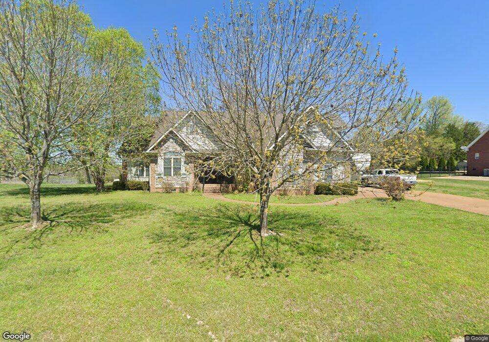
1023 Clay Place Lebanon, TN 37087
Estimated Value: $465,474 - $747,000
--
Bed
4
Baths
3,093
Sq Ft
$207/Sq Ft
Est. Value
About This Home
This home is located at 1023 Clay Place, Lebanon, TN 37087 and is currently estimated at $639,619, approximately $206 per square foot. 1023 Clay Place is a home located in Wilson County with nearby schools including Carroll Oakland Elementary School, Lebanon High School, and Friendship Christian School.
Ownership History
Date
Name
Owned For
Owner Type
Purchase Details
Closed on
Aug 2, 2005
Sold by
Armistead Roger A
Bought by
Duane Harper
Current Estimated Value
Home Financials for this Owner
Home Financials are based on the most recent Mortgage that was taken out on this home.
Original Mortgage
$291,650
Outstanding Balance
$151,431
Interest Rate
5.48%
Estimated Equity
$488,188
Purchase Details
Closed on
Apr 23, 1999
Bought by
Trice John R
Create a Home Valuation Report for This Property
The Home Valuation Report is an in-depth analysis detailing your home's value as well as a comparison with similar homes in the area
Home Values in the Area
Average Home Value in this Area
Purchase History
| Date | Buyer | Sale Price | Title Company |
|---|---|---|---|
| Duane Harper | $307,000 | -- | |
| Trice John R | $1,023,700 | -- |
Source: Public Records
Mortgage History
| Date | Status | Borrower | Loan Amount |
|---|---|---|---|
| Open | Trice John R | $291,650 |
Source: Public Records
Tax History Compared to Growth
Tax History
| Year | Tax Paid | Tax Assessment Tax Assessment Total Assessment is a certain percentage of the fair market value that is determined by local assessors to be the total taxable value of land and additions on the property. | Land | Improvement |
|---|---|---|---|---|
| 2024 | $1,605 | $84,075 | $13,750 | $70,325 |
| 2022 | $1,605 | $84,075 | $13,750 | $70,325 |
| 2021 | $1,605 | $84,075 | $13,750 | $70,325 |
| 2020 | $1,754 | $84,075 | $13,750 | $70,325 |
| 2019 | $1,754 | $69,650 | $12,175 | $57,475 |
| 2018 | $1,754 | $69,650 | $12,175 | $57,475 |
| 2017 | $1,754 | $69,650 | $12,175 | $57,475 |
| 2016 | $1,754 | $69,650 | $12,175 | $57,475 |
| 2015 | $1,790 | $69,650 | $12,175 | $57,475 |
| 2014 | $1,676 | $65,195 | $0 | $0 |
Source: Public Records
Map
Nearby Homes
- 128 Mann Rd
- 906 Koble Dr
- 0 Coles Ferry Pike Unit RTC3001704
- 0 Berea Church Rd
- 0 Trice Rd
- 811 Brook Trail
- 849 Brook Trail
- 1009 Stone Creek Ln
- 1102 Collin Dr #206
- 148 Springfield Dr
- 848 Brook Trail
- 854 Brook Trail
- 1003 Stone Creek Ln #221
- 1107 Collin Dr
- 503 Carriage Ln
- 1108 Collin Dr #209
- 1276 Trice Rd
- 129 Springfield Dr
- 15 Juniper Ln
- 5405 Manners Rd
- 1021 Clay Place
- 700 Deer Ridge Ln
- 1025 Clay Place
- 1026 Clay Place
- 628 Greene Dr
- 626 Greene Dr
- 1024 Clay Place
- 629 Greene Dr
- 1027 Clay Place
- 624 Greene Dr
- 701 Deer Ridge Ln
- 462 Cedar Grove Rd
- 500 Falling Leaf Ln
- 392 Cedar Grove Rd
- 432 Cedar Grove Rd
- 502 Falling Leaf Ln
- 1022 Clay Place
- 69 Greene Dr
- 362 Cedar Grove Rd
- 631 Greene Dr